Inloggen

Login vergeten?

Cookies moeten worden aanvaard!
De cookiefunctie van uw browser is gedeactiveerd. Activeer de functie.

Ben je nog geen lid?

Registreer nu
Inloggen

Alleen mogelijk voor ingelogde gebruikers

Log in om deze functie te kunnen gebruiken.

Login vergeten?

Cookies moeten worden aanvaard!
De cookiefunctie van uw browser is gedeactiveerd. Activeer de functie.

Ben je nog geen lid?

Registreer nu
Filter
Categorieën
Geavanceerde filters
  • Lengte (km)
  • Hoogtemeter
Filter opslaan Filter resetten

TrackRank

QRCode

Technische gegevens

Lengte5,7 km Hoogtemeter84 m Afdaling95 m Duur03:00 h:m Datum08.02.2013
Beoordelingen Auteur Landschap Funfactor Conditie Techniek

Statistiek

485 Views Beoordelingen 11 Downloads Gemiddelde
Tarief
  • Pagina van de tocht
  • Route
  • Downloads

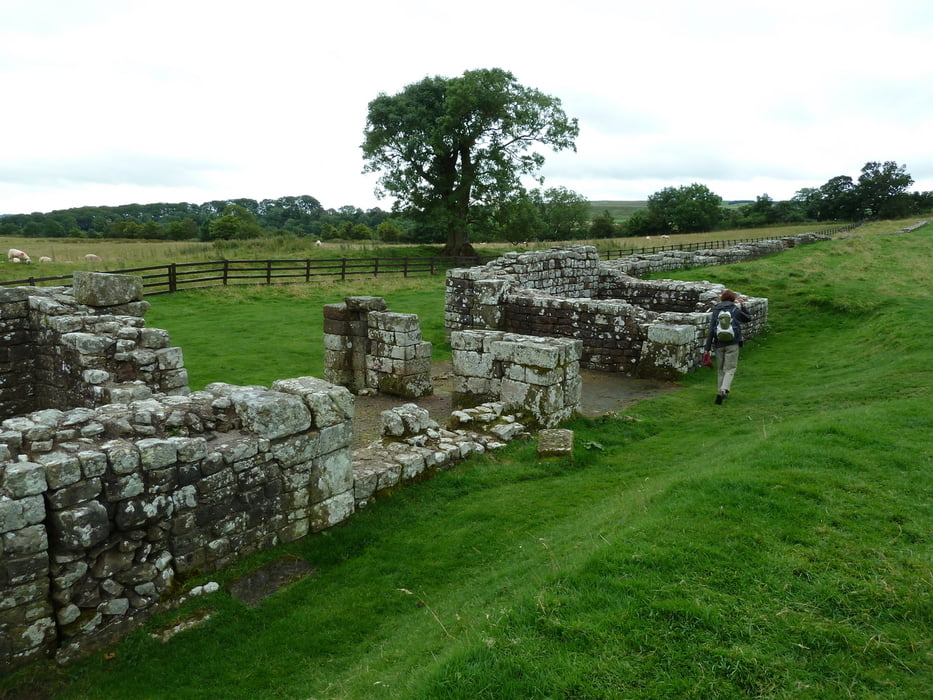
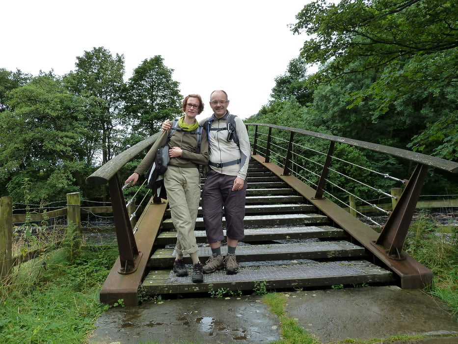
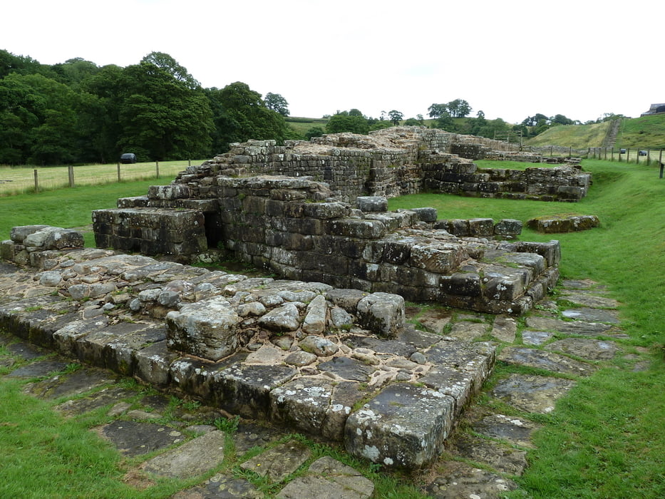
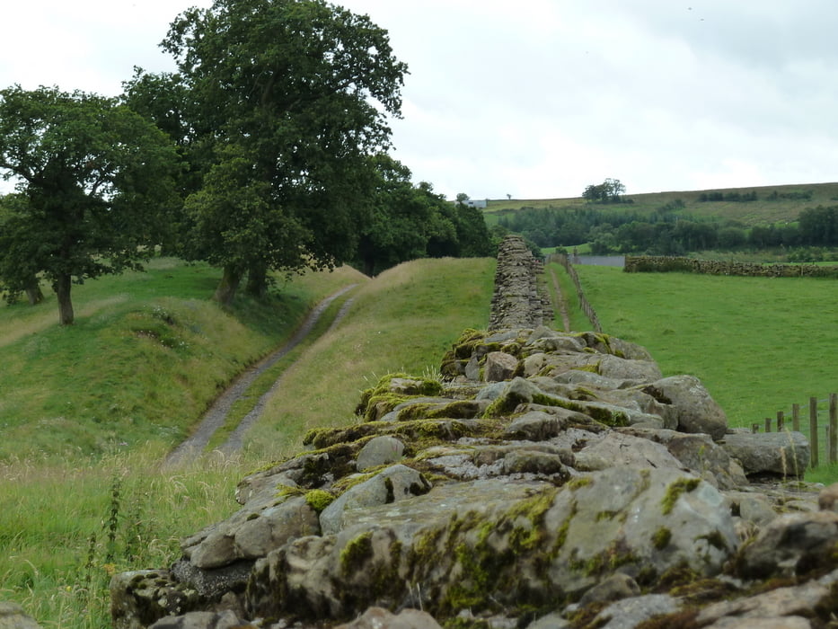
This hiking tour takes you on a round trip from Gilsland to Birdoswald Roman Fort. On the way back the track follows the line of Hadrian's Wall, crossing the River Irthing over a new footbridge. The remains of the ancient Roman bridge can be visited along this walk.

The total duration of 3 hours includes a visit to Birdoswald Roman Fort, an excarvation site managed by English Heritage. A small but interesting museum is included on site.

Refreshments can be found at Gilsland and Birdoswald.

The track starts and ends at a free car park at Gilsland.

If weather is good the track can be extended by a walk through the woods east of Gilsland to the Popping Stone. However, we have no gps-recording of this additional loop because the paths were too muddy due to heavy rain.


Verdere informatie onder

http://www.english-heritage.org.uk/daysout/properties/birdoswald-roman-fort-hadrians-wall/

Fotogalerie van de tocht

Kaart en hoogteprofiel van de tocht

  • Open Street Map
  • Google
Minimumhoogte 103 m Maximale hoogte 152 m Detailweergave

Meer over de tour auteur

Kretakulk
Lid sinds 2009

Stuur een privébericht

Commentaren

Parking spaces can be found at Birdoswald or Gilsland. However, the car park at Gilsland might be preferred because it is free of charge.

GPS-tracks

Trackpoints
  • GPX / Garmin Map Source (gpx) download
  • TCX / Garmin Training Center® (tcx) download
  • CRS / Garmin Training Center® (crs) download
  • Google Earth (kml) download
  • G7ToWin (g7t) download
  • TTQV (trk) download
  • Overlay (ovl) download
  • Fugawi (txt) download
  • Kompass (DAV) Track (tk) download
  • Pagina van de tocht (pdf) download
  • Origineel dossier van de auteur (gpx) download

Meer over de tour auteur

Kretakulk
Lid sinds 2009

Stuur een privébericht
Share track
Toevoegen aan mijn favorieten
Uit mijn favorieten verwijderen
Tags bewerken
Mijn waardering
Tarief
Tocht: Hadrian's Wall - Gilsland - Birdoswald Roman Fort
Type: Wandelen
Lengte: 5,7 km
Evaluated on:
Duur:
Dagen
Uurtjes
Minuten
Beoordeling: Landschap Funfactor Conditie Techniek