


Grenoble is surrounded by three mountain ranges: Chartreuse, Vercors and Belledonnes. During this trip we visited the Vercors.
We left Grenoble following the cycling path along the right bank of Isere northwards (downstream).
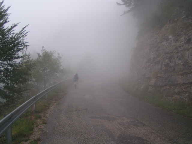
We started the exhausting climb in Veurey-Voroize and travelled uphill for next 17 kilometers achieving 1100 metres of climb.
Roads were rather free of cars and after passing Montaud we have seen almost no cars at all. The reason for that was a rupture of the road shortly before the Tunnel de Mortier.
Because of the bad weather we abandoned the idea of passing the interruption and returned along the same route.
We left Grenoble following the cycling path along the right bank of Isere northwards (downstream).
We started the exhausting climb in Veurey-Voroize and travelled uphill for next 17 kilometers achieving 1100 metres of climb.
Roads were rather free of cars and after passing Montaud we have seen almost no cars at all. The reason for that was a rupture of the road shortly before the Tunnel de Mortier.
Because of the bad weather we abandoned the idea of passing the interruption and returned along the same route.
Fotogalerie van de tocht
Kaart en hoogteprofiel van de tocht
Minimumhoogte 196 m
Maximale hoogte 1304 m
Meer over de tour auteur

|
azzie |
Commentaren

You can start from anywhere in Grenoble or Voreppe.
If you are looking for a longer trip, consider reaching the same point through Lans-en-Vercors and Autrans.
If you are looking for a longer trip, consider reaching the same point through Lans-en-Vercors and Autrans.
GPS-tracks
Trackpoints-
GPX / Garmin Map Source (gpx) download
-
TCX / Garmin Training Center® (tcx) download
-
CRS / Garmin Training Center® (crs) download
-
Google Earth (kml) download
-
G7ToWin (g7t) download
-
TTQV (trk) download
-
Overlay (ovl) download
-
Fugawi (txt) download
-
Kompass (DAV) Track (tk) download
-
Pagina van de tocht (pdf) download
-
Origineel dossier van de auteur (gpx) download
Meer over de tour auteur
|
|
azzie |
Toevoegen aan mijn favorieten
Uit mijn favorieten verwijderen
Tags bewerken
Open track
Mijn waardering
Tarief