Login

Забыл пароль?

Cookies have to be accepted!
Your browser's cookie functionality is disabled. Please enable this functionality.

Not a member yet?

Register now
Login

Available for registred users only

Log in to use this feature.

Забыл пароль?

Cookies have to be accepted!
Your browser's cookie functionality is disabled. Please enable this functionality.

Not a member yet?

Register now
Filter
Категории
Advanced filters
  • Длина (км)
  • Высотомер
Сохранить фильтр Reset filter

TrackRank

QRCode

Technical data

Длина23,3 km Высотомер1158 m Way down1169 m Длительность00:00 h:m Дата26.05.2016
Оценки Author Ландшафт Веселье Кондиция Техника

Статистика

313 Виды Оценки 25 Загрузки Среднее
Rate
  • Формуляр маршрута
  • Дорога
  • Загрузки

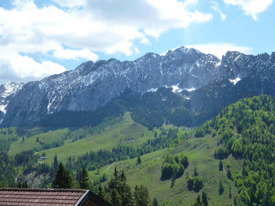
Sehr schöne Tour mit viel Einkehrmöglichkeiten und schönen Ausblicken auf Inntal und Kaisergebirge.

Als Basis diente die Bike&Carry Martin Blum's tour 

www.gps-tour.info/de/touren/detail.10845.html

Bei dem letzten Abschnitt kommt noch Kaiser's Wasserwerk und alter Sammelplatz der Schützen bei der Kapelle.

Карта маршрута и высотный профиль

  • Open Street Map
  • Google
Minimum height 505 m Maximum height 1463 m Детальный вид

More about the tour author

lilu
Member since 2009

Send private message

Комментарии

GPS-Tracks

Trackpoints
  • GPX / Garmin Map Source (gpx) download
  • TCX / Garmin Training Center® (tcx) download
  • CRS / Garmin Training Center® (crs) download
  • Google Earth (kml) download
  • G7ToWin (g7t) download
  • TTQV (trk) download
  • Overlay (ovl) download
  • Fugawi (txt) download
  • Kompass (DAV) Track (tk) download
  • Формуляр маршрута (pdf) download
  • Original file of the author (gpx) download

More about the tour author

lilu
Member since 2009

Send private message
Share track
Add to my favorites
Remove from my favorites
Edit tags
My score
Rate
Маршрут: Wilder Kaiser
Вид: Пешеходный туризм
Длина: 23,3 km
Evaluated on:
Длительность:
Day(s)
Hour(s)
Minute(s)
Оценка: Ландшафт Веселье Кондиция Техника