Login

Забыл пароль?

Cookies have to be accepted!
Your browser's cookie functionality is disabled. Please enable this functionality.

Not a member yet?

Register now
Login

Available for registred users only

Log in to use this feature.

Забыл пароль?

Cookies have to be accepted!
Your browser's cookie functionality is disabled. Please enable this functionality.

Not a member yet?

Register now
Filter
Категории
Advanced filters
  • Длина (км)
  • Высотомер
Сохранить фильтр Reset filter

TrackRank

QRCode

Technical data

Длина52,7 km Высотомер0 m Way down0 m Длительность05:00 h:m Дата20.04.2009
Оценки Author Ландшафт Веселье Кондиция Техника

Статистика

1286 Виды Оценки 266 Загрузки Среднее
Rate
  • Формуляр маршрута
  • Дорога
  • Загрузки
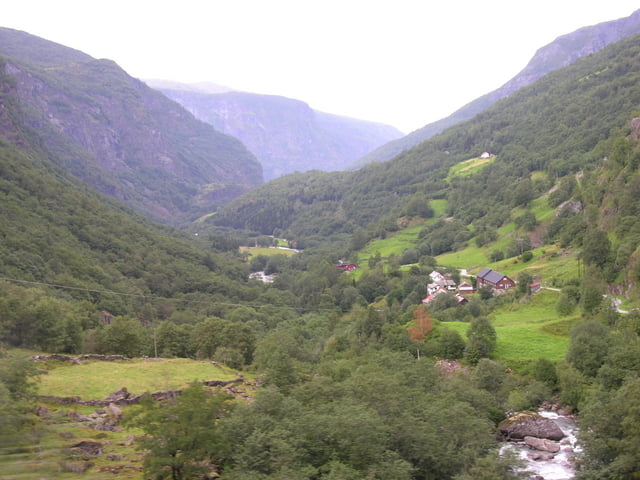
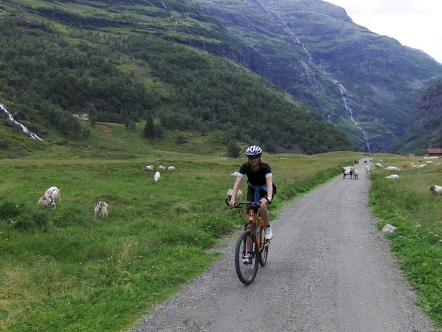
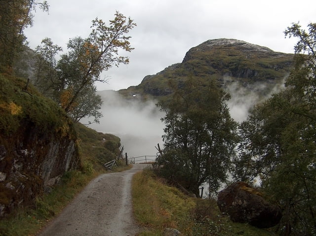
Vom Hafen und Bahnhof Flam fahren wir immer taleinwärts an Wasserfällen vorbei, durch Tunnels und steile Serpentinen bis nach Myrdal. Abzweig zum Bahnhof Myrdahl mit Möglichkeit zur Verpflegung. Dann zurück auf den Weg und weiter bis Finse auf einem ungeteerten Weg. Wunderschöne Gegend mit Seen und Fjäll. Die Serpentinen unterhalb Myrdahl sind sehr steil und schottrig und verlangen eine Portion Biss.

Галерея маршрутов

Карта маршрута и высотный профиль

  • Open Street Map
  • Google
Minimum height 99999 m Maximum height -99999 m Детальный вид

More about the tour author

huelserhighway
Member since 2007

Send private message

Комментарии

GPS-Tracks

Trackpoints
  • GPX / Garmin Map Source (gpx) download
  • TCX / Garmin Training Center® (tcx) download
  • CRS / Garmin Training Center® (crs) download
  • Google Earth (kml) download
  • G7ToWin (g7t) download
  • TTQV (trk) download
  • Overlay (ovl) download
  • Fugawi (txt) download
  • Kompass (DAV) Track (tk) download
  • Формуляр маршрута (pdf) download
  • Original file of the author (gpx) download

More about the tour author

huelserhighway
Member since 2007

Send private message
Share track
Add to my favorites
Remove from my favorites
Edit tags
My score
Rate
Маршрут: von Flam nach Finse
Вид: Горный велосипед
Длина: 52,7 km
Evaluated on:
Длительность:
Day(s)
Hour(s)
Minute(s)
Оценка: Ландшафт Веселье Кондиция Техника