Login

Login vergessen?

Cookies müssen akzeptiert werden!
Die Cookie-Funktion Ihres Browsers ist deaktiviert. Bitte aktivieren Sie die Funktion.

Noch kein Mitglied?

Jetzt Registrieren
Login

Nur für eingeloggte Benutzer möglich

Melde dich an, um diese Funktion nutzen zu können.

Login vergessen?

Cookies müssen akzeptiert werden!
Die Cookie-Funktion Ihres Browsers ist deaktiviert. Bitte aktivieren Sie die Funktion.

Noch kein Mitglied?

Jetzt Registrieren
Filter
Kategorien
Erweiterte Filter
  • Länge (km)
  • Höhenmeter
Filter speichern Filter zurücksetzen

TrackRank

QRCode

Technische Daten

Länge34,9 km Höhenmeter747 m Abstieg792 m Dauer00:00 h:m Datum14.06.2005
Bewertungen Autor Landschaft Spaßfaktor Kondition Technik

Statistik

2009 Views 2 Bewertungen 407 Downloads 3.00 Durchschnitt
Bewerten
  • Tourenblatt
  • Anfahrt
  • Downloads
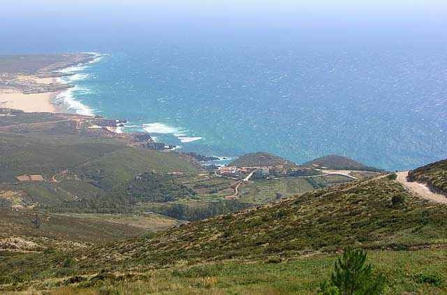
This tour is full of landscape contrasts, monuments, forest and seaside as well.
To the people who dont know the area, drive caerfully, specially on the downhills, cause some of then can be a bit technichal. Enjoy as much as you can this tour, because i believe is one of the best ways to see all the area.p.s.s soon the photos will come:]

Tour Karte und Höhenprofil

  • Open Street Map
  • Google
Minimale Höhe 7 m Maximale Höhe 479 m Detailansicht

Mehr zum Tourautor

icon8
Mitglied seit 2005

Land: Portugal

3 erstellte Touren
6.3
Private Nachricht senden

Kommentare

PAULO am 20.06.2006

LUI

BUENO
schuh am 29.08.2013

Nice landscape but ....

I would n t drive it again!

Really beautiful landscape and in parts nice ways but you have to walk alot ob this track!
And this is not becouse of minor skills or power. It is just impossible to drive up a way of deep sand...

If you think about doing the track - Do it but think about taking the road uphill to Sintra. The small pathes are not nice to walk up...

And down in the beach i would also recommend the road than the Sand dunes!

The tour starts in the historical center of Sintra near Quinta da Regaleira, then drive's you thrugh this points Seteais, Capuchos convent, Peninha convent, Azoia, Ulgueira, Praia da Adraga(beach), Praia Grande (beach), Colares, Mucifal, NAffarros, Galamares and back to sintra by Quinta da Regaleira.

GPS-Tracks

Trackpunkte
  • GPX / Garmin Map Source (gpx) download
  • TCX / Garmin Training Center® (tcx) download
  • CRS / Garmin Training Center® (crs) download
  • Google Earth (kml) download
  • G7ToWin (g7t) download
  • TTQV (trk) download
  • Overlay (ovl) download
  • Fugawi (txt) download
  • Kompass (DAV) Track (tk) download
  • Tourenblatt (pdf) download
  • Originaldatei des Autors (g7t) download

Mehr zum Tourautor

icon8
Mitglied seit 2005

Land: Portugal

3 erstellte Touren
6.3
Private Nachricht senden
Tour teilen
Zu meinen Favoriten hinzufügen
Von meinen Favoriten entfernen
Tags bearbeiten
Meine Bewertung
Bewerten
Tour: The point of europe
Art: Mountainbike
Länge: 34,9 km
Bewertet am:
Dauer:
Tag(e)
Stunde(n)
Minute(n)
Bewertung: Landschaft Spaßfaktor Kondition Technik