Login

Login vergessen?

Cookies müssen akzeptiert werden!
Die Cookie-Funktion Ihres Browsers ist deaktiviert. Bitte aktivieren Sie die Funktion.

Noch kein Mitglied?

Jetzt Registrieren
Login

Nur für eingeloggte Benutzer möglich

Melde dich an, um diese Funktion nutzen zu können.

Login vergessen?

Cookies müssen akzeptiert werden!
Die Cookie-Funktion Ihres Browsers ist deaktiviert. Bitte aktivieren Sie die Funktion.

Noch kein Mitglied?

Jetzt Registrieren
Filter
Kategorien
Erweiterte Filter
  • Länge (km)
  • Höhenmeter
Filter speichern Filter zurücksetzen

TrackRank

QRCode

Technische Daten

Länge58,8 km Höhenmeter692 m Abstieg818 m Dauer07:00 h:m Datum21.04.2009
Bewertungen Autor Landschaft Spaßfaktor Kondition Technik

Statistik

870 Views Bewertungen 102 Downloads Durchschnitt
Bewerten
  • Tourenblatt
  • Anfahrt
  • Downloads
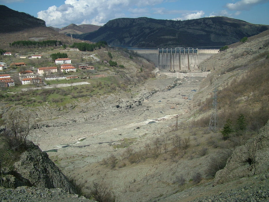
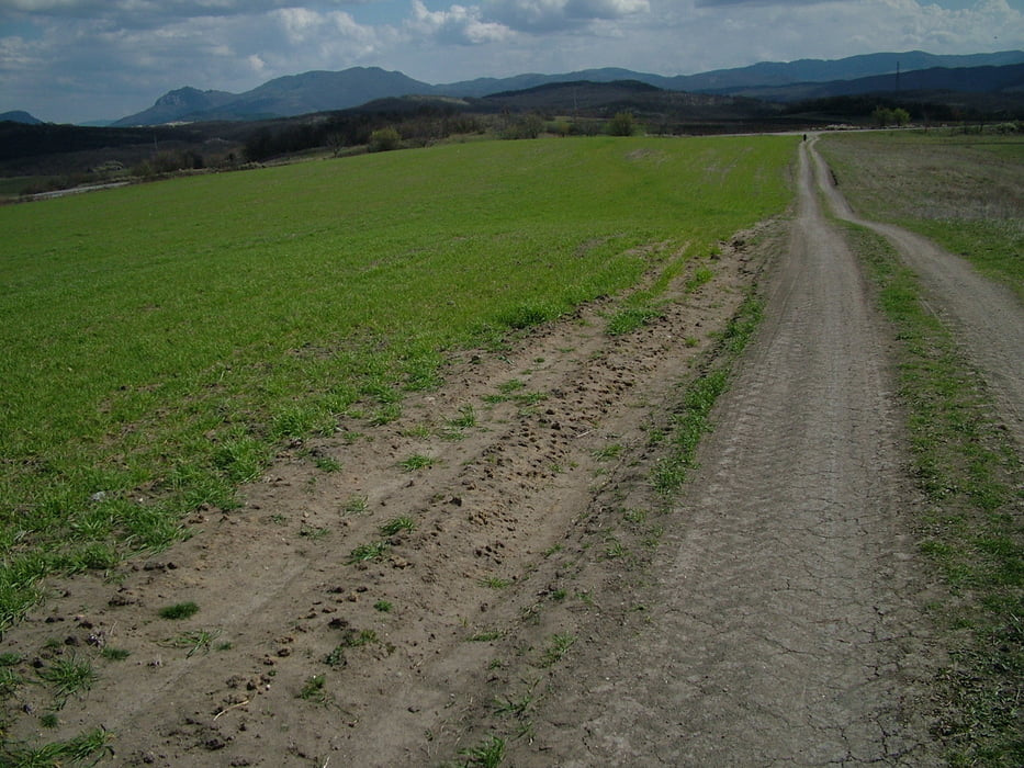
The track follows leg 12 of the "Rudopia" trail. From Perperikon you have to follow the asphalt road passing trough the villages of Chiflik, Madrets and Perperek to reach Kaloyantsi where the asphalt ends. Take left in Kaloyantsi and follow the forest road passing trough picturesque meadows and oak forests until you come to Dolishte. An asphalt road strats from there. It will take you to Konevo where you must turn right and ride to Byala Polyana. At the end of the village there is a dirt road in southern direction that you must take. Down to the creek and then up on a stony road and you will reach Svetoslav. In Svetoslav take the trail just down from the center. Soon it becomes a track which will lead you to the dam of  "Studen Kladents" Lake. You will reach an asphlat road there. Go left and pass the villages of Rabovo, Golobradovo and Pchelari. A kilometer after Pcchelari you will find a shortcut in the right hand side. It will take you to the main road and the iron bridge on Arda river. After you cross the bridge you must ride trough the villages of Kotlari, Strandjevo and Bryagovets to reach Madjarovo lovated in the former crater.

Weitere Informationen unter

http://rudopia.org

Tour Galerie

Tour Karte und Höhenprofil

  • Open Street Map
  • Google
Minimale Höhe 131 m Maximale Höhe 361 m Detailansicht

Mehr zum Tourautor

Pirateria
Mitglied seit 2008

Land: Bulgarien

57 erstellte Touren
6.6
Private Nachricht senden

Kommentare

GPS-Tracks

Trackpunkte
  • GPX / Garmin Map Source (gpx) download
  • TCX / Garmin Training Center® (tcx) download
  • CRS / Garmin Training Center® (crs) download
  • Google Earth (kml) download
  • G7ToWin (g7t) download
  • TTQV (trk) download
  • Overlay (ovl) download
  • Fugawi (txt) download
  • Kompass (DAV) Track (tk) download
  • Tourenblatt (pdf) download
  • Originaldatei des Autors (gpx) download

Mehr zum Tourautor

Pirateria
Mitglied seit 2008

Land: Bulgarien

57 erstellte Touren
6.6
Private Nachricht senden
Tour teilen
Zu meinen Favoriten hinzufügen
Von meinen Favoriten entfernen
Tags bearbeiten
Meine Bewertung
Bewerten
Tour: Perperikon - Madjarovo
Art: Mountainbike
Länge: 58,8 km
Bewertet am:
Dauer:
Tag(e)
Stunde(n)
Minute(n)
Bewertung: Landschaft Spaßfaktor Kondition Technik