Login

Login vergessen?

Cookies müssen akzeptiert werden!
Die Cookie-Funktion Ihres Browsers ist deaktiviert. Bitte aktivieren Sie die Funktion.

Noch kein Mitglied?

Jetzt Registrieren
Login

Nur für eingeloggte Benutzer möglich

Melde dich an, um diese Funktion nutzen zu können.

Login vergessen?

Cookies müssen akzeptiert werden!
Die Cookie-Funktion Ihres Browsers ist deaktiviert. Bitte aktivieren Sie die Funktion.

Noch kein Mitglied?

Jetzt Registrieren
Filter
Kategorien
Erweiterte Filter
  • Länge (km)
  • Höhenmeter
Filter speichern Filter zurücksetzen

TrackRank

QRCode

Technische Daten

Länge27,5 km Höhenmeter408 m Abstieg428 m Dauer00:00 h:m Datum26.04.2009
Bewertungen Autor Landschaft Spaßfaktor Kondition Technik

Statistik

1421 Views Bewertungen 147 Downloads Durchschnitt
Bewerten
  • Tourenblatt
  • Anfahrt
  • Downloads

MTB on Omberg

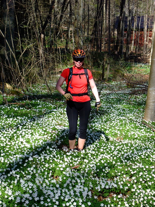
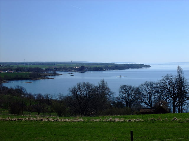
Omberg is beautifully situated by the shores of Lake Vättern. The flora is very varied and there are lots of flowers in spring time.

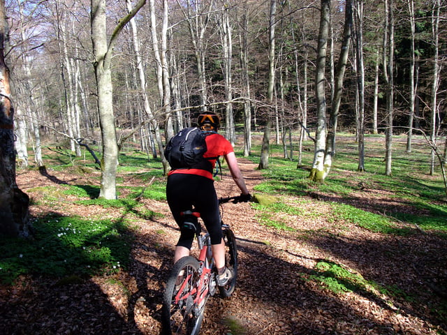
The forested hill Omberg is a popular area for outdoor avtivities and there are several hiking trails but not all of them suited for biking.Give way to walkers, be especially careful around the most popular areas around Hjässan, Ellen Key's Strand and Stocklycke.

The tour

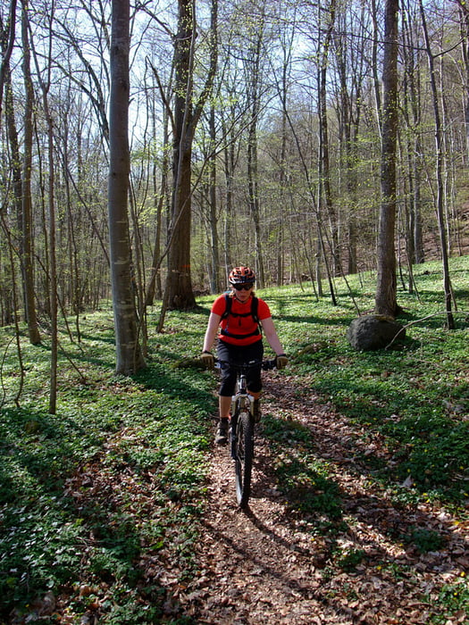
This tour is best done clockwise and consists of a mixture of  trails (64%), gravel (17%) and tarmac (19%).

There are challanging climbs, fast and fun downhills, lovely views of Lake Vättern and the surrounding plains.

Today we started and ended the loop at Ellen Key's Strand. Other possible starting points are; Ombergs Turisthotell, Stocklycke, Storpissan or Hjässatorget.

Food breaks

If you don't BYO, tehe are lunch and snack possibilities en-route at Ombergs Turishotell and Stocklycke. Close to the trail are Borghamn and Hästholmen.

Places to stay

Try the web site "Tiderna landskap - A Spritual Haven" www.tidernaslandskap.se/Default.asp

Weitere Informationen unter

http://www.sveaskog.se/Jakt-fiske-och-friluftsliv/besoksomraden/ekoparker/Ekopark-Omberg/

Tour Galerie

Tour Karte und Höhenprofil

  • Open Street Map
  • Google
Minimale Höhe 80 m Maximale Höhe 246 m Detailansicht

Mehr zum Tourautor

Eva
Mitglied seit 2006

Land: Schweden

8 erstellte Touren
6.6
Private Nachricht senden

Kommentare

derwolf am 24.08.2015

Great tour!

We did this thour beginning of August this year and it was really great! We started at the north end and did it clockwise. First some forrest roads for warm-up, then trails, trails, trails in such a beautiful landscape. Definitely one of the best MTB tours I ever did in Sweden! Thanks a lot for tracking it.

GPS-Tracks

Trackpunkte
  • GPX / Garmin Map Source (gpx) download
  • TCX / Garmin Training Center® (tcx) download
  • CRS / Garmin Training Center® (crs) download
  • Google Earth (kml) download
  • G7ToWin (g7t) download
  • TTQV (trk) download
  • Overlay (ovl) download
  • Fugawi (txt) download
  • Kompass (DAV) Track (tk) download
  • Tourenblatt (pdf) download
  • Originaldatei des Autors (gpx) download

Mehr zum Tourautor

Eva
Mitglied seit 2006

Land: Schweden

8 erstellte Touren
6.6
Private Nachricht senden
Tour teilen
Zu meinen Favoriten hinzufügen
Von meinen Favoriten entfernen
Tags bearbeiten
Meine Bewertung
Bewerten
Tour: MTB on Omberg
Art: Mountainbike
Länge: 27,5 km
Bewertet am:
Dauer:
Tag(e)
Stunde(n)
Minute(n)
Bewertung: Landschaft Spaßfaktor Kondition Technik