Login

Login vergessen?

Cookies müssen akzeptiert werden!
Die Cookie-Funktion Ihres Browsers ist deaktiviert. Bitte aktivieren Sie die Funktion.

Noch kein Mitglied?

Jetzt Registrieren
Login

Nur für eingeloggte Benutzer möglich

Melde dich an, um diese Funktion nutzen zu können.

Login vergessen?

Cookies müssen akzeptiert werden!
Die Cookie-Funktion Ihres Browsers ist deaktiviert. Bitte aktivieren Sie die Funktion.

Noch kein Mitglied?

Jetzt Registrieren
Filter
Kategorien
Erweiterte Filter
  • Länge (km)
  • Höhenmeter
Filter speichern Filter zurücksetzen

TrackRank

QRCode

Technische Daten

Länge58,8 km Höhenmeter1768 m Abstieg1749 m Dauer05:00 h:m Datum17.07.2009
Bewertungen Autor User Landschaft Spaßfaktor Kondition Technik

Statistik

3684 Views 1 Bewertung 274 Downloads 4.00 Durchschnitt
Bewerten
  • Tourenblatt
  • Anfahrt
  • Downloads

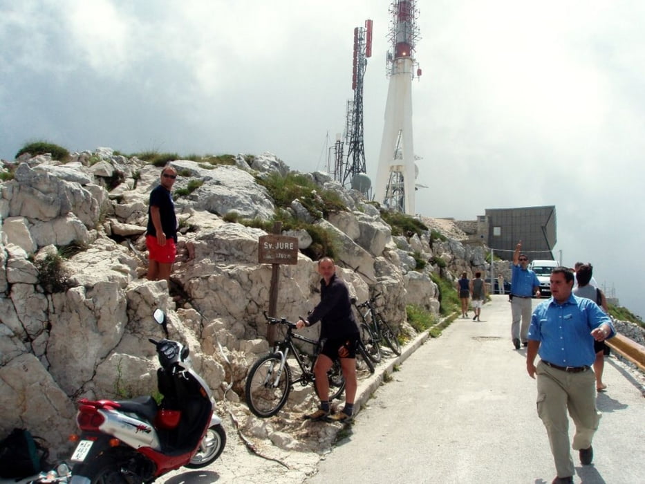
Výjezd na dominantu Makarské riviery horu Sv. Juri 1760 m.

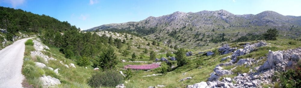
Trasa není nijak náročná, co se týče techniky jízdy, ale je náročná na délků stoupání. Pokud to vezmete od moře, tedy od nuly máte před sebou čistých 30 km stoupání s převýšením samozřejmě 1760 m. Tedy né úplně tuto výšku protože až nakopec se s kolem nedostanete. Od vysílače musíte zbytek, asi 50 výškových netrů pěšky.

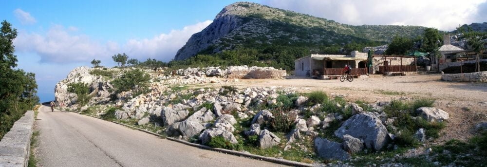
Za vstup do NP Biokovo se platí vstup 35 km za osobu.

Doporučuji vyrazit brzy z rána. Na vrchol mohou taky auta a to je celkem nepříjenmé na úzkých slničkách vedoucích k vrcholu. Optimální je před 6 ráno. Vyhnete se autům a taky vedru. Ny výjezd počítejte cca 3-4 hodiny usilovného šlapání.

Doporučuji dostatek tekutin. Je to štreka. Já měl 3 litry a byl jsem rád.

Více na ných osobních stránkách www.horskesporty.cz

Weitere Informationen unter

http://www.horskesporty.cz/view.php?nazevclanku=chorvatsko-na-kole-biokovo-sv-jure-1760&cisloclanku=2009070001

Tour Galerie

Tour Karte und Höhenprofil

  • Open Street Map
  • Google
Minimale Höhe -2 m Maximale Höhe 1742 m Detailansicht

Mehr zum Tourautor

Aldo
Mitglied seit 2008

Private Nachricht senden

Kommentare

Silmarillion am 13.08.2014

Comments in English

This is a very nice tour which should be started if driven during the summer in the early morning. I drove this track i summer 2014 an started in Pogorski at 7:00 to be on the summit of Sveti Jure at about 10:00. The track is equally good for MTB or for race bike, as its 100% street with asphalt. The entry to the Bikokovo Nature park is 25Kuna (2014) which are well investet as you get a map in all major languages and a nice CD.
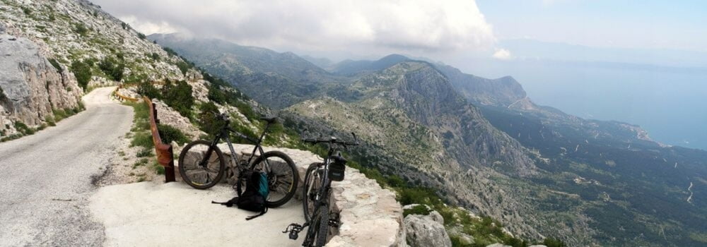
Spare some energy for the partbefore the serpentines to the summit start. Here you have some really nice 15-20% before the final serpentines to the summit start, which are again more flat. Even starting the track in Pogorski (and not directly in front of the Biokovo park entrence) is a very good idea and brings some extra km ;-)
Silmarillion am 13.08.2014

correction to previous comment

Its should be Podgora instead of Pogorski....
Optimální start je v centru Podgory na hlídaném parkovišti, přímo u moře. Máte to od "0"

GPS-Tracks

Trackpunkte
  • GPX / Garmin Map Source (gpx) download
  • TCX / Garmin Training Center® (tcx) download
  • CRS / Garmin Training Center® (crs) download
  • Google Earth (kml) download
  • G7ToWin (g7t) download
  • TTQV (trk) download
  • Overlay (ovl) download
  • Fugawi (txt) download
  • Kompass (DAV) Track (tk) download
  • Tourenblatt (pdf) download
  • Originaldatei des Autors (gpx) download

Mehr zum Tourautor

Aldo
Mitglied seit 2008

Private Nachricht senden
Tour teilen
Zu meinen Favoriten hinzufügen
Von meinen Favoriten entfernen
Tags bearbeiten
Meine Bewertung
Bewerten
Tour: Biokovo Sv Jure 1760
Art: Mountainbike
Länge: 58,8 km
Bewertet am:
Dauer:
Tag(e)
Stunde(n)
Minute(n)
Bewertung: Landschaft Spaßfaktor Kondition Technik