Login

Login vergessen?

Cookies müssen akzeptiert werden!
Die Cookie-Funktion Ihres Browsers ist deaktiviert. Bitte aktivieren Sie die Funktion.

Noch kein Mitglied?

Jetzt Registrieren
Login

Nur für eingeloggte Benutzer möglich

Melde dich an, um diese Funktion nutzen zu können.

Login vergessen?

Cookies müssen akzeptiert werden!
Die Cookie-Funktion Ihres Browsers ist deaktiviert. Bitte aktivieren Sie die Funktion.

Noch kein Mitglied?

Jetzt Registrieren
Filter
Kategorien
Erweiterte Filter
  • Länge (km)
  • Höhenmeter
Filter speichern Filter zurücksetzen

TrackRank

QRCode

Technische Daten

Länge34,5 km Höhenmeter1535 m Abstieg1502 m Dauer07:00 h:m Datum21.02.2010
Bewertungen Autor Landschaft Spaßfaktor Kondition Technik

Statistik

1748 Views Bewertungen 189 Downloads Durchschnitt
Bewerten
  • Tourenblatt
  • Anfahrt
  • Downloads

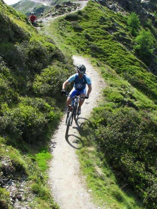
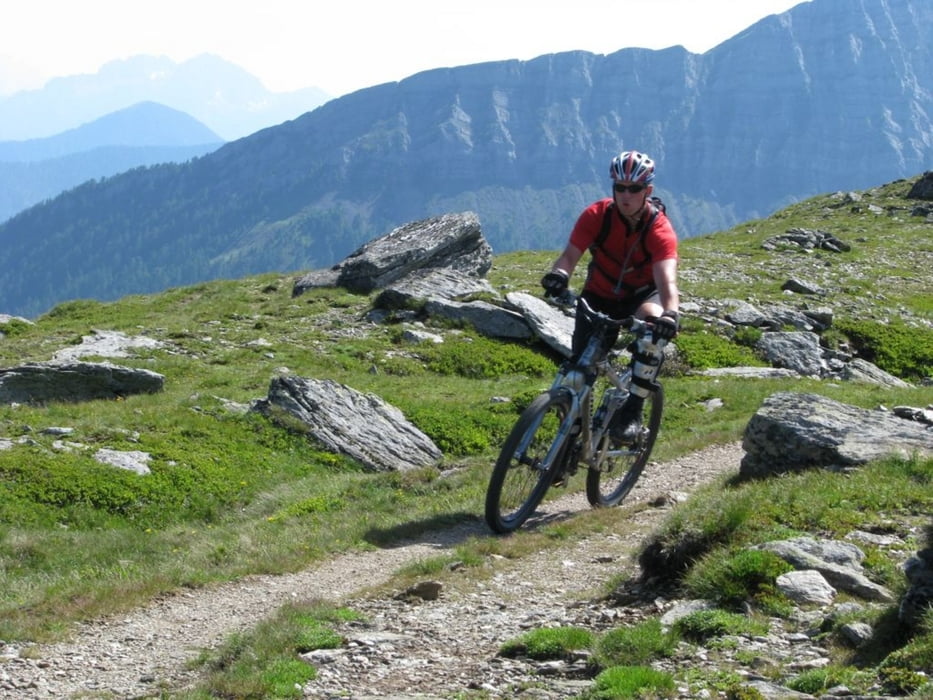
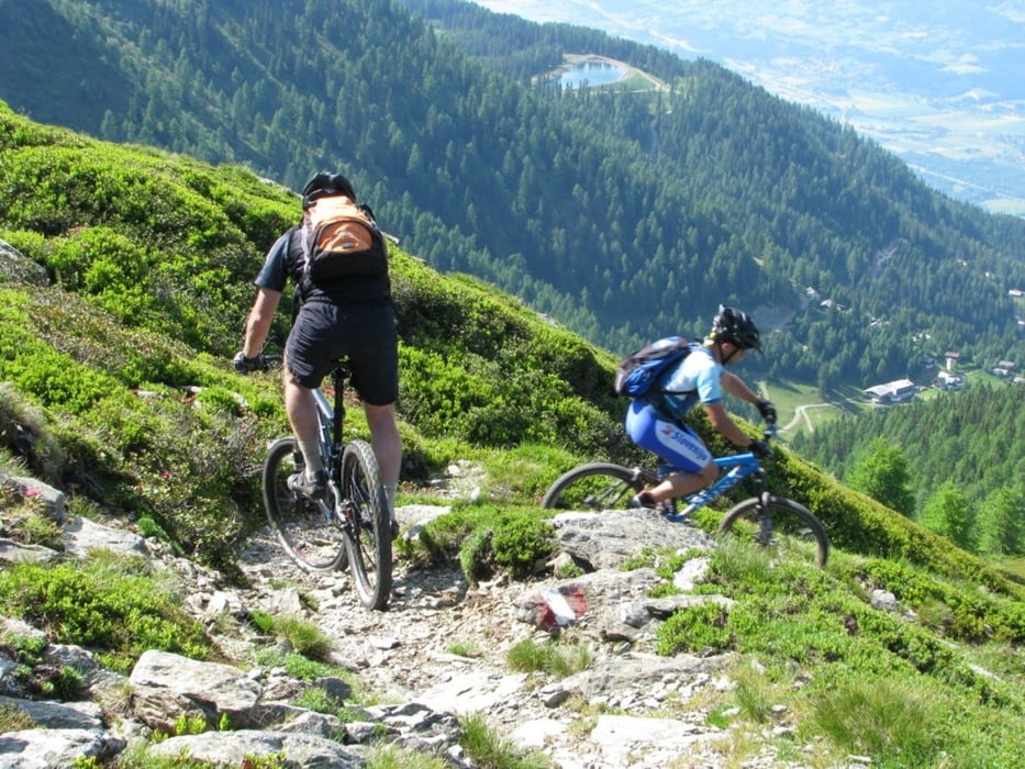
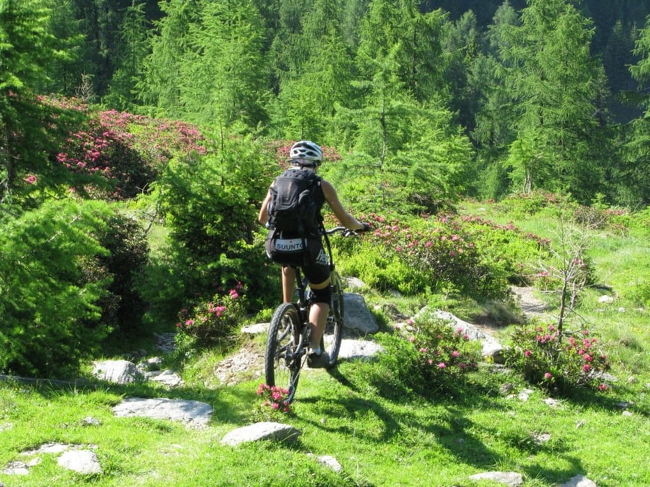
Tour starts with long uphill on unpaved road. You can park your car on parking at the bottom of cable car station. On the top there  is nice cottage with good strudel and other cakes. Downhill is on the average not very difficult for bikers of all mountain category, but there are some short parts with S2 singletrail skala difficulty. About 1/3 of downhill is on the unpaved road, other part is trail.  Somewhere in the middle of downhill you will probably think  that track is wrong (small cottage on the left). Just proceed  and follow the track. After short walk through  bushes trail will continue. The bottom part of downhill is steep trail in the forest.Please take care not to leave traces of braking on the trail.

Weitere Informationen unter

http://84.255.207.31/gallery/v/uporabniki/pokora/goldeck2/

Tour Galerie

Tour Karte und Höhenprofil

  • Open Street Map
  • Google
Minimale Höhe 561 m Maximale Höhe 2070 m Detailansicht

Mehr zum Tourautor

cindro
Mitglied seit 2008

Land: Slowenien

14 erstellte Touren
7.4
Private Nachricht senden

Kommentare

Tour starts in Spittal at cable car station.

GPS-Tracks

Trackpunkte
  • GPX / Garmin Map Source (gpx) download
  • TCX / Garmin Training Center® (tcx) download
  • CRS / Garmin Training Center® (crs) download
  • Google Earth (kml) download
  • G7ToWin (g7t) download
  • TTQV (trk) download
  • Overlay (ovl) download
  • Fugawi (txt) download
  • Kompass (DAV) Track (tk) download
  • Tourenblatt (pdf) download
  • Originaldatei des Autors (gpx) download

Mehr zum Tourautor

cindro
Mitglied seit 2008

Land: Slowenien

14 erstellte Touren
7.4
Private Nachricht senden
Tour teilen
Zu meinen Favoriten hinzufügen
Von meinen Favoriten entfernen
Tags bearbeiten
Meine Bewertung
Bewerten
Tour: Spittal - Goldeck
Art: Mountainbike
Länge: 34,5 km
Bewertet am:
Dauer:
Tag(e)
Stunde(n)
Minute(n)
Bewertung: Landschaft Spaßfaktor Kondition Technik