Login

Login vergessen?

Cookies müssen akzeptiert werden!
Die Cookie-Funktion Ihres Browsers ist deaktiviert. Bitte aktivieren Sie die Funktion.

Noch kein Mitglied?

Jetzt Registrieren
Login

Nur für eingeloggte Benutzer möglich

Melde dich an, um diese Funktion nutzen zu können.

Login vergessen?

Cookies müssen akzeptiert werden!
Die Cookie-Funktion Ihres Browsers ist deaktiviert. Bitte aktivieren Sie die Funktion.

Noch kein Mitglied?

Jetzt Registrieren
Filter
Kategorien
Erweiterte Filter
  • Länge (km)
  • Höhenmeter
Filter speichern Filter zurücksetzen

TrackRank

QRCode

Technische Daten

Länge11,5 km Höhenmeter392 m Abstieg434 m Dauer04:00 h:m Datum23.06.2011
Bewertungen Autor Landschaft Spaßfaktor Kondition Technik

Statistik

1049 Views 2 Bewertungen 112 Downloads 3.50 Durchschnitt
Bewerten
  • Tourenblatt
  • Anfahrt
  • Downloads

This is a hiking-track in the area of Kato Zakros (Eastern End of Crete).

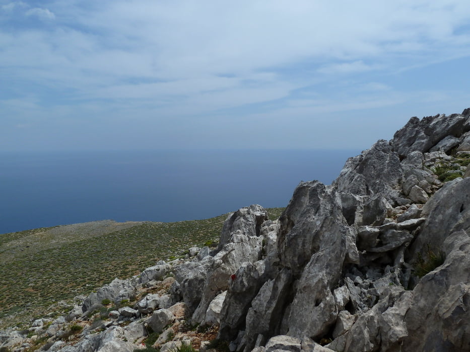
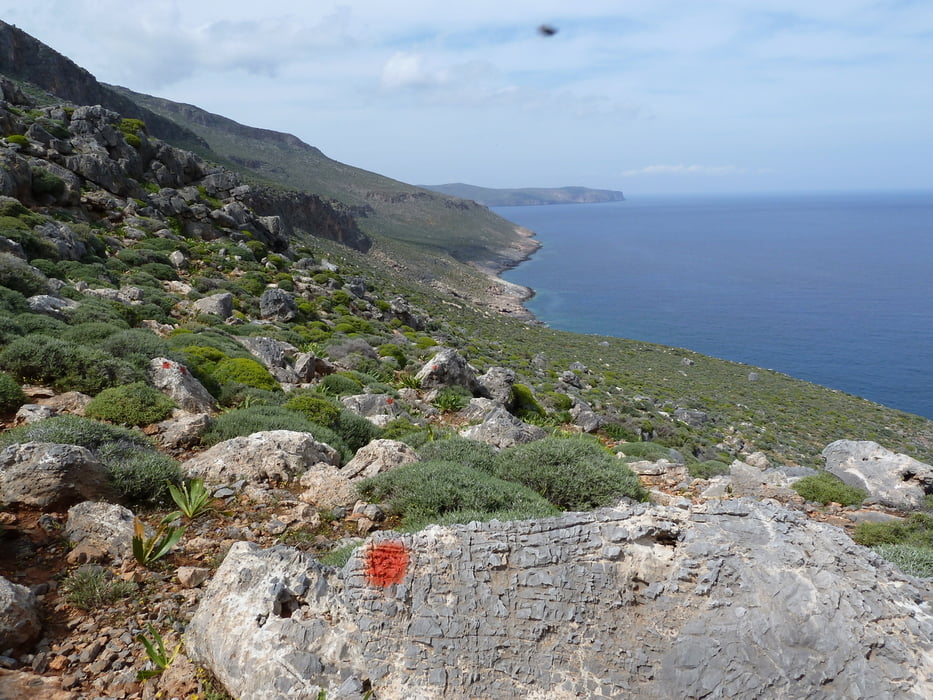
It is a very nice trip offering great panoramic views over the bay of Kato Zakros. It first goes up on the right side of the mouth of Zakros Gorge, and later on turns east towards the ridge of Skopeli which dominates the cliffs north of Kato Zakros.

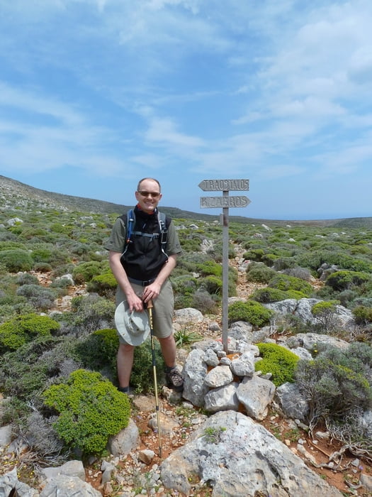
At the highest point you will reach a signpost, pointing south towards Kato Zakros and Skopeli summit, north toward the even higher Mt. Traostalos and east towards Pelekita cave at the coast. The track continues east, descending towards Pelekita cave. From there it follows a path south back to Kato Zakros.

Part of the way is very well waymarked with signs and red dots (special thanks to Stella's Traditional in Kato Zakros!), and it is not too difficult to walk. However, the way up onto Skopeli ridge does not follow any waymarking or even a clear path, but instead we have tried to find a workable way without too many difficulties.

Take a good amount of water with you, because there is virtually no shadow on the way.

Weitere Informationen unter

http://www.stelapts.com/

Tour Galerie

Tour Karte und Höhenprofil

  • Open Street Map
  • Google
Minimale Höhe -6 m Maximale Höhe 364 m Detailansicht

Mehr zum Tourautor

Kretakulk
Mitglied seit 2009

Land: Deutschland

27 erstellte Touren
8.8
Private Nachricht senden

Kommentare

Drive down to Kato Zakros and continue past the Taverns at the beach and follow the sign towards the archeological site of Kato Zakros. Drive past the Minoan palace to the mouth of the Gorge of Dead (at the right side). Some meters before the entrance to the Gorge is a wooden signpost pointing towards Azokeramos and Mt. Traostalos. This is the beginning of the track.

GPS-Tracks

Trackpunkte
  • GPX / Garmin Map Source (gpx) download
  • TCX / Garmin Training Center® (tcx) download
  • CRS / Garmin Training Center® (crs) download
  • Google Earth (kml) download
  • G7ToWin (g7t) download
  • TTQV (trk) download
  • Overlay (ovl) download
  • Fugawi (txt) download
  • Kompass (DAV) Track (tk) download
  • Tourenblatt (pdf) download
  • Originaldatei des Autors (gpx) download

Mehr zum Tourautor

Kretakulk
Mitglied seit 2009

Land: Deutschland

27 erstellte Touren
8.8
Private Nachricht senden
Tour teilen
Zu meinen Favoriten hinzufügen
Von meinen Favoriten entfernen
Tags bearbeiten
Meine Bewertung
Bewerten
Tour: Kato Zakros - Skopeli - Pelekita (round trip)
Art: Wandern
Länge: 11,5 km
Bewertet am:
Dauer:
Tag(e)
Stunde(n)
Minute(n)
Bewertung: Landschaft Spaßfaktor Kondition Technik