Login

Login vergessen?

Cookies müssen akzeptiert werden!
Die Cookie-Funktion Ihres Browsers ist deaktiviert. Bitte aktivieren Sie die Funktion.

Noch kein Mitglied?

Jetzt Registrieren
Login

Nur für eingeloggte Benutzer möglich

Melde dich an, um diese Funktion nutzen zu können.

Login vergessen?

Cookies müssen akzeptiert werden!
Die Cookie-Funktion Ihres Browsers ist deaktiviert. Bitte aktivieren Sie die Funktion.

Noch kein Mitglied?

Jetzt Registrieren
Filter
Kategorien
Erweiterte Filter
  • Länge (km)
  • Höhenmeter
Filter speichern Filter zurücksetzen

TrackRank

QRCode

Technische Daten

Länge15,0 km Höhenmeter577 m Abstieg589 m Dauer04:00 h:m Datum11.03.2014
Bewertungen Autor Landschaft Spaßfaktor Kondition Technik

Statistik

99 Views Bewertungen 7 Downloads Durchschnitt
Bewerten
  • Tourenblatt
  • Anfahrt
  • Downloads

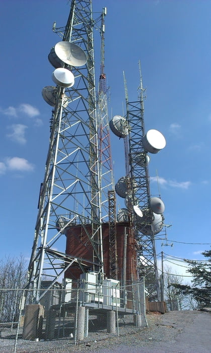
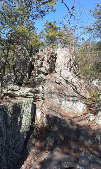
Starting the tour at Linwood Road Access, take the Backside Trail (blazed in orange hexagons) up to the Overlook. The gravel road at the beginning ends up into a hicking trail and finally the last steep part before reaching the summit, hikers will climb up 336 wooden steps. From the summit we follow the Rocktop Trail (blazed in red squares) to the road crossing of Sparrow Springs Road and Freedom Mill Road. This trail crosses several rock ledges and requires good footwear and careful attention to staying on the trail.

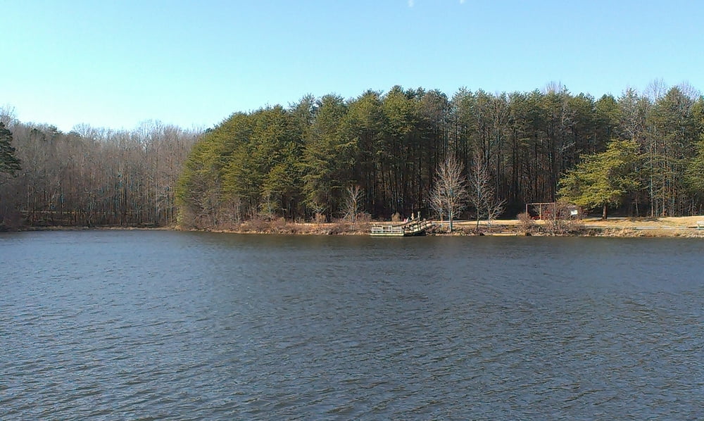
Following the Soarrow Springs Road we reach the Lake Trail (blazed in light blue circles). This easy 0.8 mile loop trail goes around the park lake.

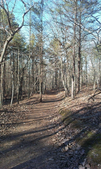
Back to the parking lot follow the Turnback Trail (blazed in white triangles) this moderate 1.2 mile (one-way) trail begins at the southeast corner of the visitor center parking lot and ends at the Pinnacle Trail. Following the Pinnacle Trail (blazed in orange circles) to the north east, we reach the Crowders Trail (blazed in white diamonds). This moderately strenuous trail  ends at the backside trail before that trail reaches the summit.

Tour Galerie

Tour Karte und Höhenprofil

  • Open Street Map
  • Google
Minimale Höhe 239 m Maximale Höhe 488 m Detailansicht

Mehr zum Tourautor

erwin417
Mitglied seit 2009

Land: Österreich

26 erstellte Touren
8.2
Private Nachricht senden

Kommentare

The tour (as described) was started at the Linwood Road Access. Follow I-85 S from Charlotte, take  Exit 13 and follow the signs to the Linwood Road Access.

GPS-Tracks

Trackpunkte
  • GPX / Garmin Map Source (gpx) download
  • TCX / Garmin Training Center® (tcx) download
  • CRS / Garmin Training Center® (crs) download
  • Google Earth (kml) download
  • G7ToWin (g7t) download
  • TTQV (trk) download
  • Overlay (ovl) download
  • Fugawi (txt) download
  • Kompass (DAV) Track (tk) download
  • Tourenblatt (pdf) download
  • Originaldatei des Autors (gpx) download

Mehr zum Tourautor

erwin417
Mitglied seit 2009

Land: Österreich

26 erstellte Touren
8.2
Private Nachricht senden
Tour teilen
Zu meinen Favoriten hinzufügen
Von meinen Favoriten entfernen
Tags bearbeiten
Meine Bewertung
Bewerten
Tour: Crowders Mountain National Park
Art: Wandern
Länge: 15,0 km
Bewertet am:
Dauer:
Tag(e)
Stunde(n)
Minute(n)
Bewertung: Landschaft Spaßfaktor Kondition Technik