Login

Login vergessen?

Cookies müssen akzeptiert werden!
Die Cookie-Funktion Ihres Browsers ist deaktiviert. Bitte aktivieren Sie die Funktion.

Noch kein Mitglied?

Jetzt Registrieren
Login

Nur für eingeloggte Benutzer möglich

Melde dich an, um diese Funktion nutzen zu können.

Login vergessen?

Cookies müssen akzeptiert werden!
Die Cookie-Funktion Ihres Browsers ist deaktiviert. Bitte aktivieren Sie die Funktion.

Noch kein Mitglied?

Jetzt Registrieren
Filter
Kategorien
Erweiterte Filter
  • Länge (km)
  • Höhenmeter
Filter speichern Filter zurücksetzen

TrackRank

QRCode

Technische Daten

Länge8,2 km Höhenmeter425 m Abstieg448 m Dauer00:00 h:m Datum10.12.2005
Bewertungen Autor Landschaft Spaßfaktor Kondition Technik

Statistik

1425 Views Bewertungen 77 Downloads Durchschnitt
Bewerten
  • Tourenblatt
  • Anfahrt
  • Downloads
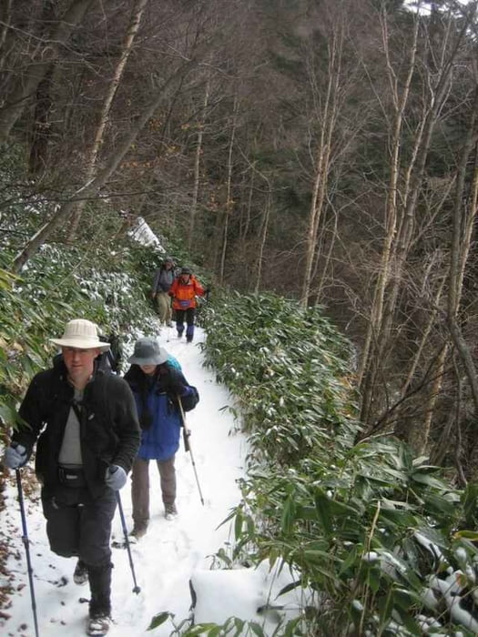
This is an easy loop hike starting at Yumoto Onsen in Oku-Nikko, and ending at Kotoku Onsen, from where you can get a bus back to Yumoto or Nikko.
You can hike this from May to December, and snowshoe it from late December to April.
It takes about 5 hours, and you should purchase a hiking map (the 'Yama-tokougen' series are best).

Tour Galerie

Tour Karte und Höhenprofil

  • Open Street Map
  • Google
Minimale Höhe 1423 m Maximale Höhe 1744 m Detailansicht

Mehr zum Tourautor

zangezur
Mitglied seit 2004

Land: Japan

14 erstellte Touren
8.2
Private Nachricht senden

Kommentare

From Tobu-Asakusa in Tokyo take the Tobu line to Tobu-Nikko. The 7.10 train will get you to Nikko at 9.15. Then take a bus from opposite the station to Nikko-Yumoto (at 9.24), which will take 1.5 hours.
It's best to stay one night in Yumoto Onsen to be able to enjoy the area without rushing back to Tokyo.
From Yumoto Onsen find the trai which climbs up to the highway from behind the village (where you can see the hot springs), then cross the highway, and hike along the valley beyond. This trail will take you up to a pass, then down into another valley leading to two lakes, Karikomi-ko and Kirikomi-ko. Past there you will see a road up ahead, which you will need to cimb up to. Turn right on the road, then immediately take a trail off to the right, which will then descend into the valey beyond, leading down towards Kotoku Onsen, where you will find a hotel. (In winter they have XC skiing). There is a bus stop here with departures for both Yumoto Onsen and Nikko.

GPS-Tracks

Trackpunkte
  • GPX / Garmin Map Source (gpx) download
  • TCX / Garmin Training Center® (tcx) download
  • CRS / Garmin Training Center® (crs) download
  • Google Earth (kml) download
  • G7ToWin (g7t) download
  • TTQV (trk) download
  • Overlay (ovl) download
  • Fugawi (txt) download
  • Kompass (DAV) Track (tk) download
  • Tourenblatt (pdf) download
  • Originaldatei des Autors (gpx) download

Mehr zum Tourautor

zangezur
Mitglied seit 2004

Land: Japan

14 erstellte Touren
8.2
Private Nachricht senden
Tour teilen
Zu meinen Favoriten hinzufügen
Von meinen Favoriten entfernen
Tags bearbeiten
Meine Bewertung
Bewerten
Tour: Nikko Yumoto
Art: Wandern
Länge: 8,2 km
Bewertet am:
Dauer:
Tag(e)
Stunde(n)
Minute(n)
Bewertung: Landschaft Spaßfaktor Kondition Technik