Login

Forgotten password?

Cookies have to be accepted!
Your browser's cookie functionality is disabled. Please enable this functionality.

Not a member yet?

Register now
Login

Available for registred users only

Log in to use this feature.

Forgotten password?

Cookies have to be accepted!
Your browser's cookie functionality is disabled. Please enable this functionality.

Not a member yet?

Register now
Filter
Categories
Advanced filters
  • Distance (km)
  • Height
Save filters Reset filter

TrackRank

QRCode

Technical data

Distance89,9 km Height1263 m Way down1261 m Duration03:15 h:m Date27.08.2012
Scores Author Landscape Fun factor Fitness Technique

Statistics

64 Views Scores 3 Downloads Average
Rate
  • Track data sheet
  • Directions
  • Downloads

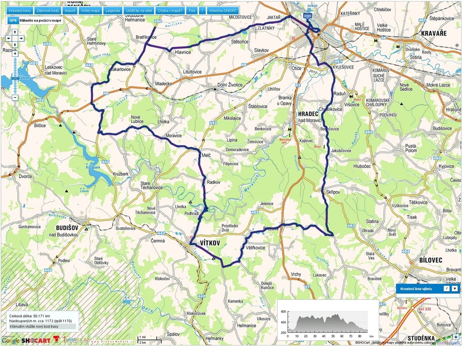
V neděli ráno a dopol. pršelo tak na kolo až ve dvě, horák stál na prázdné zadní pneu - vzal jsem silničku a vyrazil, nakonec z toho bylo 90km s jednou 5min zastávkou uprostřed lesa v minipivovaru Slezan na výýýýbornou černou 14ku.


Tour map and elevation profile

  • Open Street Map
  • Google
Minimum height 247 m Maximum height 557 m Detailed view

More about the tour author

mtbBen
Member since 2011

Send private message

Comments

GPS tracks

Trackpoints
  • GPX / Garmin Map Source (gpx) download
  • TCX / Garmin Training Center® (tcx) download
  • CRS / Garmin Training Center® (crs) download
  • Google Earth (kml) download
  • G7ToWin (g7t) download
  • TTQV (trk) download
  • Overlay (ovl) download
  • Fugawi (txt) download
  • Kompass (DAV) Track (tk) download
  • Track data sheet (pdf) download
  • Original file of the author (gpx) download

More about the tour author

mtbBen
Member since 2011

Send private message
Share track
Add to my favorites
Remove from my favorites
Edit tags
My score
Rate
Track: 20120826RB 90
Type: Road biking
Distance: 89,9 km
Evaluated on:
Duration:
Day(s)
Hour(s)
Minute(s)
Score: Landscape Fun factor Fitness Technique