
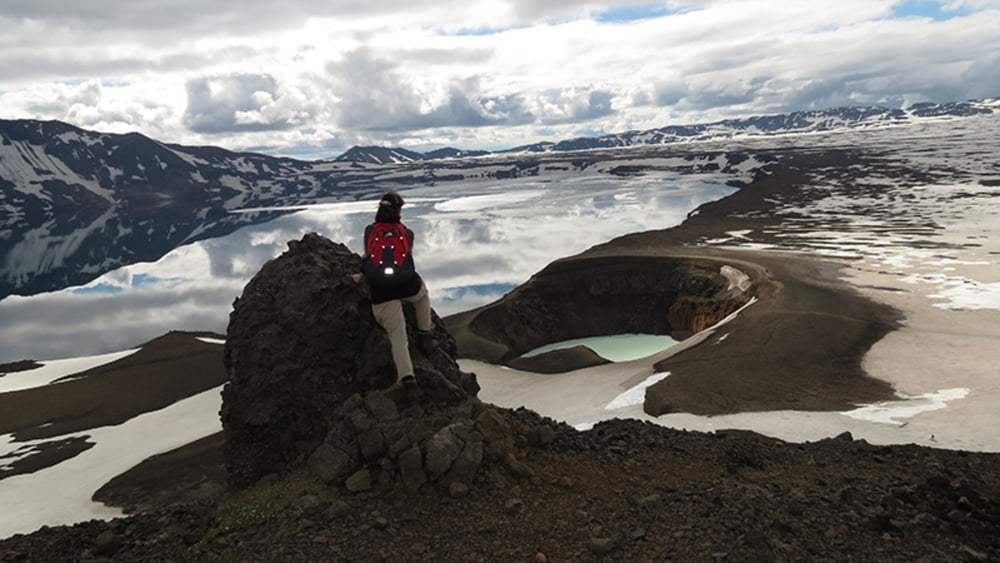

Askja ist ein mehrere Hunderttausend Jahre alter Zentralvulkan im Hochland von Island.
Der mächtige Vulkan setzt sich aus mindestens drei ineinander verschachtelten Calderen zusammen. In der Mitte der jüngsten, in der vulkanotektonischen Episode von 1875 entstandenen Caldera befindet sich der See Öskjuvatn, mit 220 m der tiefste See Islands. Der kleinere Víti-Krater ist ebenfalls von einem See ausgefüllt, in dem man eigentlich baden kann. Zur Zeit ist der Abstieg in den Krater jedoch abgesperrt.
Further information at
http://www.ski-web24.de/island2014/frame.htmTour map and elevation profile
Minimum height 1043 m
Maximum height 1369 m
More about the tour author
|
|
biauwe |
Comments

GPS tracks
Trackpoints-
GPX / Garmin Map Source (gpx) download
-
TCX / Garmin Training Center® (tcx) download
-
CRS / Garmin Training Center® (crs) download
-
Google Earth (kml) download
-
G7ToWin (g7t) download
-
TTQV (trk) download
-
Overlay (ovl) download
-
Fugawi (txt) download
-
Kompass (DAV) Track (tk) download
-
Track data sheet (pdf) download
-
Original file of the author (gpx) download
More about the tour author
|
|
biauwe |
Add to my favorites
Remove from my favorites
Edit tags
Open track
My score
Rate