


Grenoble is surrounded by three mountain ranges: Chartreuse, Vercors and Belledonnes. During this trip we visited lower parts of Belledonnes. We set off from the city as usual.
The trip starts with a warmup climb to St-Martin-d'Uriage, where you choose the road to Chamrousse ski station. Our goal was to reach Luitel lake. If you have enough energy to climb further, you could follow the uphill road up to 1700 meters.
The road during the descent is very twisty, narrow, steep and rough, so good brakes are needed.
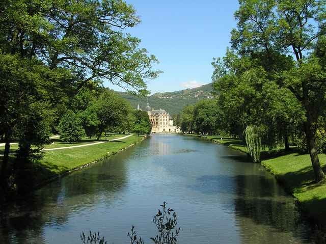
When you reach Vizille, don't miss the castle. The museum is extremly boring, but the parc is definitely worth seeing.
The way back to Grenoble through Le Pont-de-Claix is flat. If you consider it too easy, you may choose to climb to Commune de Brie-et-Angonnes.
The trip starts with a warmup climb to St-Martin-d'Uriage, where you choose the road to Chamrousse ski station. Our goal was to reach Luitel lake. If you have enough energy to climb further, you could follow the uphill road up to 1700 meters.
The road during the descent is very twisty, narrow, steep and rough, so good brakes are needed.
When you reach Vizille, don't miss the castle. The museum is extremly boring, but the parc is definitely worth seeing.
The way back to Grenoble through Le Pont-de-Claix is flat. If you consider it too easy, you may choose to climb to Commune de Brie-et-Angonnes.
Mappa itinerario e altimetria
Altezza minima 216 m
Altezza massima 1268 m
Maggiori informazioni sull'autore del tour

|
azzie |
Commenti

Maggiori informazioni sull'autore del tour
|
|
azzie |
Aggiungi ai miei preferiti
Rimuovi dai miei preferiti
Modifica dei tag
Tour aperto


Il mio voto
Vota