


This walk follows one of the many ancient Pilgrims paths that are found in Mallorca. This 8 mile hike goes from the village of Caimari to the Lluc Monastery.
The walk is taken in the reverse from Coll de sa Bataia near to the Monastery down to the sleepy village of Caimari. This means that it is all down hill to Caimari and all uphill on the return.
The village square is a good place for a halfway rest and lunch.
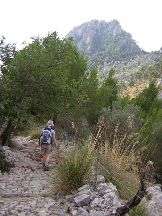
The walk crosses and recrosses the original route and occasionally uses the actual Pilgrims path that has been restored in places. The route is said to be 700 years old. There are some stupendous views along the way.
The route and path can be very rocky and uneven so good walking boots are essential.
The walk is taken in the reverse from Coll de sa Bataia near to the Monastery down to the sleepy village of Caimari. This means that it is all down hill to Caimari and all uphill on the return.
The village square is a good place for a halfway rest and lunch.
The walk crosses and recrosses the original route and occasionally uses the actual Pilgrims path that has been restored in places. The route is said to be 700 years old. There are some stupendous views along the way.
The route and path can be very rocky and uneven so good walking boots are essential.
Galleria itinerari

Mappa itinerario e altimetria
Altezza minima 178 m
Altezza massima 613 m
Maggiori informazioni sull'autore del tour

|
SILVAED |
Commenti

The start of the walk is from the restaurant at the Coll de sa Bataia. You can park here and have a cold drink on your return. Or you can get a bus to the Lluc Monastery and walk from there.
Tracce GPS
Punti di traccia-
GPX / Garmin Map Source (gpx) download
-
TCX / Garmin Training Center® (tcx) download
-
CRS / Garmin Training Center® (crs) download
-
Google Earth (kml) download
-
G7ToWin (g7t) download
-
TTQV (trk) download
-
Overlay (ovl) download
-
Fugawi (txt) download
-
Kompass (DAV) Track (tk) download
-
Scheda tecnica (pdf) download
-
File originale dell'autore (gpx) download
Maggiori informazioni sull'autore del tour
|
|
SILVAED |
Aggiungi ai miei preferiti
Rimuovi dai miei preferiti
Modifica dei tag
Tour aperto
Il mio voto
Vota