


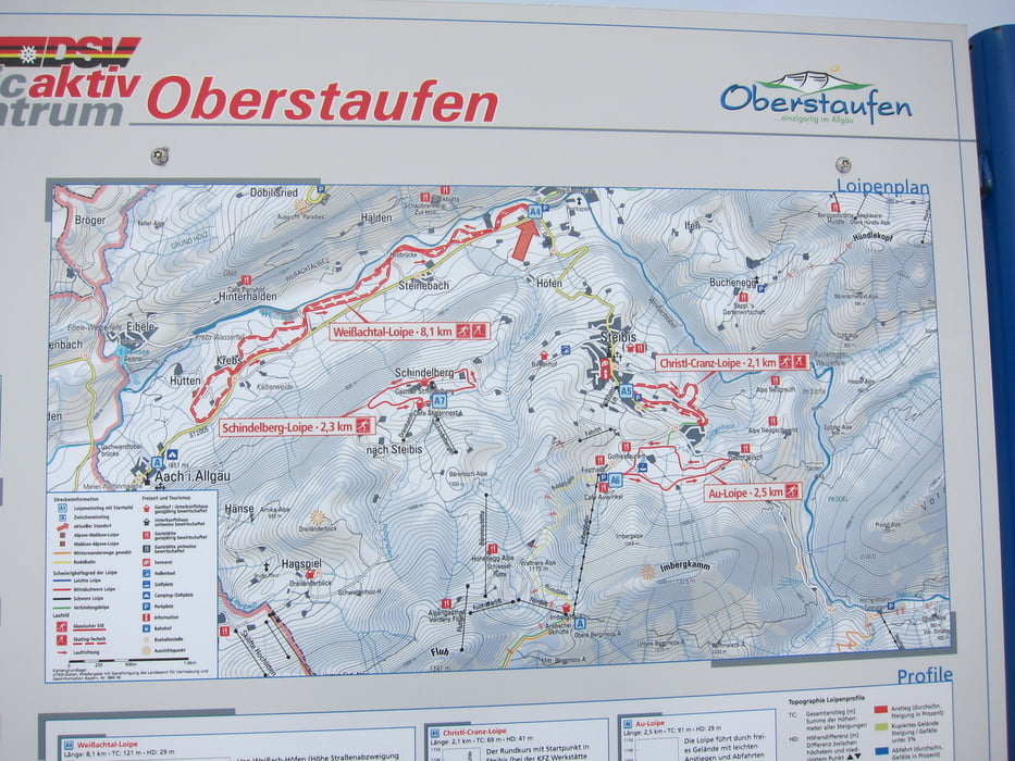
Vom Parkplatz aus zur Loipe, muss die Straße überquert werden. Die mittelschwere Loipe ist für diagonal und klassisch SKI gespurt.
Die erste Hälfte verläuft schön am Fluss “Weißach” entlang, zurück geht’s meist neben der Straße, was uns weniger gefiel. Auch muss man mehrmals kleinere Wege überqueren.
Further information at
http://oberstaufen.de/webcams/Галерея маршрутов
Карта маршрута и высотный профиль
Minimum height 629 m
Maximum height 662 m
More about the tour author
|
|
W-C |
Комментарии

Von der Queralpenstraße B308 kommend durch Weißach. Bei Höfen, Abbiegung links nach Steibis. Gleich nach der Abbiegung wieder links zum gebührenfreien Parkplatz.
Parkplatz - Koordinaten für dein Navigationsgerät
N 47° 32. 532´
E 10° 00. 917´
GPS-Tracks
Trackpoints-
GPX / Garmin Map Source (gpx) download
-
TCX / Garmin Training Center® (tcx) download
-
CRS / Garmin Training Center® (crs) download
-
Google Earth (kml) download
-
G7ToWin (g7t) download
-
TTQV (trk) download
-
Overlay (ovl) download
-
Fugawi (txt) download
-
Kompass (DAV) Track (tk) download
-
Формуляр маршрута (pdf) download
-
Original file of the author (gpx) download
More about the tour author
|
|
W-C |
Add to my favorites
Remove from my favorites
Edit tags
Open track
My score
Rate