Login

Zabudli ste prihlasovacia meno

Cookies have to be accepted!
Your browser's cookie functionality is disabled. Please enable this functionality.

Not a member yet?

Register now
Login

Available for registred users only

Log in to use this feature.

Zabudli ste prihlasovacia meno

Cookies have to be accepted!
Your browser's cookie functionality is disabled. Please enable this functionality.

Not a member yet?

Register now
Filter
Kategórie
Advanced filters
  • Dĺžka (km)
  • výškomer
Uložiť filter Reset filter

TrackRank

QRCode

Technical data

Dĺžka4,3 km výškomer251 m Way down249 m Doba00:40 h:m dátum20.06.2013
ohodnotenia Author Kraj pôžitok z túry kondícia technika

štatistika

541 náhľady ohodnotenia 52 Stiahnutia priemer
Rate
  • list trasy
  • príjazd
  • Stiahnutia
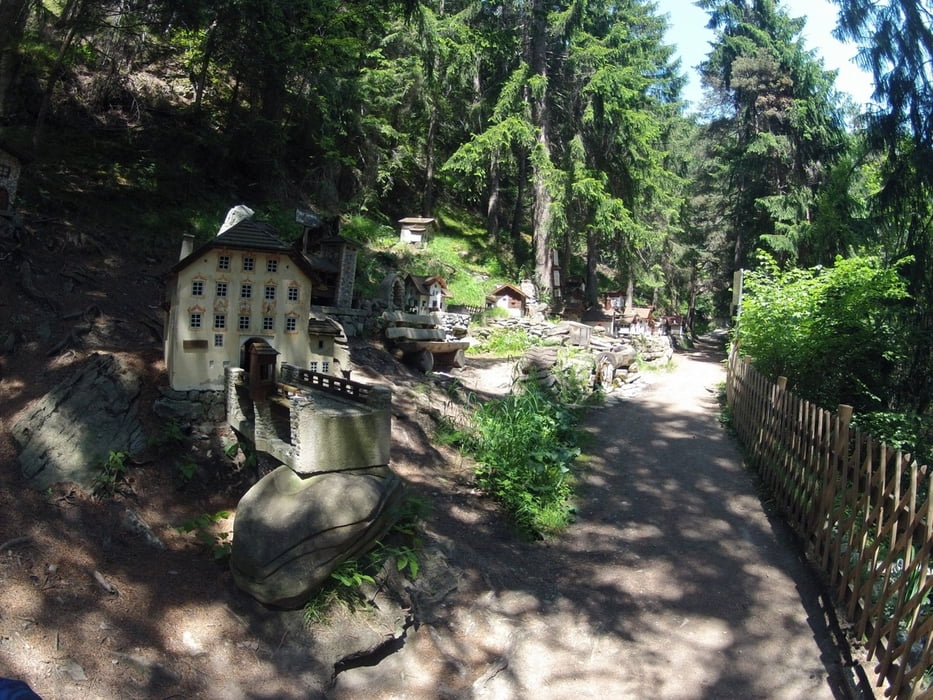
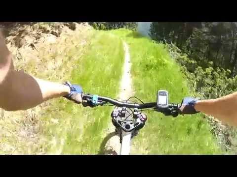
Ein sehr kurzer Insidertrail, aber unbedingt empfehlenswert. Ein Flowspaß für Fullys ohne große Ansprüche, für alle gelangweilten Ehemänner auf der Via Claudia. Vom Billaparkplatz in Pfunds geht es ein Stück hinauf Richtung Kobler. Die Asphaltstraße wird dann links auf einen Schotterweg verlassen, der widerum nach einigen Kurven scharf links auf einen Trail verlassen wird. Dieser führt einige Zeit ziemlich flowig hinab und mündet schließlich in eine Wegekreuzung. Hier halblinks sanft bergauf, vorbei an der Miniaturwelt Minifundus, zurück zum Ausgangspunkt am Billa. Kalte Getränke gibt's übrigens gegenüber beim MPreis :)

galéria trás

Mapa trasy a výškový profil

  • Open Street Map
  • Google
Minimum height 970 m Maximum height 1186 m Detailný pohľad

More about the tour author

BergBiken
Member since 2010

Send private message

komentáre

Nach Pfunds per Bus oder Auto. Start am Billa. Dort bestehen Parkmöglichkeiten. Die Fahrt mit dem Auto nach Pfunds hinein ist einfach, die Reschenstraße nicht verlassen, dann gibt es am südseitigen Ortsende zwei Supermärkte. Der meist etwas leerere Parkplatz ist der vom Billa auf der Ostseite. Busse haben übrigens kostenlose Bikemitnahme!


GPS trasy

Trackpoints
  • GPX / Garmin Map Source (gpx) download
  • TCX / Garmin Training Center® (tcx) download
  • CRS / Garmin Training Center® (crs) download
  • Google Earth (kml) download
  • G7ToWin (g7t) download
  • TTQV (trk) download
  • Overlay (ovl) download
  • Fugawi (txt) download
  • Kompass (DAV) Track (tk) download
  • list trasy (pdf) download
  • Original file of the author (gpx) download

More about the tour author

BergBiken
Member since 2010

Send private message
Share track
Add to my favorites
Remove from my favorites
Edit tags
My score
Rate
trasa: Minifundus Trail in Pfunds
Druh: horský bicykel
Dĺžka: 4,3 km
Evaluated on:
Doba:
Day(s)
Hour(s)
Minute(s)
ohodnotenie: Kraj pôžitok z túry kondícia technika