Login

Zabudli ste prihlasovacia meno

Cookies have to be accepted!
Your browser's cookie functionality is disabled. Please enable this functionality.

Not a member yet?

Register now
Login

Available for registred users only

Log in to use this feature.

Zabudli ste prihlasovacia meno

Cookies have to be accepted!
Your browser's cookie functionality is disabled. Please enable this functionality.

Not a member yet?

Register now
Filter
Kategórie
Advanced filters
  • Dĺžka (km)
  • výškomer
Uložiť filter Reset filter

TrackRank

QRCode

Technical data

Dĺžka8,9 km výškomer0 m Way down0 m Doba03:00 h:m dátum06.07.2014
ohodnotenia Author Kraj pôžitok z túry kondícia technika

štatistika

1150 náhľady ohodnotenia 84 Stiahnutia priemer
Rate
  • list trasy
  • príjazd
  • Stiahnutia

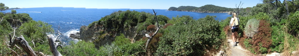
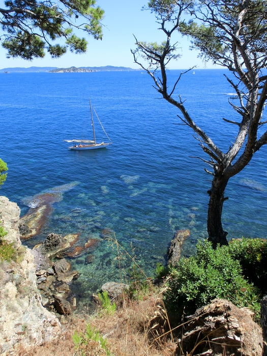
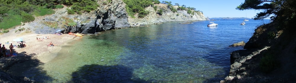
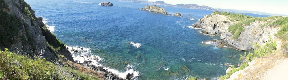
Toller Panorama-Küstenweg entlang des sentier du littoral mit schönsten Ausblicken und Bademöglichkeiten, der die Trails auf Porquerolles und Port-Cros evtl sogar aussticht. 

Wir haben den Track damals nicht aufgenommen, deshalb habe ich ihn mit Oruxmaps im Nachinein erstellt. Die 350 Höhenmeter sind eine grobe Schätzung.

Es lässt sich toll campen auf der Halbinsel Giens, die Strände sind prima, Giens ein charmantes Örtchen. Wenn man das Ziel hat, auch noch nach Porquerolles, Port-Cros ect. zu Tagesausflügen überzusetzen, kann man sich Einges an Nerverei ersparen, wenn man direkt auf der Halbinsel wohnt, denn Tausende fahren am Morgen hinauf, um die Fähren zu bekommen, und reisen am frühen Abend wieder zurück, also Stau total. In die jeweiligen Gegenrichtungen hatten wir hingegen immer freie Fahrt. :-)

galéria trás

Mapa trasy a výškový profil

  • Open Street Map
  • Google
Minimum height 99999 m Maximum height -99999 m Detailný pohľad

More about the tour author

mackator
Member since 2012

Send private message

komentáre

Start am Kirchvorplatz in Giens. Am Ende des Trails Bus nach Giens zurück nehmen (unregelmäßige Fahrzeiten).


GPS trasy

Trackpoints
  • GPX / Garmin Map Source (gpx) download
  • TCX / Garmin Training Center® (tcx) download
  • CRS / Garmin Training Center® (crs) download
  • Google Earth (kml) download
  • G7ToWin (g7t) download
  • TTQV (trk) download
  • Overlay (ovl) download
  • Fugawi (txt) download
  • Kompass (DAV) Track (tk) download
  • list trasy (pdf) download
  • Original file of the author (gpx) download

More about the tour author

mackator
Member since 2012

Send private message
Share track
Add to my favorites
Remove from my favorites
Edit tags
My score
Rate
trasa: Presq'il de Giens - Sentier du littoral
Druh: trasa
Dĺžka: 8,9 km
Evaluated on:
Doba:
Day(s)
Hour(s)
Minute(s)
ohodnotenie: Kraj pôžitok z túry kondícia technika