


- Rundkurs im Uhrzeigersinn
- Start/Ziel: St.Peter-Villnöss
Von St.Peter-Dorfzenturm MH. 1.134 auf Teerstrasse zur Jausenstation Moarhof MH 1.329 KM 4,06.
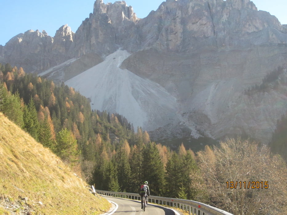
Weiter auf Forstweg bis zur einzigen Schiebepassage (40HM) MH 1.451 KM 7,07.
Auf Forstweg, in stetigem Auf u. Ab bis zum Russiskreuz (höchster Punkt der Tour) MH 1.734 KM 19,5.
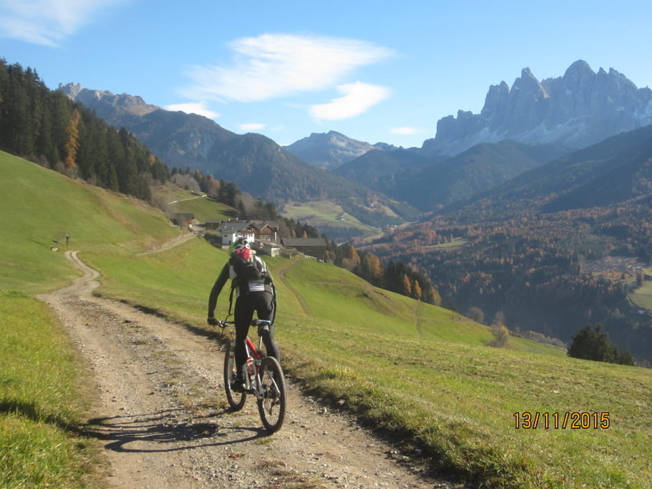
Abfahrt auf Teerstrasse u. Forstweg hinunter ins Tal nach St. Magdalena u. auf Nebenwegen talauswärts zurück zum Ausgangspunkt nach St. Peter MH 1.134 KM 28.
PS. Ausblick auf Geislergruppe, Villnössertal, Plose Aferer Tal.
galéria trás

Mapa trasy a výškový profil
Minimum height 1125 m
Maximum height 1735 m
More about the tour author
|
|
MargesinFriedrich |
komentáre

GPS trasy
Trackpoints-
GPX / Garmin Map Source (gpx) download
-
TCX / Garmin Training Center® (tcx) download
-
CRS / Garmin Training Center® (crs) download
-
Google Earth (kml) download
-
G7ToWin (g7t) download
-
TTQV (trk) download
-
Overlay (ovl) download
-
Fugawi (txt) download
-
Kompass (DAV) Track (tk) download
-
list trasy (pdf) download
-
Original file of the author (gpx) download
More about the tour author
|
|
MargesinFriedrich |
Add to my favorites
Remove from my favorites
Edit tags
Open track
My score
Rate