Login

Zabudli ste prihlasovacia meno

Cookies have to be accepted!
Your browser's cookie functionality is disabled. Please enable this functionality.

Not a member yet?

Register now
Login

Available for registred users only

Log in to use this feature.

Zabudli ste prihlasovacia meno

Cookies have to be accepted!
Your browser's cookie functionality is disabled. Please enable this functionality.

Not a member yet?

Register now
Filter
Kategórie
Advanced filters
  • Dĺžka (km)
  • výškomer
Uložiť filter Reset filter

TrackRank

QRCode

Technical data

Dĺžka6,2 km výškomer880 m Way down403 m Doba09:00 h:m dátum30.08.2017
ohodnotenia Author Kraj pôžitok z túry kondícia technika

štatistika

835 náhľady ohodnotenia 15 Stiahnutia priemer
Rate
  • list trasy
  • príjazd
  • Stiahnutia

ACHTUNG !

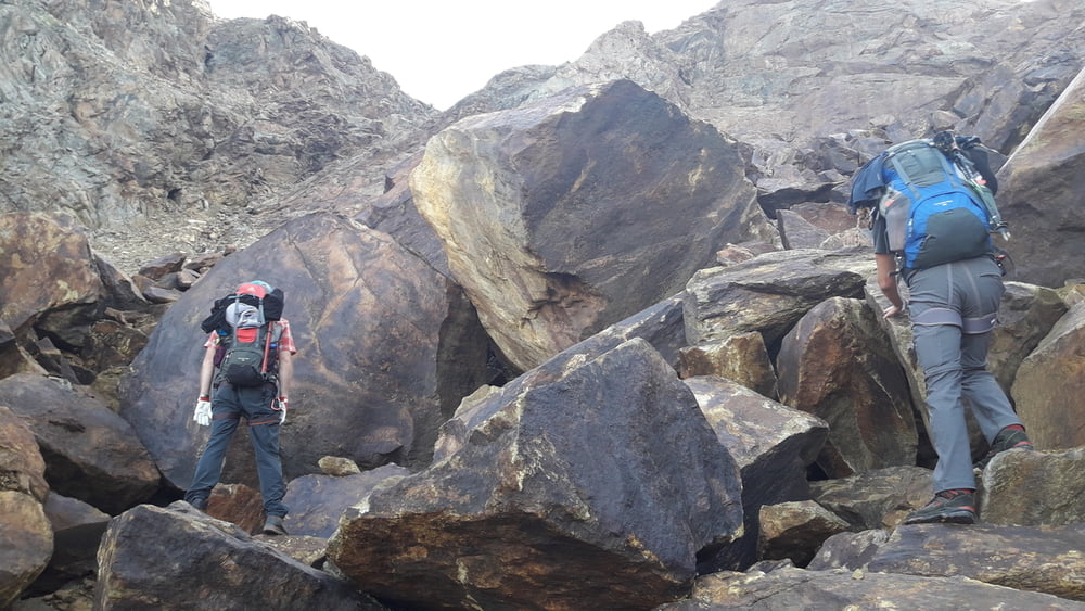
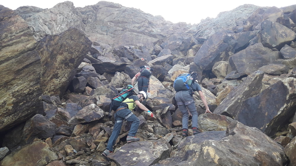
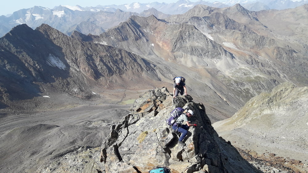
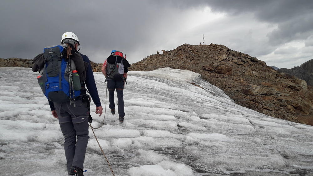
Es ist 4-Tage Tour und NUR für geübte mit Bergführer! Es ist NICHT oder serh schlecht markiert und NICHT gesiechert!

1 Tag - Aufstieg zur Sigerlandhütte (leicht)
2 Tag - Siegerlandhütte - Hohes Eis 3392hm - Sonklarspitze 3467hm - Becherhaus (NUR mit Bergführer!)
3 Tag - Becherhaus - Windachscharte - Siegerlandhuette (NUR mit Bergführer!)
4 Tag - Siegerlandhuette - Windachalm - Sölden

Am 3 Tag wurde geplant von Becherhaus auf Wilder Pfaff zu steigen, dann auf Zuckerhütl und in Hildesheimerhütte Übernachten. Wegen instabiles Wetter und schlechte Markierung Plan wurde geändert.

Further information at

https://www.gpsies.com/map.do?fileId=jjdbynwypbbmgvsw

galéria trás

Mapa trasy a výškový profil

  • Open Street Map
  • Google
Minimum height 2721 m Maximum height 3452 m Detailný pohľad

More about the tour author

copyright
Member since 2013

Send private message

komentáre

https://goo.gl/maps/v6MdvQqjUDE2  In Parkhaus parken.

GPS trasy

Trackpoints
  • GPX / Garmin Map Source (gpx) download
  • TCX / Garmin Training Center® (tcx) download
  • CRS / Garmin Training Center® (crs) download
  • Google Earth (kml) download
  • G7ToWin (g7t) download
  • TTQV (trk) download
  • Overlay (ovl) download
  • Fugawi (txt) download
  • Kompass (DAV) Track (tk) download
  • list trasy (pdf) download
  • Original file of the author (gpx) download

More about the tour author

copyright
Member since 2013

Send private message
Share track
Add to my favorites
Remove from my favorites
Edit tags
My score
Rate
trasa: Hochstubai2017 (Tag 2/4 ) Siegerlandhütte - Hohes Eis 3392hm - Sonklarspitze 3467hm - Becherhaus 27.08.2017
Druh: sklon stúpania
Dĺžka: 6,2 km
Evaluated on:
Doba:
Day(s)
Hour(s)
Minute(s)
ohodnotenie: Kraj pôžitok z túry kondícia technika