Login

Zabudli ste prihlasovacia meno

Cookies have to be accepted!
Your browser's cookie functionality is disabled. Please enable this functionality.

Not a member yet?

Register now
Login

Available for registred users only

Log in to use this feature.

Zabudli ste prihlasovacia meno

Cookies have to be accepted!
Your browser's cookie functionality is disabled. Please enable this functionality.

Not a member yet?

Register now
Filter
Kategórie
Advanced filters
  • Dĺžka (km)
  • výškomer
Uložiť filter Reset filter

TrackRank

QRCode

Technical data

Dĺžka158,6 km výškomer2313 m Way down2285 m Doba07:00 h:m dátum04.08.2022
ohodnotenia Author Kraj pôžitok z túry kondícia technika

štatistika

196 náhľady ohodnotenia 8 Stiahnutia priemer
Rate
  • list trasy
  • príjazd
  • Stiahnutia

Diese Tour hat einen steilen Anstieg zum Passo Fittanze, der Rest ist zum Genießen.

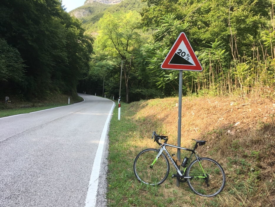
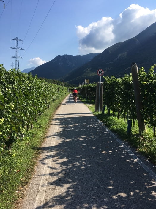
Nach dem Einrollen auf Radweg entlang der Etsch kommt der 1000 Hm Anstieg. Laut Verkehrsschild 20 %, was sicherlich etwas übertrieben ist. Mein Garmin zeigt bei einer Steigung 17,5 %, was auch nicht ganz ohne ist.

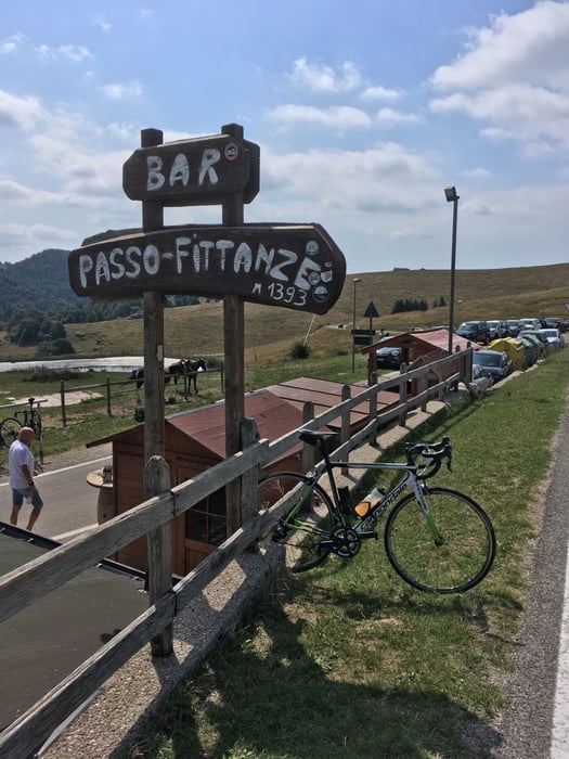
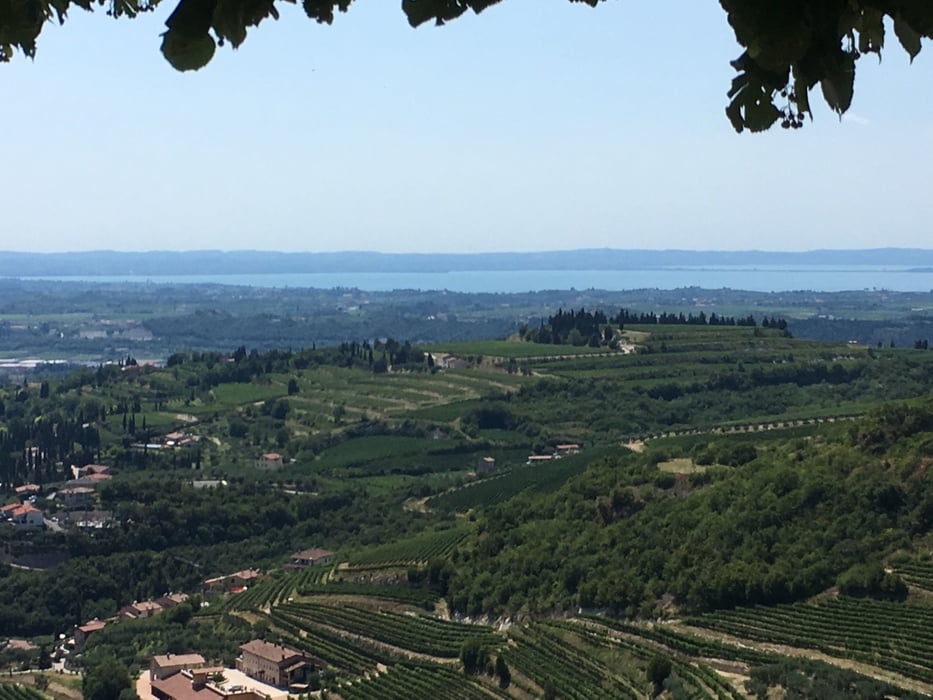
Ab dem Passo delle Fittanze kommt der herrliche Teil der Tour. Anfangs über die Hochebene, dann hinunter durch Weinberge und Oliven und das alles auf kleinen Straßen. Der Blick reicht über die weite Ebene bis hin zum Gardasee. Vom Dorfplatz in San Giorgio di Valpolicella hat man einen schönen Ausblick bis zum Gardasee. Einmal unten angekommen geht es über den Radweg wieder zurück nach Rovereto.

Man kann die Runde natürlich auch anders herum fahren, so spart man sich die steile Auffahrt, aber man hat auch nicht die schönen Ausblicke bei der Abfahrt. 

Ps.alle meine Touren sind auch auf Strava.


Further information at

https://www.altalessinia.com/de/naturpark-der-lessinia/

galéria trás

Mapa trasy a výškový profil

  • Open Street Map
  • Google
Minimum height 81 m Maximum height 1534 m Detailný pohľad

More about the tour author

Califan
Member since 2010

Send private message

komentáre

Parkplatz AB Ausfahrt Rovereto Nord 

https://www.google.com/maps/place/45%C2%B054'51.5%22N+11%C2%B002'09.1%22E/@45.9142226,11.0352666,19.25z/data=!4m6!3m5!1s0x0:0xad67845aa00d7c74!7e2!8m2!3d45.9143039!4d11.0358669

GPS trasy

Trackpoints
  • GPX / Garmin Map Source (gpx) download
  • TCX / Garmin Training Center® (tcx) download
  • CRS / Garmin Training Center® (crs) download
  • Google Earth (kml) download
  • G7ToWin (g7t) download
  • TTQV (trk) download
  • Overlay (ovl) download
  • Fugawi (txt) download
  • Kompass (DAV) Track (tk) download
  • list trasy (pdf) download
  • Original file of the author (gpx) download

More about the tour author

Califan
Member since 2010

Send private message
Share track
Add to my favorites
Remove from my favorites
Edit tags
My score
Rate
trasa: Ala - Monte Lessini
Druh: pretekársky bicykel
Dĺžka: 158,6 km
Evaluated on:
Doba:
Day(s)
Hour(s)
Minute(s)
ohodnotenie: Kraj pôžitok z túry kondícia technika