Login

Zabudli ste prihlasovacia meno

Cookies have to be accepted!
Your browser's cookie functionality is disabled. Please enable this functionality.

Not a member yet?

Register now
Login

Available for registred users only

Log in to use this feature.

Zabudli ste prihlasovacia meno

Cookies have to be accepted!
Your browser's cookie functionality is disabled. Please enable this functionality.

Not a member yet?

Register now
Filter
Kategórie
Advanced filters
  • Dĺžka (km)
  • výškomer
Uložiť filter Reset filter

TrackRank

QRCode

Technical data

Dĺžka68,0 km výškomer707 m Way down716 m Doba00:00 h:m dátum09.01.2024
ohodnotenia Author Kraj pôžitok z túry kondícia technika

štatistika

165 náhľady ohodnotenia 2 Stiahnutia priemer
Rate
  • list trasy
  • príjazd
  • Stiahnutia
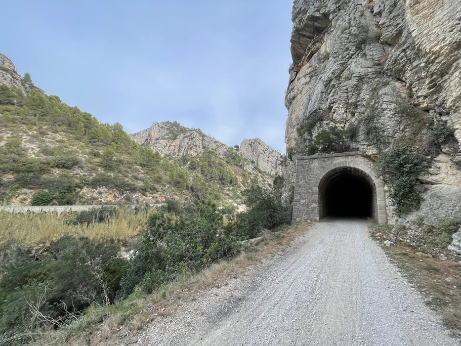
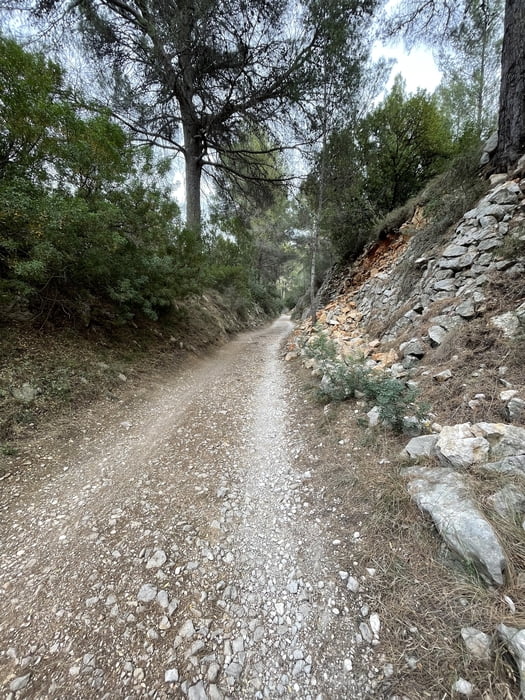
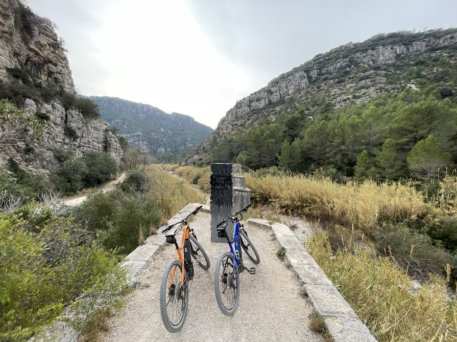
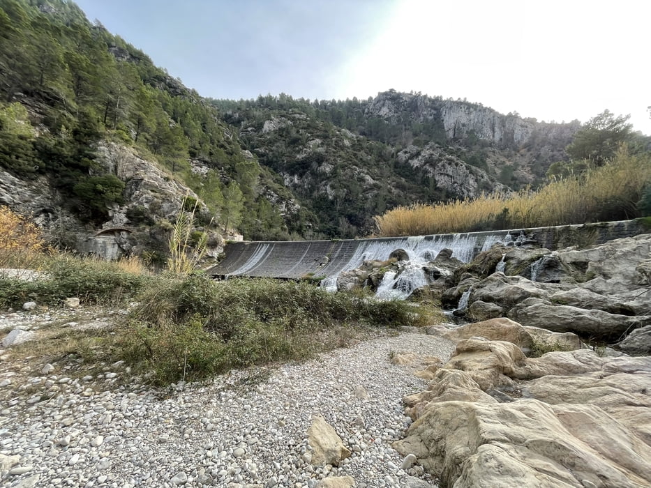
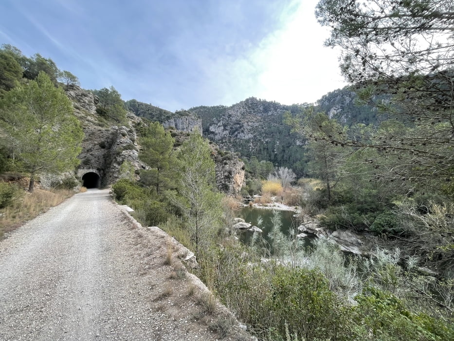
Die Tour startet und endet an der Strandpromenade von Oliva und führt Richtung Osten entlang eine stillgelegten und renaturierten Eisenbahnstrecke entlang. Wer ohne Akku-Unterstützung diese Tour bestreiten möchte, sollte gut im Training stehen. Man muss dabei einige Tunnel passieren. Für einen/zwei davon ist eine Taschenlampe empfehlenswert, eine Handylampe tut es aber auch. Ich habe es aber auch selbst erlebt, dass die erfahrenen Einheimischen dort ohne Licht durch’s Dunkle „brettern“. Nachdem man die Nebenstraßen hinter sich gelassen hat und die Berge bzw. der Wald beginnt ist diese Tour ein landschaftlicher Leckerbissen. Die Wende ist ein Dorf in den Bergen, Gastronomie mit einer Bar war augenscheinlich vorhanden, wurde aber von uns nicht genutzt. Die Strecke ist somit kein wirklicher Rundweg, aber die anschließende Abfahrt bietet noch einmal eine andere Perspektive der landschaftlichen Idylle. 

galéria trás

Mapa trasy a výškový profil

  • Open Street Map
  • Google
Minimum height -11 m Maximum height 331 m Detailný pohľad

More about the tour author

RonRonin
Member since 2023

Send private message

komentáre

GPS trasy

Trackpoints
  • GPX / Garmin Map Source (gpx) download
  • TCX / Garmin Training Center® (tcx) download
  • CRS / Garmin Training Center® (crs) download
  • Google Earth (kml) download
  • G7ToWin (g7t) download
  • TTQV (trk) download
  • Overlay (ovl) download
  • Fugawi (txt) download
  • Kompass (DAV) Track (tk) download
  • list trasy (pdf) download
  • Original file of the author (gpx) download

More about the tour author

RonRonin
Member since 2023

Send private message
Share track
Add to my favorites
Remove from my favorites
Edit tags
My score
Rate
trasa: Von Oliva entlang einer stillgelegten Eisenbahn
Druh: horský bicykel
Dĺžka: 68,0 km
Evaluated on:
Doba:
Day(s)
Hour(s)
Minute(s)
ohodnotenie: Kraj pôžitok z túry kondícia technika