Login

Zabudli ste prihlasovacia meno

Cookies have to be accepted!
Your browser's cookie functionality is disabled. Please enable this functionality.

Not a member yet?

Register now
Login

Available for registred users only

Log in to use this feature.

Zabudli ste prihlasovacia meno

Cookies have to be accepted!
Your browser's cookie functionality is disabled. Please enable this functionality.

Not a member yet?

Register now
Filter
Kategórie
Advanced filters
  • Dĺžka (km)
  • výškomer
Uložiť filter Reset filter

TrackRank

QRCode

Technical data

Dĺžka360,5 km výškomer21 m Way down18 m Doba00:00 h:m dátum03.01.2006
ohodnotenia Author Kraj pôžitok z túry kondícia technika

štatistika

9227 náhľady 3 ohodnotenia 1474 Stiahnutia 2.67 priemer
Rate
  • list trasy
  • príjazd
  • Stiahnutia
Diese Transalp ist angelehnt an die Heckmaier Route bzw. die Summit von U. Stanciu aus seinem Buch "Traumtouren Transalp". Allerdings haben wir den Tremalzo weggelassen und sind dafür über den "Passe Bregn da l´Ors gefahren. Hier könnte man sich auch einen Tag sparen, aber wir hatten es nicht eilig.
Reisezeit war vom 15.7. - 21.7.
1. Tag: Oberstdorf - Daalas (56km/1750hm)
2. Tag: Dalaas - Davos (55km/2536hm)
3. Tag: Davos - Livigno (57km/2100hm)
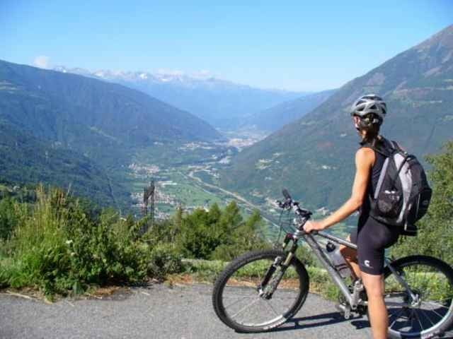
4. Tag: Livigno - Grosio (65km/1320hm)
5. Tag: Grosio - Dimaro (86km / 2250hm)
6. Tag: Dimaro - Ponte Arche (60km/1820)
7. Tag: Ponte Arche - Riva (25km /600hm)

galéria trás

Mapa trasy a výškový profil

  • Open Street Map
  • Google
Minimum height 1809 m Maximum height 1821 m Detailný pohľad

More about the tour author

doweb
Member since 2005

Send private message

komentáre

klemid on 15.06.2006

Schieben

Wichtig fände ich die Info, wieviel geschoben/getragen werden muss.
Uli on 12.11.2006

Höhendaten

ich schätze, das ist wirklich eine wirklich tolle und anspruchsvolle tour. Nur Schade, daß die GPS Daten ohne Höhenprofil sind.
A7 Ulm - Füssen, bei Kempten nach Oberstdorf

GPS trasy

Trackpoints
  • GPX / Garmin Map Source (gpx) download
  • TCX / Garmin Training Center® (tcx) download
  • CRS / Garmin Training Center® (crs) download
  • Google Earth (kml) download
  • G7ToWin (g7t) download
  • TTQV (trk) download
  • Overlay (ovl) download
  • Fugawi (txt) download
  • Kompass (DAV) Track (tk) download
  • list trasy (pdf) download
  • Original file of the author (gpx) download

More about the tour author

doweb
Member since 2005

Send private message
Share track
Add to my favorites
Remove from my favorites
Edit tags
My score
Rate
trasa: Von Oberstdorf nach Riva
Druh: Transalp
Dĺžka: 360,5 km
Evaluated on:
Doba:
Day(s)
Hour(s)
Minute(s)
ohodnotenie: Kraj pôžitok z túry kondícia technika