Login

Zabudli ste prihlasovacia meno

Cookies have to be accepted!
Your browser's cookie functionality is disabled. Please enable this functionality.

Not a member yet?

Register now
Login

Available for registred users only

Log in to use this feature.

Zabudli ste prihlasovacia meno

Cookies have to be accepted!
Your browser's cookie functionality is disabled. Please enable this functionality.

Not a member yet?

Register now
Filter
Kategórie
Advanced filters
  • Dĺžka (km)
  • výškomer
Uložiť filter Reset filter

TrackRank

QRCode

Technical data

Dĺžka27,1 km výškomer315 m Way down303 m Doba02:30 h:m dátum10.07.2009
ohodnotenia Author Kraj pôžitok z túry kondícia technika

štatistika

517 náhľady ohodnotenia 92 Stiahnutia priemer
Rate
  • list trasy
  • príjazd
  • Stiahnutia

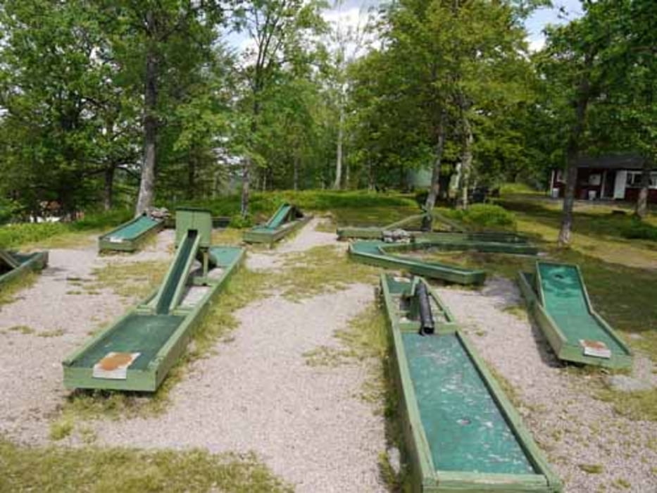
Die Tour startet im Zentrum von Ramkvilla. Zunächst werden zwei knackige Anstiege zu bewältigen sein. Zur Belohnung kann nach etwa 1/3 der Strecke die Aussicht bei einer Tasse Kaffee und ner Partie Minigolf genossen werden. Die Anlage ist echt nostalgisch. Es folgen leichte Abfahrten und leichte Anstiege.

Die Tour verläuft zu 2/3 auf Schotterwegen und die restliche Strecke führt über Asphalt. Das Verkehrsaufkommen ist gering bis mäßig zu beurteilen.

Further information at

http://www.ramkvilla.com/de

galéria trás

Mapa trasy a výškový profil

  • Open Street Map
  • Google
Minimum height 176 m Maximum height 313 m Detailný pohľad

More about the tour author

sissi759
Member since 2008

Send private message

komentáre

Parkplätze stehen an der Tourist-Info am Golfplatz zur Verfügung. Hier gibt es u.a. weitere Tourpläne für weitere Strecken. Diese sind jedoch relativ grob. Eine zusätzliche Straßenkarten oder eine Topo wäre hier sinnvoll.

GPS trasy

Trackpoints
  • GPX / Garmin Map Source (gpx) download
  • TCX / Garmin Training Center® (tcx) download
  • CRS / Garmin Training Center® (crs) download
  • Google Earth (kml) download
  • G7ToWin (g7t) download
  • TTQV (trk) download
  • Overlay (ovl) download
  • Fugawi (txt) download
  • Kompass (DAV) Track (tk) download
  • list trasy (pdf) download
  • Original file of the author (gpx) download

More about the tour author

sissi759
Member since 2008

Send private message
Share track
Add to my favorites
Remove from my favorites
Edit tags
My score
Rate
trasa: Ramkvilla Kullen Tour
Druh: horský bicykel
Dĺžka: 27,1 km
Evaluated on:
Doba:
Day(s)
Hour(s)
Minute(s)
ohodnotenie: Kraj pôžitok z túry kondícia technika