Login

Zabudli ste prihlasovacia meno

Cookies have to be accepted!
Your browser's cookie functionality is disabled. Please enable this functionality.

Not a member yet?

Register now
Login

Available for registred users only

Log in to use this feature.

Zabudli ste prihlasovacia meno

Cookies have to be accepted!
Your browser's cookie functionality is disabled. Please enable this functionality.

Not a member yet?

Register now
Filter
Kategórie
Advanced filters
  • Dĺžka (km)
  • výškomer
Uložiť filter Reset filter

TrackRank

QRCode

Technical data

Dĺžka16,7 km výškomer464 m Way down1498 m Doba00:04 h:m dátum19.12.2010
ohodnotenia Author Kraj pôžitok z túry kondícia technika

štatistika

789 náhľady 2 ohodnotenia 14 Stiahnutia 5.00 priemer
Rate
  • list trasy
  • príjazd
  • Stiahnutia

Start dieser einmalig schönen Schlittelstrecke ist Grindelwald (1.100 m). Von hier aus fährt man mit der Seilbahn hinauf zum First (2.140 m).

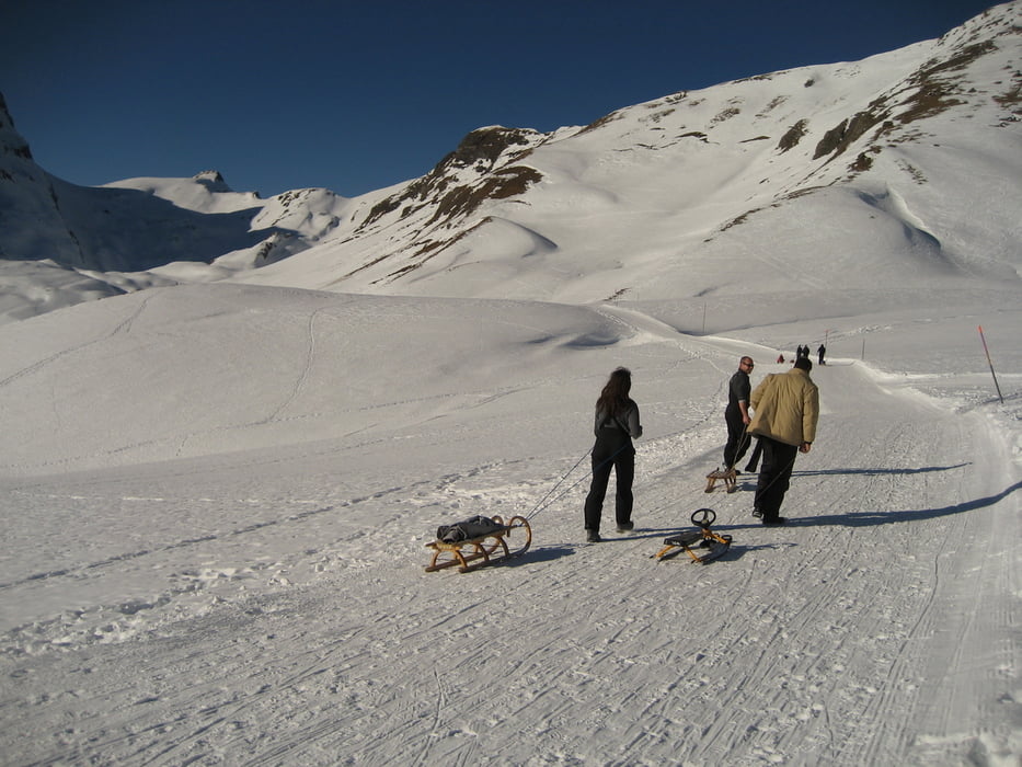
An der Bergstation angekommen, kann man auf einer schönen Sonnenterrasse ein Bierchen trinken! Aber Vorsicht!! Von hier aus sind es noch 1,5 Stunden Fußmarsch und fast 500 Höhenmeter zum Startpunkt der Schlittenabfahrt!!!

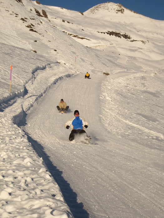
Vorbei am Bachsee zieht sich der gewalzte und markierte Weg hinauf zum Faulhorn (2.540 m). Im Sattel unterhalb des Hotels Faulhorn beginnt nun dies Schlittelstrecke über 1.400 Höhenmeter hinunter nach Grindelwald ...... echt einmalig!! Unterwegs kommt man vorbei an der Busalp(1.800 m). Bis hier her kann man auch mit dem Bus von Grindelwald herauf fahren. Allerdings verpasst man dann den spannendsten Teil der Strecke....

Viel Spaß

Jörn Koberne aus Freiburg

galéria trás

Mapa trasy a výškový profil

  • Open Street Map
  • Google
Minimum height 1122 m Maximum height 2569 m Detailný pohľad

More about the tour author

Kobi
Member since 2008

Send private message

komentáre

Cattleya on 14.03.2013

zusatz

http://www.youtube.com/watch?v=wuibdy3S9Ak&feature=player_detailpage


<iframe width="640" height="360" src="http://www.youtube.com/embed/wuibdy3S9Ak?feature=player_detailpage" frameborder="0" allowfullscreen></iframe>

Bern - Interlaken - Grindelwald

GPS trasy

Trackpoints
  • GPX / Garmin Map Source (gpx) download
  • TCX / Garmin Training Center® (tcx) download
  • CRS / Garmin Training Center® (crs) download
  • Google Earth (kml) download
  • G7ToWin (g7t) download
  • TTQV (trk) download
  • Overlay (ovl) download
  • Fugawi (txt) download
  • Kompass (DAV) Track (tk) download
  • list trasy (pdf) download
  • Original file of the author (gpx) download

More about the tour author

Kobi
Member since 2008

Send private message
Share track
Add to my favorites
Remove from my favorites
Edit tags
My score
Rate
trasa: Europas längste Rodelstrecke...super!!!
Druh: Sane
Dĺžka: 16,7 km
Evaluated on:
Doba:
Day(s)
Hour(s)
Minute(s)
ohodnotenie: Kraj pôžitok z túry kondícia technika