


Road Map:
- Day 1: Lindau - Hospental (210.9km 2,242m)
- Day 2: Hospental - Martigny (164.9km 1,241m)
- Day 3: Martigny - Séez (155.5km 3,516m)
- Day 4: Séez- Saint-Michele-de-Maurienne (122.1km 2,140m)
- Day 5: Saint-Michelle-de-Maurienne - Briançon (68.9km 1,780m)
- Day 6: Briançon - Jausiers (94.4km 2,299m)
- Day 7: Jausiers - Nice (135.7km 1,618m)
- Day 8: Nice - Digne-les-Bains (157.7km 2,896m)
- Day 9: Dignes-les-Bains - La Mure (141.2km 1,772m)
- Day 10: La Mure - Annecy ( 151.8km 1,126m)
- Day 11: Annecy - Vevey (123.7km 1,026m)
- Day 12: Vevey - Sachseln (163.3km 2,384m)
- Day 13: Sachseln - Lindau (242.1km 1,060m)
Mountain passes (in order):
- Oberalppass
- Furkapass
- Col du Grand St. Bernard
- Col du Petit St. Bernard
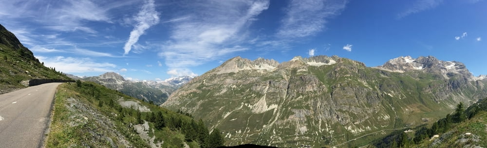
- Col de l'Iseran
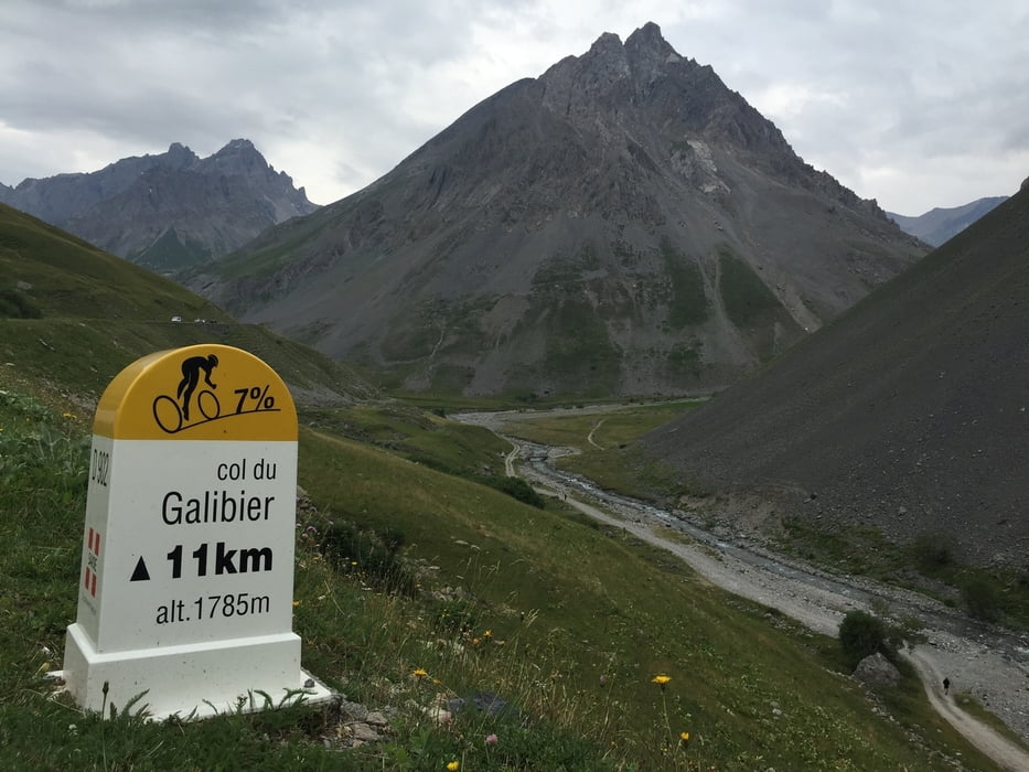
- Col du Galibier
- Col d'Izoard
- Col de Vars
- Col de la Bonette
From Nice back: mostly flat ;-)
If you have any questions (English, German) about the tour, leave a comment. I will check them regularly - at least this year.
Túra fotóalbuma
Túratérkép és magasságprofil
Minimum height -23 m
Maximum height 2656 m
More about the tour author

|
quivis |
Megjegyzések

GPS trackek
Trackpoints-
GPX / Garmin Map Source (gpx) download
-
TCX / Garmin Training Center® (tcx) download
-
CRS / Garmin Training Center® (crs) download
-
Google Earth (kml) download
-
G7ToWin (g7t) download
-
TTQV (trk) download
-
Overlay (ovl) download
-
Fugawi (txt) download
-
Kompass (DAV) Track (tk) download
-
Túralap (pdf) download
-
Original file of the author (gpx) download
More about the tour author
|
|
quivis |
Add to my favorites
Remove from my favorites
Edit tags
Open track
My score
Rate