


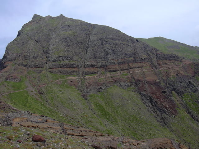
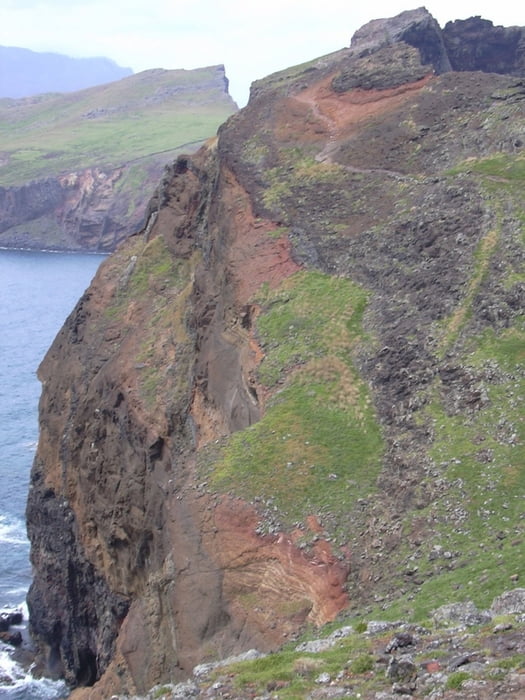
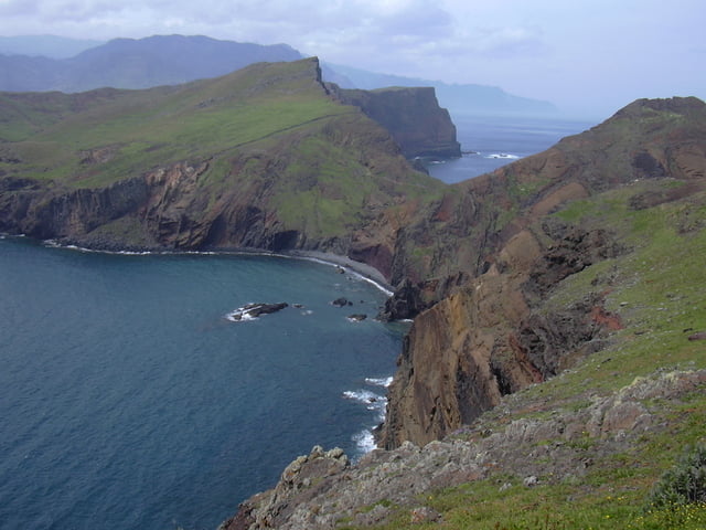
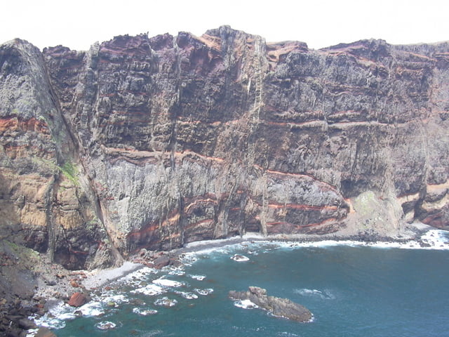
The Sao Lourenco Peninsular, on the Island of Madeira is the most easterly point on the Island.
This hike is absolutely stunning, walked on a sunny day, the colours of the volcanic lava cliffs and rocks has to be seen live, photos do not have the impact of actually being there.
The whole of the area is a World Protected site, so for the care of the wildlife, flora and not least your own safety, the marked paths must be kept to.
The hike is reasonably strenuous and you need to be sure footed. The full walk is around 7km, so do not attempt it later in the day as you may get stuck out there in the dark.
Be prepared with what you take as the weather can be very variable in Spring and Autumn and very hot in the Summer. I would advise making use of a guided tour as I did (Madeira Explorers) to make use of the invaluable knowledge of a local guide.
Ulteriori informazioni sotto
http://www.madeira-levada-walks.comGalleria itinerari
Mappa itinerario e altimetria
Altezza minima 23 m
Altezza massima 128 m
Maggiori informazioni sull'autore del tour

|
SILVAED |
Commenti

The trailhead is a car park at the end of the ER 109 road. This is easily reached by car but a guided tour is best as your transport is provided.
A bus is possible from Funchal to Canical, and then from Canical to the start. This is not advised, because by the time you get there, there is not enough time to complete the walk and get back
A bus is possible from Funchal to Canical, and then from Canical to the start. This is not advised, because by the time you get there, there is not enough time to complete the walk and get back
Tracce GPS
Punti di traccia-
GPX / Garmin Map Source (gpx) download
-
TCX / Garmin Training Center® (tcx) download
-
CRS / Garmin Training Center® (crs) download
-
Google Earth (kml) download
-
G7ToWin (g7t) download
-
TTQV (trk) download
-
Overlay (ovl) download
-
Fugawi (txt) download
-
Kompass (DAV) Track (tk) download
-
Scheda tecnica (pdf) download
-
File originale dell'autore (g7t) download
Maggiori informazioni sull'autore del tour
|
|
SILVAED |
Aggiungi ai miei preferiti
Rimuovi dai miei preferiti
Modifica dei tag
Tour aperto
Il mio voto
Vota