


This hike, commonly known as The Aphrodite Trail, takes you to the top of Mouti tis Sotiras on the Akamas Peninsular. This path takes a route up the rear of the mountain which is much easier. The path zig-zags up a steepish hillside, up on to a flat section, you will now see an arrow straight path that makes a rocky twenty minute climb up to Pyritos tis Regina. This is the worse bit over.
Continue up the marked path until you come to the base of the rocky plateau that forms the summit. You can miss the actual summit altogether and continue around the base to a viewpoint and two benches.
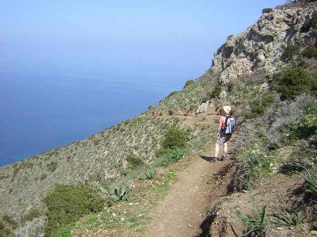
As you round the rocky base, there is a rough track off to the left. See the GPS track.
Take this track and continue up in the same general direction. After a couple of minutes, you arrive on the rocky plateau of the summit. Walking toward the edge of the plateau, you are suddenly faced with the absolutely stunning view of the complete Akamas Peninsular stretched out in front of you some 378 mtr below.
Now starts the exciting second half and return hike down the steep front face of the mountain. The path zig-zags at first and then evens out to a long sloping path right across the front of the mountain.
The views on the descent are fantastic, have the camera ready. The path continues down until it eventually meets the rough road that continues along most of the coast of the peninsular. Take this road back to the Car Park for a cold beer at the Restaurant.
Continue up the marked path until you come to the base of the rocky plateau that forms the summit. You can miss the actual summit altogether and continue around the base to a viewpoint and two benches.
As you round the rocky base, there is a rough track off to the left. See the GPS track.
Take this track and continue up in the same general direction. After a couple of minutes, you arrive on the rocky plateau of the summit. Walking toward the edge of the plateau, you are suddenly faced with the absolutely stunning view of the complete Akamas Peninsular stretched out in front of you some 378 mtr below.
Now starts the exciting second half and return hike down the steep front face of the mountain. The path zig-zags at first and then evens out to a long sloping path right across the front of the mountain.
The views on the descent are fantastic, have the camera ready. The path continues down until it eventually meets the rough road that continues along most of the coast of the peninsular. Take this road back to the Car Park for a cold beer at the Restaurant.
Galleria itinerari
Mappa itinerario e altimetria
Altezza minima 18 m
Altezza massima 364 m
Maggiori informazioni sull'autore del tour

|
SILVAED |
Commenti

This walk is on the northern side of the Akamas Peninsular near Polis. The walk starts from the car park at the Baths of Aphrodite.
Take the signposted paved path to the Aphrodite Baths, do the photo opportunity thing and then take the path at your rear as you face the Baths.
Take the signposted paved path to the Aphrodite Baths, do the photo opportunity thing and then take the path at your rear as you face the Baths.
Tracce GPS
Punti di traccia-
GPX / Garmin Map Source (gpx) download
-
TCX / Garmin Training Center® (tcx) download
-
CRS / Garmin Training Center® (crs) download
-
Google Earth (kml) download
-
G7ToWin (g7t) download
-
TTQV (trk) download
-
Overlay (ovl) download
-
Fugawi (txt) download
-
Kompass (DAV) Track (tk) download
-
Scheda tecnica (pdf) download
-
File originale dell'autore (gpx) download
Maggiori informazioni sull'autore del tour
|
|
SILVAED |
Aggiungi ai miei preferiti
Rimuovi dai miei preferiti
Modifica dei tag
Tour aperto
Il mio voto
Vota