Login

Zapomniałeś swój login?

Cookies have to be accepted!
Your browser's cookie functionality is disabled. Please enable this functionality.

Not a member yet?

Register now
Login

Available for registred users only

Log in to use this feature.

Zapomniałeś swój login?

Cookies have to be accepted!
Your browser's cookie functionality is disabled. Please enable this functionality.

Not a member yet?

Register now
Filter
Kategorie
Advanced filters
  • Długość (km)
  • Wysokość
Zapisz filtr Reset filter

TrackRank

QRCode

Technical data

Długość56,0 km Wysokość2479 m Way down1402 m Czas trwania05:35 h:m Data25.08.2015
Oceny Author Krajobraz Czynnik zadowolenia Kondycja Technika

Statystyka

354 Widoki Oceny 62 Downloads / Pliki do pobrania Przeciętnie
Rate
  • Karta trasy
  • Dojazd
  • Downloads / Pliki do pobrania

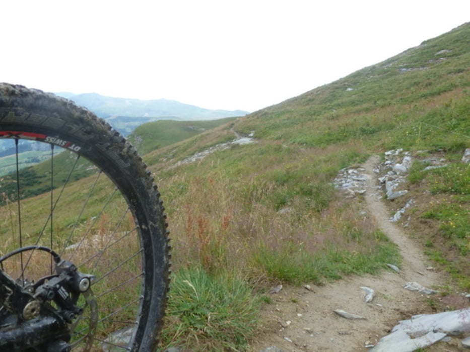
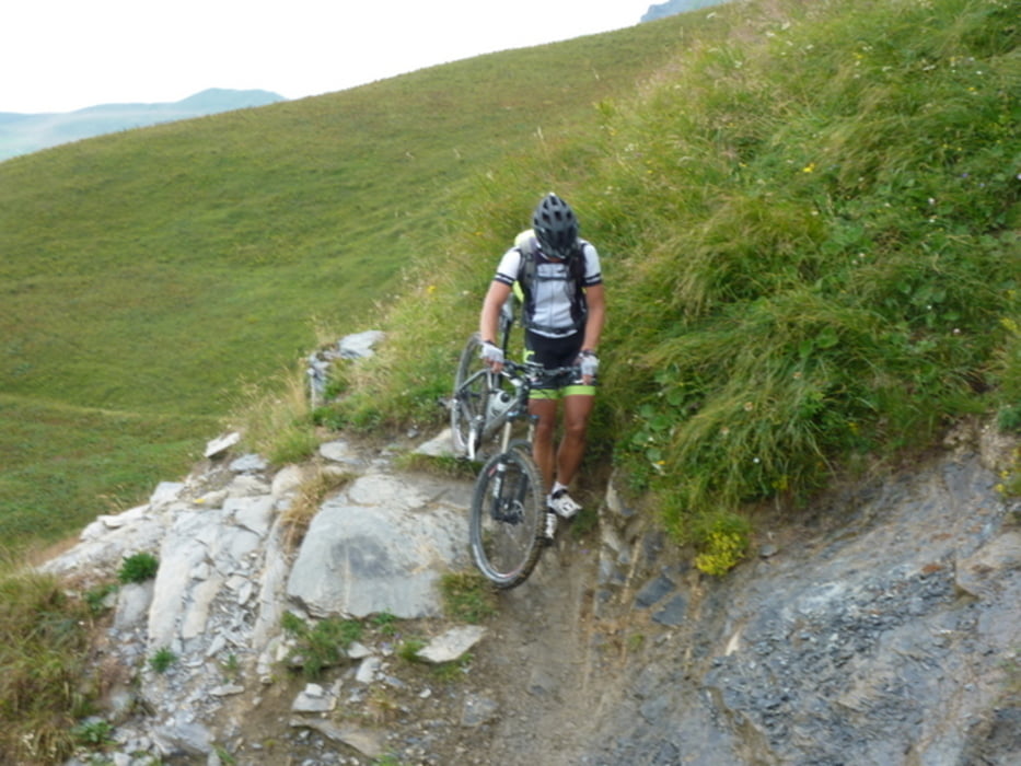
Straßenauffahrt nach Saisies, dann Schotterweg über den Col de la Lezette, Col de la Legette Col du Very. Von dort dann über einen Singeltrail zum Col du Joly. Leider kommt man dabei um eine längere Tragepassage auf der Tour de Beaufortain nicht herum. 

Wer darauf keine Lust hat, läßt Saisies gleich links liegen und fährt über Hautluce direkt zum Col du Joly.

Die Abfahrt nach les Contamines-Montjoie erfolgt auf einem Schotterweg.

In Bionnay den Abzweig nach Bionassy nicht verpassen! Steile Asphaltauffahrt. In Bionassy gibt es eine Übernachtungsmöglichkeit (die bestimmt günstiger ist als im Hotel Prarion). Am nächsten Paß (Col de Voza) haben wir nichts gefunden. Deswegen sind wir noch zum Hotel Le Prarion hoch und hatten von dort eine traumhafte Aussicht.  


Galeria trasy

Mapa trasy i profil wysokości

  • Open Street Map
  • Google
Minimum height 693 m Maximum height 2005 m Widok szczegółowy

More about the tour author

CF2008
Member since 2011

Send private message

Komentarze

GPS tracks

Trackpoints
  • GPX / Garmin Map Source (gpx) download
  • TCX / Garmin Training Center® (tcx) download
  • CRS / Garmin Training Center® (crs) download
  • Google Earth (kml) download
  • G7ToWin (g7t) download
  • TTQV (trk) download
  • Overlay (ovl) download
  • Fugawi (txt) download
  • Kompass (DAV) Track (tk) download
  • Karta trasy (pdf) download
  • Original file of the author (gpx) download

More about the tour author

CF2008
Member since 2011

Send private message
Share track
Add to my favorites
Remove from my favorites
Edit tags
My score
Rate
Trasa: Tour du Mont Blanc 3.Tag
Rodzaj: Rower górski (MTB)
Długość: 56,0 km
Evaluated on:
Czas trwania:
Day(s)
Hour(s)
Minute(s)
Ocena: Krajobraz Czynnik zadowolenia Kondycja Technika