Login

Zapomniałeś swój login?

Cookies have to be accepted!
Your browser's cookie functionality is disabled. Please enable this functionality.

Not a member yet?

Register now
Login

Available for registred users only

Log in to use this feature.

Zapomniałeś swój login?

Cookies have to be accepted!
Your browser's cookie functionality is disabled. Please enable this functionality.

Not a member yet?

Register now
Filter
Kategorie
Advanced filters
  • Długość (km)
  • Wysokość
Zapisz filtr Reset filter

TrackRank

QRCode

Technical data

Długość21,9 km Wysokość465 m Way down461 m Czas trwania04:00 h:m Data13.03.2018
Oceny Author Krajobraz Czynnik zadowolenia Kondycja Technika

Statystyka

836 Widoki Oceny 4 Downloads / Pliki do pobrania Przeciętnie
Rate
  • Karta trasy
  • Dojazd
  • Downloads / Pliki do pobrania
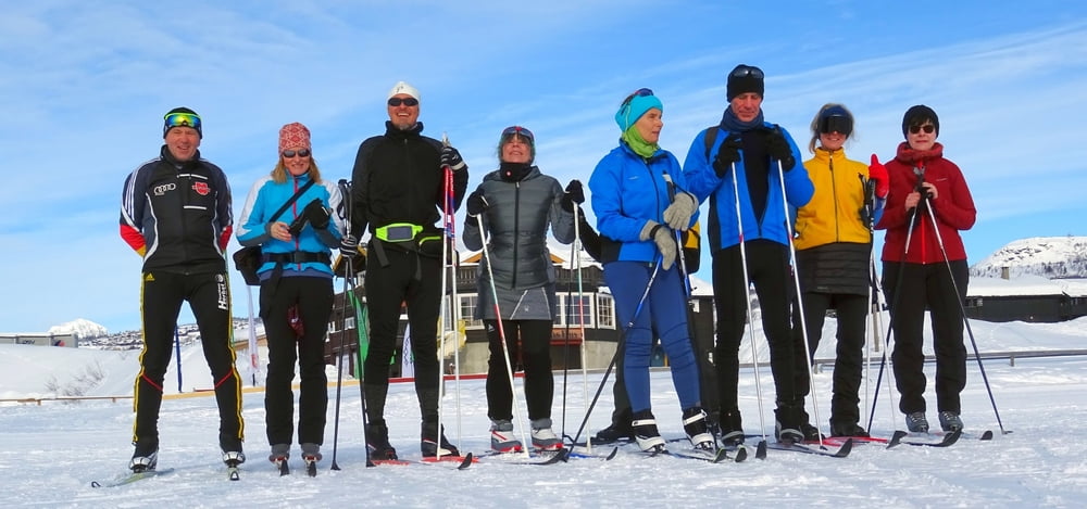
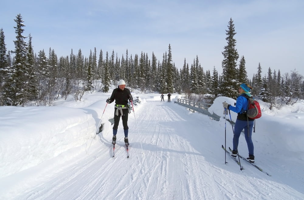
Beitostolen Langlaufstrecke, möglicherweise auch ohne Schnee für andere Aktivitäten nutzbar. Landschaftlich wirklich sehr schön ;-)

Galeria trasy

Mapa trasy i profil wysokości

  • Open Street Map
  • Google
Minimum height 868 m Maximum height 1086 m Widok szczegółowy

More about the tour author

Daxtuning
Member since 2018

Send private message

Komentarze

Start am Sportstadion Beitostolen

GPS tracks

Trackpoints
  • GPX / Garmin Map Source (gpx) download
  • TCX / Garmin Training Center® (tcx) download
  • CRS / Garmin Training Center® (crs) download
  • Google Earth (kml) download
  • G7ToWin (g7t) download
  • TTQV (trk) download
  • Overlay (ovl) download
  • Fugawi (txt) download
  • Kompass (DAV) Track (tk) download
  • Karta trasy (pdf) download
  • Original file of the author (tcx) download

More about the tour author

Daxtuning
Member since 2018

Send private message
Share track
Add to my favorites
Remove from my favorites
Edit tags
My score
Rate
Trasa: Beitostolen Route 22 Km
Rodzaj: Biegi narciarskie
Długość: 21,9 km
Evaluated on:
Czas trwania:
Day(s)
Hour(s)
Minute(s)
Ocena: Krajobraz Czynnik zadowolenia Kondycja Technika