Login

Zapomniałeś swój login?

Cookies have to be accepted!
Your browser's cookie functionality is disabled. Please enable this functionality.

Not a member yet?

Register now
Login

Available for registred users only

Log in to use this feature.

Zapomniałeś swój login?

Cookies have to be accepted!
Your browser's cookie functionality is disabled. Please enable this functionality.

Not a member yet?

Register now
Filter
Kategorie
Advanced filters
  • Długość (km)
  • Wysokość
Zapisz filtr Reset filter

TrackRank

QRCode

Technical data

Długość18,8 km Wysokość2108 m Way down2105 m Czas trwania07:20 h:m Data20.03.2019
Oceny Author Krajobraz Czynnik zadowolenia Kondycja Technika

Statystyka

307 Widoki Oceny 16 Downloads / Pliki do pobrania Przeciętnie
Rate
  • Karta trasy
  • Dojazd
  • Downloads / Pliki do pobrania

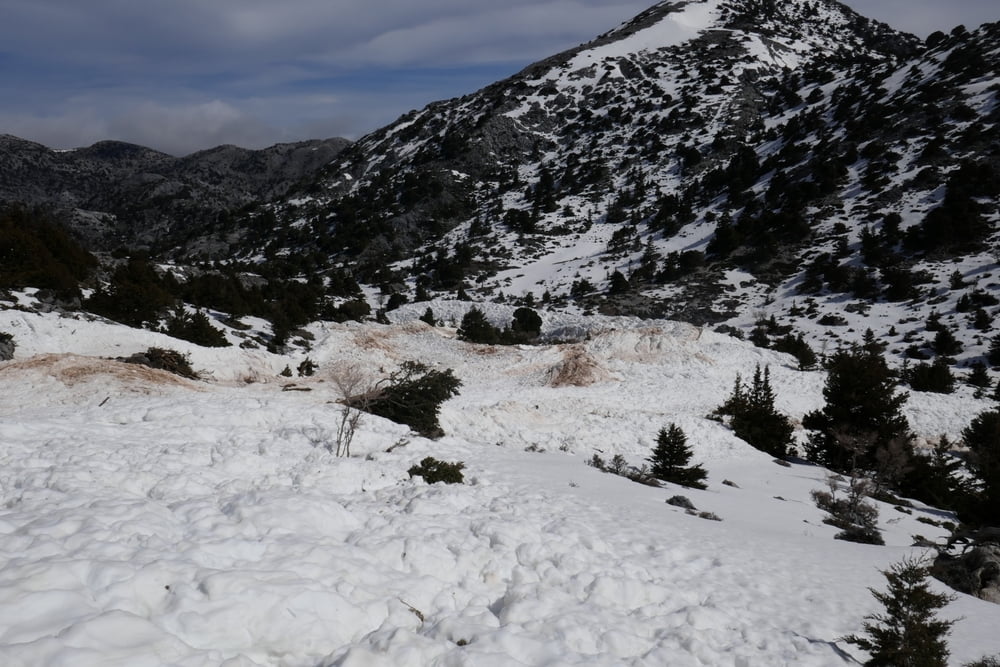
Rundtour über 3 Berge, zuletzt mit Abfahrt vom Kastro. Die Tour kreuzt mehrere große (ältere) Lawinenabgänge. Also auf die Verhältnisse achten!

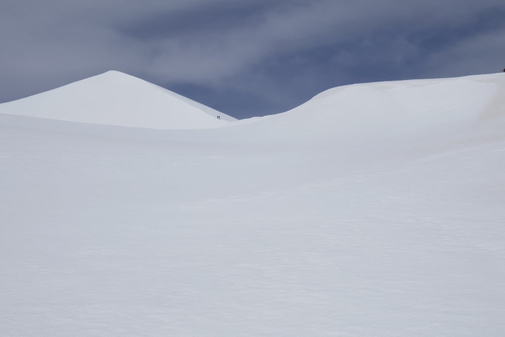
Zuerst überquert man das Niato Plateau nach Norden auf einen Sattel um dann das vom Fanari östlich herabziehende  Bachtal anzusteigen. Von ca. 2000 m bis auf 1250 m hinab ist hier eine Lawine durch den gesamten Talgrund abgegangen. Links davon besteigen wir den Fanari-Ostgipfel. Schöne Abfahrt nach Norden und Wiederaufsteig auf den Paspalomyti. Da die Verhältnisse in der Nordflanke gut aussehen, sparen wir uns die Umrundung auf die sonniger SW-Seite sondern steigen direkt durch die Nordflanke auf.

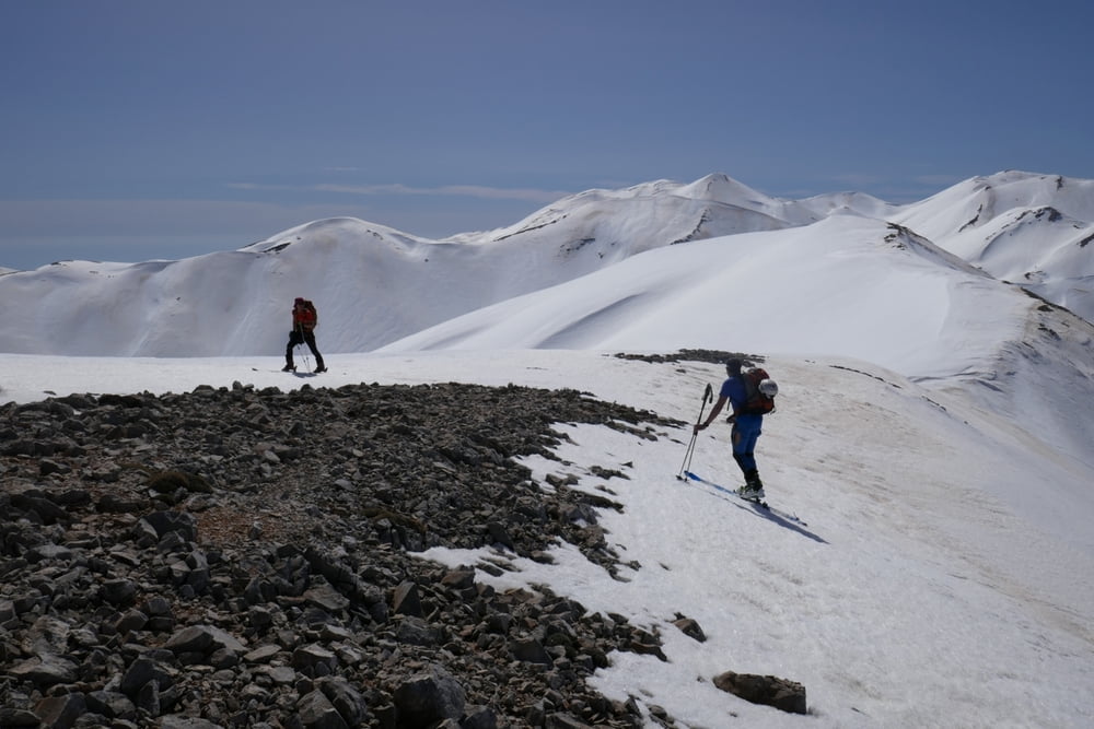
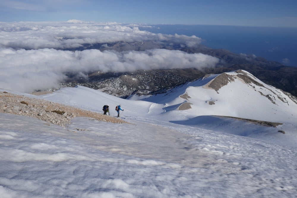
Tolle Firnabfahrt nach Süden und Wiederanstieg auf den Kastro. Abfahrt über die SO-Flanke in ein Tal durch das ebenfalls eine große Lawine bis ins Niato Plateau abgegangen war. Links der Lawine und die felsige Steilstufe kurz vor dem Niato Plateau nördlich umgehend zurück zum Auto

Galeria trasy

Mapa trasy i profil wysokości

  • Open Street Map
  • Google
Minimum height 1206 m Maximum height 2210 m Widok szczegółowy

More about the tour author

Gi
Member since 2010

Send private message

Komentarze

Von der Hauptstraße bei Asfikou eine bald ungeteerte Straße (hohe Bodenfreiheit empfehlenswert) hinauf zum Tavri Refuge und weiter in Richtung Niato-Ebene bis zur Schneegrenze

GPS tracks

Trackpoints
  • GPX / Garmin Map Source (gpx) download
  • TCX / Garmin Training Center® (tcx) download
  • CRS / Garmin Training Center® (crs) download
  • Google Earth (kml) download
  • G7ToWin (g7t) download
  • TTQV (trk) download
  • Overlay (ovl) download
  • Fugawi (txt) download
  • Kompass (DAV) Track (tk) download
  • Karta trasy (pdf) download
  • Original file of the author (gpx) download

More about the tour author

Gi
Member since 2010

Send private message
Share track
Add to my favorites
Remove from my favorites
Edit tags
My score
Rate
Trasa: Kastro
Rodzaj: Narty
Długość: 18,8 km
Evaluated on:
Czas trwania:
Day(s)
Hour(s)
Minute(s)
Ocena: Krajobraz Czynnik zadowolenia Kondycja Technika