Login

Zapomniałeś swój login?

Cookies have to be accepted!
Your browser's cookie functionality is disabled. Please enable this functionality.

Not a member yet?

Register now
Login

Available for registred users only

Log in to use this feature.

Zapomniałeś swój login?

Cookies have to be accepted!
Your browser's cookie functionality is disabled. Please enable this functionality.

Not a member yet?

Register now
Filter
Kategorie
Advanced filters
  • Długość (km)
  • Wysokość
Zapisz filtr Reset filter

TrackRank

QRCode

Technical data

Długość13,4 km Wysokość431 m Way down431 m Czas trwania00:00 h:m Data14.06.2008
Oceny Author Krajobraz Czynnik zadowolenia Kondycja Technika

Statystyka

815 Widoki Oceny 264 Downloads / Pliki do pobrania Przeciętnie
Rate
  • Karta trasy
  • Dojazd
  • Downloads / Pliki do pobrania

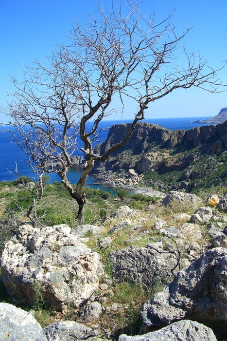
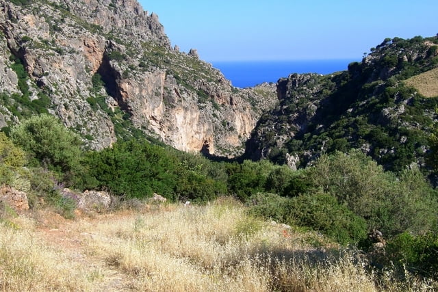
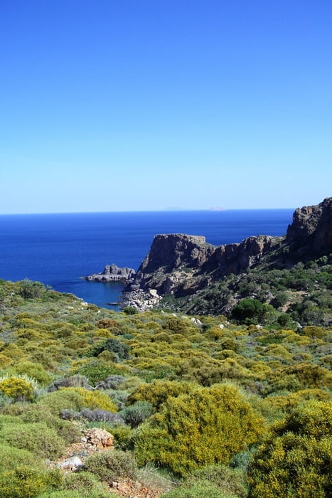
Nice walk in a beatifull gorge.By the end of the gorgeyou will find water.

The beach is very lonely.

Galeria trasy

Mapa trasy i profil wysokości

  • Open Street Map
  • Google
Minimum height -46 m Maximum height 357 m Widok szczegółowy

More about the tour author

medoc
Member since 2005

Send private message

Komentarze

The trailhead is close to the first taverna comming from the north 

GPS tracks

Trackpoints
  • GPX / Garmin Map Source (gpx) download
  • TCX / Garmin Training Center® (tcx) download
  • CRS / Garmin Training Center® (crs) download
  • Google Earth (kml) download
  • G7ToWin (g7t) download
  • TTQV (trk) download
  • Overlay (ovl) download
  • Fugawi (txt) download
  • Kompass (DAV) Track (tk) download
  • Karta trasy (pdf) download
  • Original file of the author (gpx) download

More about the tour author

medoc
Member since 2005

Send private message
Share track
Add to my favorites
Remove from my favorites
Edit tags
My score
Rate
Trasa: Kambos gorge
Rodzaj: Wędrówki
Długość: 13,4 km
Evaluated on:
Czas trwania:
Day(s)
Hour(s)
Minute(s)
Ocena: Krajobraz Czynnik zadowolenia Kondycja Technika