Login

Zapomniałeś swój login?

Cookies have to be accepted!
Your browser's cookie functionality is disabled. Please enable this functionality.

Not a member yet?

Register now
Login

Available for registred users only

Log in to use this feature.

Zapomniałeś swój login?

Cookies have to be accepted!
Your browser's cookie functionality is disabled. Please enable this functionality.

Not a member yet?

Register now
Filter
Kategorie
Advanced filters
  • Długość (km)
  • Wysokość
Zapisz filtr Reset filter

TrackRank

QRCode

Technical data

Długość9,6 km Wysokość959 m Way down959 m Czas trwania04:45 h:m Data18.05.2023
Oceny Author Krajobraz Czynnik zadowolenia Kondycja Technika

Statystyka

138 Widoki Oceny 0 Downloads / Pliki do pobrania Przeciętnie
Rate
  • Karta trasy
  • Dojazd
  • Downloads / Pliki do pobrania

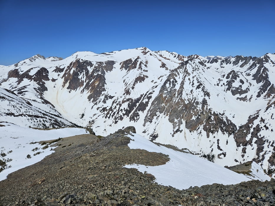
Tour im Rekordschneejahr 2023, normalerweise wohl 2-4 Wochen früher die gleichen Verhältnisse

Steile, nicht allzulange Tour.

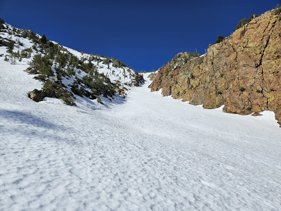
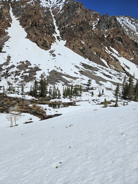
Zunächst knapp 2 km auf Forststraße, dann links eine Schneebrücke für die Bachquerung suchen. Die Flanke hinauf auf eine Rinne zu. Nun kontinuierlich steil durch die Rinne und weiter durch die Flanke bis zu den Felsen. Die letzten Meter über leichtes Blockgelände zu Fuß zum Gipfel. Weiter rechts reichte der Schnee etwas weiter hinauf, deshalb die Ski dort deponiert und abgefahren.

Randnotiz: Auf der Forststraße Bärenspuren entdeckt, die vermutlich vom Vortag stammten

Galeria trasy

Mapa trasy i profil wysokości

  • Open Street Map
  • Google
Minimum height 2395 m Maximum height 3370 m Widok szczegółowy

More about the tour author

Gi
Member since 2010

Send private message

Komentarze

Von der US 395 nördlich Lee Vining zum Lundy Lake und weiter bis zum Ende der Schneeräumung

GPS tracks

Trackpoints
  • GPX / Garmin Map Source (gpx) download
  • TCX / Garmin Training Center® (tcx) download
  • CRS / Garmin Training Center® (crs) download
  • Google Earth (kml) download
  • G7ToWin (g7t) download
  • TTQV (trk) download
  • Overlay (ovl) download
  • Fugawi (txt) download
  • Kompass (DAV) Track (tk) download
  • Karta trasy (pdf) download
  • Original file of the author (gpx) download

More about the tour author

Gi
Member since 2010

Send private message
Share track
Add to my favorites
Remove from my favorites
Edit tags
My score
Rate
Trasa: Mt. Scowden
Rodzaj: Narty
Długość: 9,6 km
Evaluated on:
Czas trwania:
Day(s)
Hour(s)
Minute(s)
Ocena: Krajobraz Czynnik zadowolenia Kondycja Technika