Login

Zapomniałeś swój login?

Cookies have to be accepted!
Your browser's cookie functionality is disabled. Please enable this functionality.

Not a member yet?

Register now
Login

Available for registred users only

Log in to use this feature.

Zapomniałeś swój login?

Cookies have to be accepted!
Your browser's cookie functionality is disabled. Please enable this functionality.

Not a member yet?

Register now
Filter
Kategorie
Advanced filters
  • Długość (km)
  • Wysokość
Zapisz filtr Reset filter

TrackRank

QRCode

Technical data

Długość27,6 km Wysokość2098 m Way down2079 m Czas trwania09:00 h:m Data28.02.2023
Oceny Author Krajobraz Czynnik zadowolenia Kondycja Technika

Statystyka

256 Widoki Oceny 5 Downloads / Pliki do pobrania Przeciętnie
Rate
  • Karta trasy
  • Dojazd
  • Downloads / Pliki do pobrania
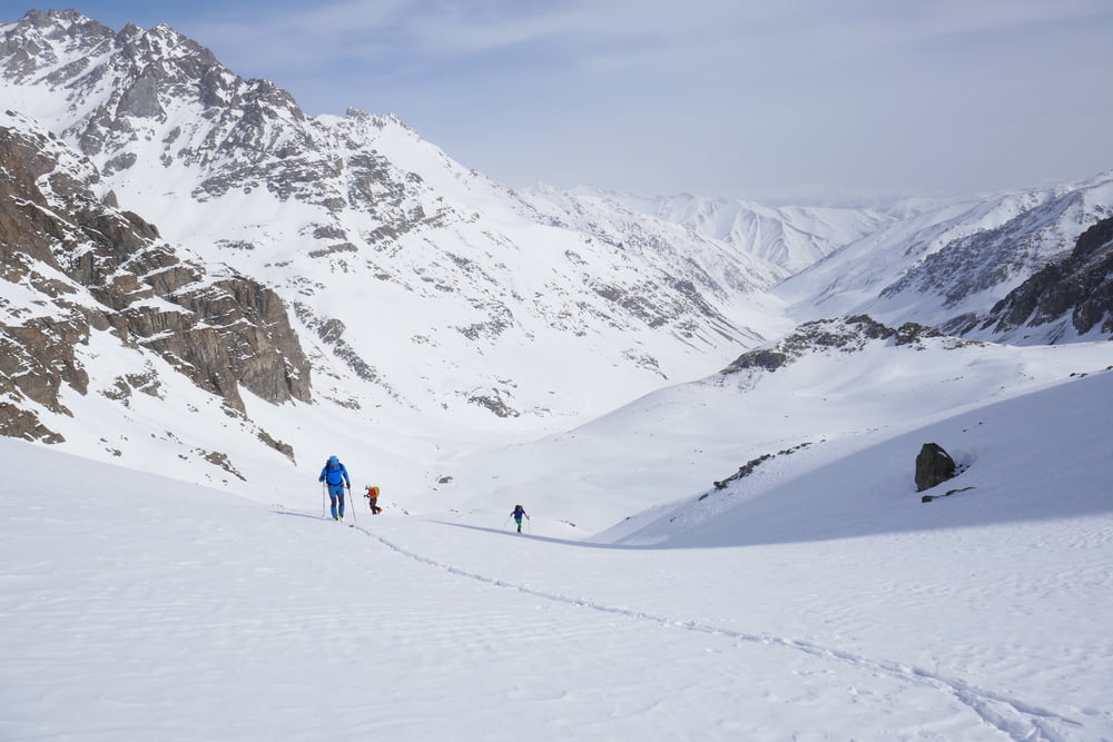
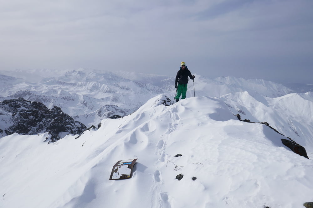
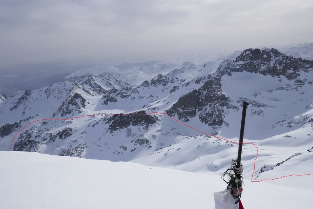
Von Olgunlar lange flach das Tal des Bürük Deresi hinter bis zur Stelle des Sommercamps. Hier umgeht man halblinks den steilen Talsschluss und wendet sich auf 3200 m zurück nach rechts eine Rinne hinauf und hinüber zum Deniz Gölü See. Weiter aufwärts zu einer Scharte. Wegen des starken Windes dort nahmen wir erst einmal Abstand vom Weiterweg und stiegen die Flanke Richtung Sonmez auf. Nach einer Pause dann doch Fortsetzung der Tour: Die Scharte mit möglichst wenig Höhenverlust hinab und hinüber zum Anstieg auf den Kackar Dag. Die steileren Stellen umgehend die Flanke hinauf bis zum Grat. Skidepot. Über den Grat zum Gipfel. Abfahrt wie Aufstieg. Das flache Tal kann man die Ski ganz gut hinaus laufen lassen.

Galeria trasy

Mapa trasy i profil wysokości

  • Open Street Map
  • Google
Minimum height 2120 m Maximum height 3930 m Widok szczegółowy

More about the tour author

Gi
Member since 2010

Send private message

Komentarze

Über Yusufeli und Yaylalar nach Olgunlar. Die ab Yusufeli schmale Straße ist nach Schneefällen schwierig befahrbar, ab Yalalar ohne schweren 4x4 oft unpassierbar. In Olgunlar gute Unterkunft "Kackar Pansiyon" (Flughafentransfer nach Erzurum möglich). Start von der Unterkunft.

GPS tracks

Trackpoints
  • GPX / Garmin Map Source (gpx) download
  • TCX / Garmin Training Center® (tcx) download
  • CRS / Garmin Training Center® (crs) download
  • Google Earth (kml) download
  • G7ToWin (g7t) download
  • TTQV (trk) download
  • Overlay (ovl) download
  • Fugawi (txt) download
  • Kompass (DAV) Track (tk) download
  • Karta trasy (pdf) download
  • Original file of the author (gpx) download

More about the tour author

Gi
Member since 2010

Send private message
Share track
Add to my favorites
Remove from my favorites
Edit tags
My score
Rate
Trasa: Kackar Dagi
Rodzaj: Narty
Długość: 27,6 km
Evaluated on:
Czas trwania:
Day(s)
Hour(s)
Minute(s)
Ocena: Krajobraz Czynnik zadowolenia Kondycja Technika