Login

Zapomniałeś swój login?

Cookies have to be accepted!
Your browser's cookie functionality is disabled. Please enable this functionality.

Not a member yet?

Register now
Login

Available for registred users only

Log in to use this feature.

Zapomniałeś swój login?

Cookies have to be accepted!
Your browser's cookie functionality is disabled. Please enable this functionality.

Not a member yet?

Register now
Filter
Kategorie
Advanced filters
  • Długość (km)
  • Wysokość
Zapisz filtr Reset filter

TrackRank

QRCode

Technical data

Długość34,7 km Wysokość1475 m Way down1455 m Czas trwania03:33 h:m Data14.11.2023
Oceny Author Krajobraz Czynnik zadowolenia Kondycja Technika

Statystyka

147 Widoki Oceny 3 Downloads / Pliki do pobrania Przeciętnie
Rate
  • Karta trasy
  • Dojazd
  • Downloads / Pliki do pobrania
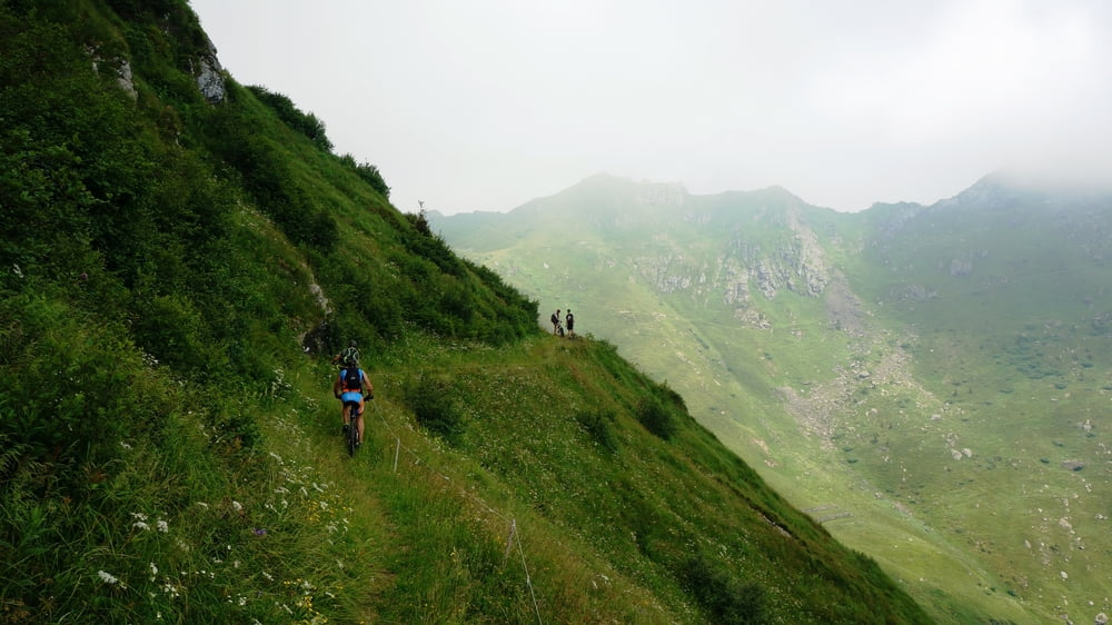
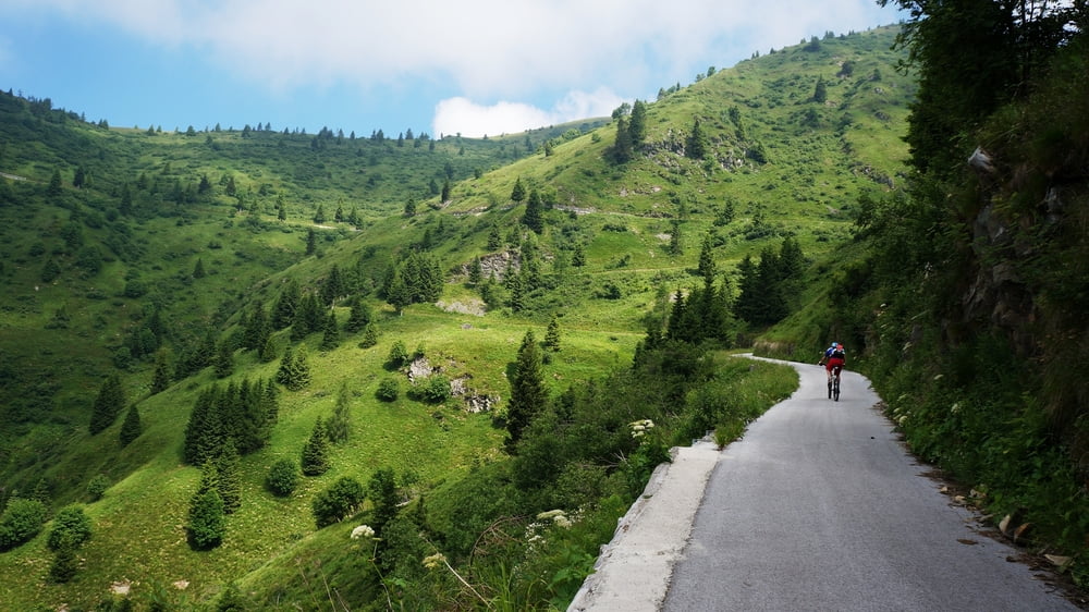
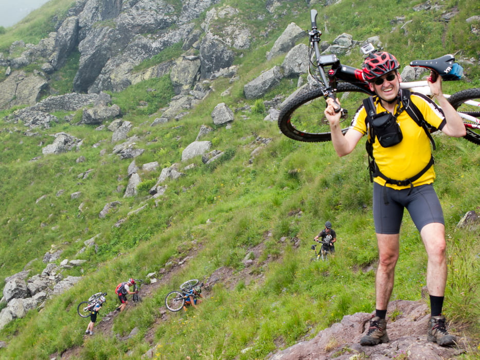
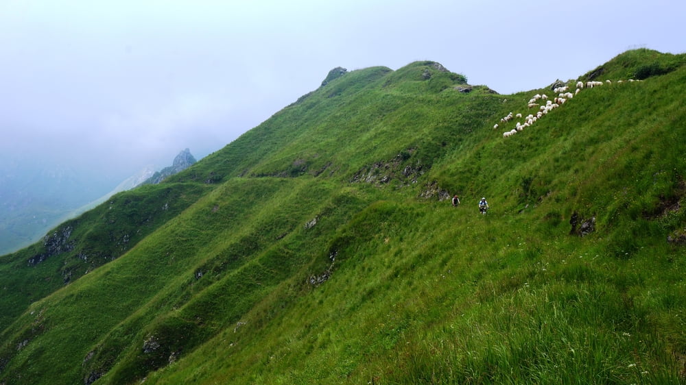
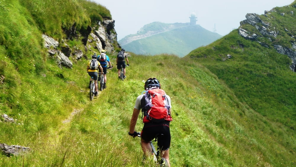
Wunderschöne und einsame Rundtour von Ravascletto aus. Bis km12 geht es auf guten Strassen rund 900hm stetig bergauf (8%). Die Querung zum Monte Zoufplan ist bis auf ein kurzes Tragestück bei der Casera Crasolina (Bergsturz) gut fahrfahr und ein landschaftliches Highlight. Die Abfahrt ist steil und forderend - kann aber alternativ auch auf der Asphaltstrasse erfolgen. 

Galeria trasy

Mapa trasy i profil wysokości

  • Open Street Map
  • Google
Minimum height 529 m Maximum height 1857 m Widok szczegółowy

More about the tour author

ETTMAYER
Member since 2007

Send private message

Komentarze

GPS tracks

Trackpoints
  • GPX / Garmin Map Source (gpx) download
  • TCX / Garmin Training Center® (tcx) download
  • CRS / Garmin Training Center® (crs) download
  • Google Earth (kml) download
  • G7ToWin (g7t) download
  • TTQV (trk) download
  • Overlay (ovl) download
  • Fugawi (txt) download
  • Kompass (DAV) Track (tk) download
  • Karta trasy (pdf) download
  • Original file of the author (gpx) download

More about the tour author

ETTMAYER
Member since 2007

Send private message
Share track
Add to my favorites
Remove from my favorites
Edit tags
My score
Rate
Trasa: Monte Zoufplan
Rodzaj: Rower górski (MTB)
Długość: 34,7 km
Evaluated on:
Czas trwania:
Day(s)
Hour(s)
Minute(s)
Ocena: Krajobraz Czynnik zadowolenia Kondycja Technika