Login

Zapomniałeś swój login?

Cookies have to be accepted!
Your browser's cookie functionality is disabled. Please enable this functionality.

Not a member yet?

Register now
Login

Available for registred users only

Log in to use this feature.

Zapomniałeś swój login?

Cookies have to be accepted!
Your browser's cookie functionality is disabled. Please enable this functionality.

Not a member yet?

Register now
Filter
Kategorie
Advanced filters
  • Długość (km)
  • Wysokość
Zapisz filtr Reset filter

TrackRank

QRCode

Technical data

Długość28,2 km Wysokość369 m Way down369 m Czas trwania00:00 h:m Data01.01.2024
Oceny Author Krajobraz Czynnik zadowolenia Kondycja Technika

Statystyka

168 Widoki Oceny 2 Downloads / Pliki do pobrania Przeciętnie
Rate
  • Karta trasy
  • Dojazd
  • Downloads / Pliki do pobrania
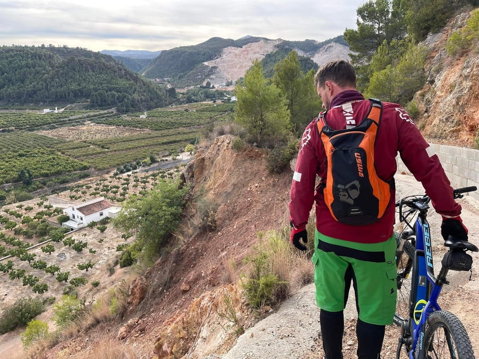
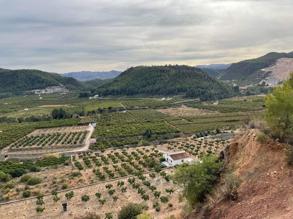
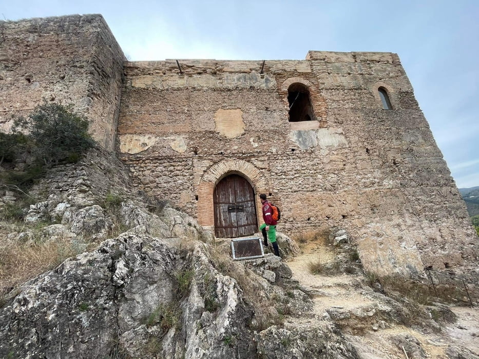
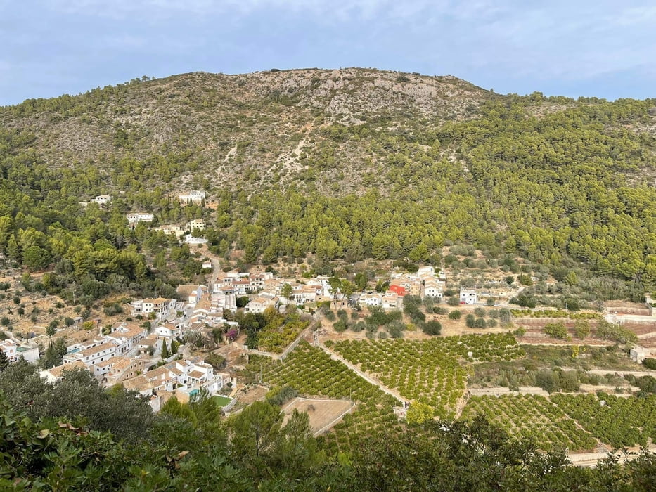
Die Tour startet und endet an der Strandpromenade von Oliva. Bis auf einen kurzen Abstecher durch den Außenbezirk der Stadt besteht diese aus unbefestigten Wegen, wenig befahrenen Landstraßen und landwirtschaftlichen Wege durch die umliegenden Orangenplantagen sowie einer abenteuerlichen Verbindungspassage. Die Aufstiege sind alle beherrschbar bei guter Kondition. Von Weiten ist bereits die Burg zu erkennen. Wir waren am Silvestertag bei traumhaften Wetter allein vor Ort, ein Hinaufkraxeln bis zu den Burgmauern möglich. Von dort oben hat man einen sagenhafte Aussicht ins Tal und bis zum Meer. Auf dem Rückweg rollt man dann entspannt bis vor die Tore der Stadt. 

Galeria trasy

Mapa trasy i profil wysokości

  • Open Street Map
  • Google
Minimum height -1 m Maximum height 211 m Widok szczegółowy

More about the tour author

RonRonin
Member since 2023

Send private message

Komentarze

GPS tracks

Trackpoints
  • GPX / Garmin Map Source (gpx) download
  • TCX / Garmin Training Center® (tcx) download
  • CRS / Garmin Training Center® (crs) download
  • Google Earth (kml) download
  • G7ToWin (g7t) download
  • TTQV (trk) download
  • Overlay (ovl) download
  • Fugawi (txt) download
  • Kompass (DAV) Track (tk) download
  • Karta trasy (pdf) download
  • Original file of the author (gpx) download

More about the tour author

RonRonin
Member since 2023

Send private message
Share track
Add to my favorites
Remove from my favorites
Edit tags
My score
Rate
Trasa: Von Oliva zum Castillo de Forna
Rodzaj: Rower górski (MTB)
Długość: 28,2 km
Evaluated on:
Czas trwania:
Day(s)
Hour(s)
Minute(s)
Ocena: Krajobraz Czynnik zadowolenia Kondycja Technika