Login

Zapomniałeś swój login?

Cookies have to be accepted!
Your browser's cookie functionality is disabled. Please enable this functionality.

Not a member yet?

Register now
Login

Available for registred users only

Log in to use this feature.

Zapomniałeś swój login?

Cookies have to be accepted!
Your browser's cookie functionality is disabled. Please enable this functionality.

Not a member yet?

Register now
Filter
Kategorie
Advanced filters
  • Długość (km)
  • Wysokość
Zapisz filtr Reset filter

TrackRank

QRCode

Technical data

Długość13,3 km Wysokość651 m Way down592 m Czas trwania03:30 h:m Data19.01.2024
Oceny Author Krajobraz Czynnik zadowolenia Kondycja Technika

Statystyka

139 Widoki Oceny 0 Downloads / Pliki do pobrania Przeciętnie
Rate
  • Karta trasy
  • Dojazd
  • Downloads / Pliki do pobrania
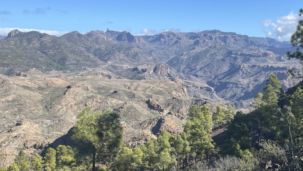
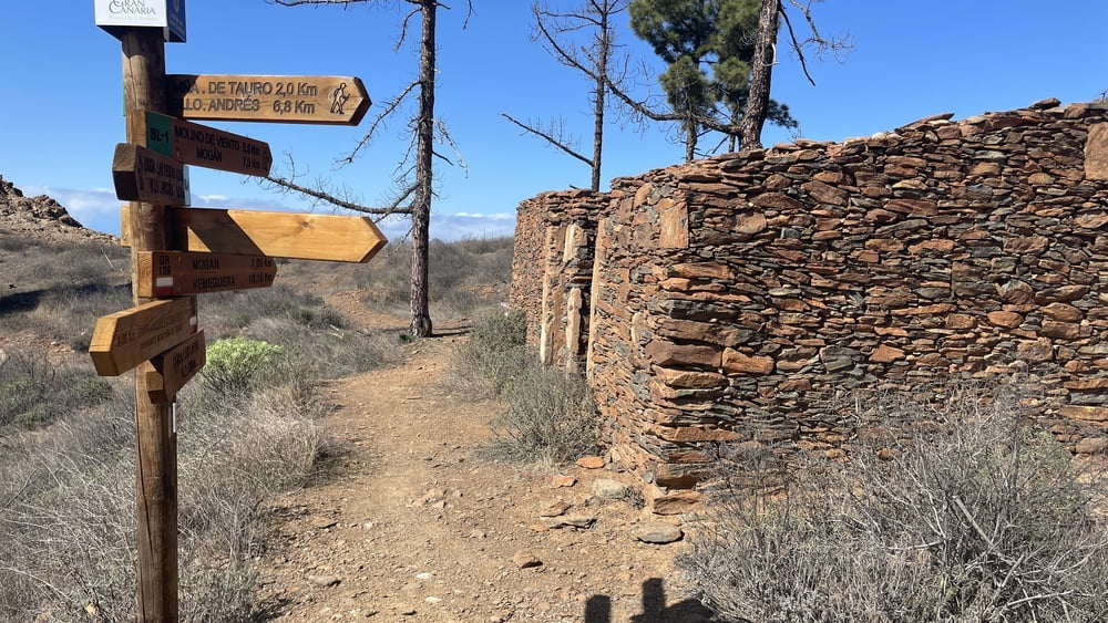
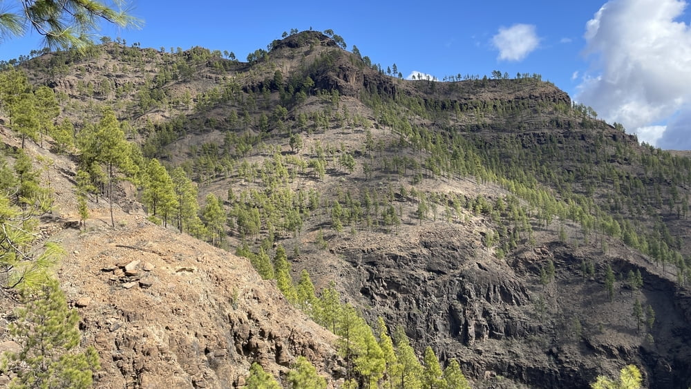
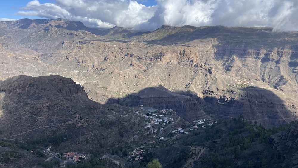
Den Gipfel des Tauro erreicht man bereits nach etwa 45 Min. Da es ab hier eine Rundwanderung ist laufen wir sie gegen den Uhrzeiger. Über das flachen Plateau das leicht mit Kiefernbäume bewaldet ist, senkt sich der Pfad zu einer Hütte am Westhang hin. Von dort geht es in östlicher Richtung zum tiefsten Punkt der Wanderung. Was folgt, ist ein langer steiler Aufstieg bis zu einem weiteren Aussichtspunkt an der Ostseite des Berges. Von dort sind es nur noch wenige Meter zu einer verfallenen Hütte, bevor es wieder hinunter zum Ausgangspunkt geht.

Galeria trasy

Mapa trasy i profil wysokości

  • Open Street Map
  • Google
Minimum height 842 m Maximum height 1167 m Widok szczegółowy

More about the tour author

schleidy
Member since 2013

Send private message

Komentarze

GPS tracks

Trackpoints
  • GPX / Garmin Map Source (gpx) download
  • TCX / Garmin Training Center® (tcx) download
  • CRS / Garmin Training Center® (crs) download
  • Google Earth (kml) download
  • G7ToWin (g7t) download
  • TTQV (trk) download
  • Overlay (ovl) download
  • Fugawi (txt) download
  • Kompass (DAV) Track (tk) download
  • Karta trasy (pdf) download
  • Original file of the author (gpx) download

More about the tour author

schleidy
Member since 2013

Send private message
Share track
Add to my favorites
Remove from my favorites
Edit tags
My score
Rate
Trasa: Gran Canaria: Wanderung zum Montaña de Tauro
Rodzaj: Wędrówki
Długość: 13,3 km
Evaluated on:
Czas trwania:
Day(s)
Hour(s)
Minute(s)
Ocena: Krajobraz Czynnik zadowolenia Kondycja Technika