Login

Zapomniałeś swój login?

Cookies have to be accepted!
Your browser's cookie functionality is disabled. Please enable this functionality.

Not a member yet?

Register now
Login

Available for registred users only

Log in to use this feature.

Zapomniałeś swój login?

Cookies have to be accepted!
Your browser's cookie functionality is disabled. Please enable this functionality.

Not a member yet?

Register now
Filter
Kategorie
Advanced filters
  • Długość (km)
  • Wysokość
Zapisz filtr Reset filter

TrackRank

QRCode

Technical data

Długość10,1 km Wysokość270 m Way down270 m Czas trwania03:00 h:m Data03.03.2024
Oceny Author Krajobraz Czynnik zadowolenia Kondycja Technika

Statystyka

78 Widoki Oceny 0 Downloads / Pliki do pobrania Przeciętnie
Rate
  • Karta trasy
  • Dojazd
  • Downloads / Pliki do pobrania

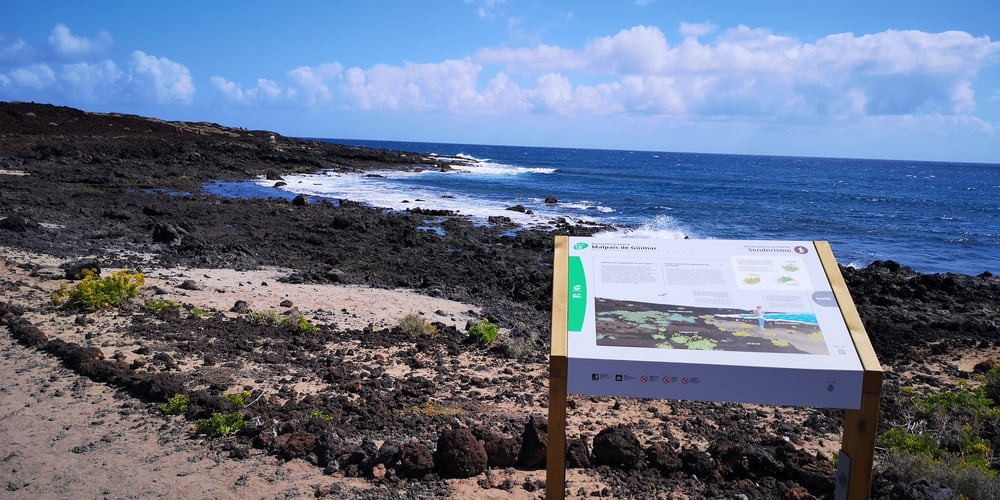
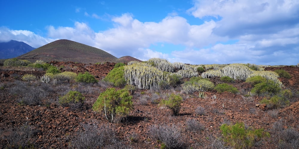
Zunächst ist es ein flache Küstenwanderung. Am Sonntag gut besucht von Familien. Überlaufen ist es trotzdem nicht. Ich bin bis zur nächsten Ortschaft El Socorro gewandert und von hier aus etwas entfernt zur Küsten zurückgelaufen. Dabei habe ich darauf geachtet nicht zu weit an die laute Autobahn zu kommen. Man kommt aber trotzdem am Fuße des Vulkankegel vorbei. Man könnte ihn ganz umrunden aber wegen der dann nahen Autobahn habe ich darauf verzichtet.

Es ist eine einfache Küstenwanderung durch Lavalandschaft. Wenn es im Norden regnet hat man gute Chancen das hier die Sonne scheint.

Galeria trasy

Mapa trasy i profil wysokości

  • Open Street Map
  • Google
Minimum height 9 m Maximum height 149 m Widok szczegółowy

More about the tour author

JoachimDief
Member since 2016

Send private message

Komentarze

Von der Autobahn die Ausfahrt nach Puertito de Güimar nehmen. In Puertito de Guimar gibt es etwas entfernt zum Hafen einen großen kostenlosen Parkplatz. Näher zum Hafen und dem Plaza von Puertito de Güimar habe ich in den Gassen keinen Platz zum Parken gefunden.

GPS tracks

Trackpoints
  • GPX / Garmin Map Source (gpx) download
  • TCX / Garmin Training Center® (tcx) download
  • CRS / Garmin Training Center® (crs) download
  • Google Earth (kml) download
  • G7ToWin (g7t) download
  • TTQV (trk) download
  • Overlay (ovl) download
  • Fugawi (txt) download
  • Kompass (DAV) Track (tk) download
  • Karta trasy (pdf) download
  • Original file of the author (gpx) download

More about the tour author

JoachimDief
Member since 2016

Send private message
Share track
Add to my favorites
Remove from my favorites
Edit tags
My score
Rate
Trasa: Malpais de Güimar
Rodzaj: Wędrówki
Długość: 10,1 km
Evaluated on:
Czas trwania:
Day(s)
Hour(s)
Minute(s)
Ocena: Krajobraz Czynnik zadowolenia Kondycja Technika