Login

Zapomniałeś swój login?

Cookies have to be accepted!
Your browser's cookie functionality is disabled. Please enable this functionality.

Not a member yet?

Register now
Login

Available for registred users only

Log in to use this feature.

Zapomniałeś swój login?

Cookies have to be accepted!
Your browser's cookie functionality is disabled. Please enable this functionality.

Not a member yet?

Register now
Filter
Kategorie
Advanced filters
  • Długość (km)
  • Wysokość
Zapisz filtr Reset filter

TrackRank

QRCode

Technical data

Długość19,2 km Wysokość450 m Way down449 m Czas trwania01:30 h:m Data27.08.2008
Oceny Author Krajobraz Czynnik zadowolenia Kondycja Technika

Statystyka

591 Widoki Oceny 131 Downloads / Pliki do pobrania Przeciętnie
Rate
  • Karta trasy
  • Dojazd
  • Downloads / Pliki do pobrania

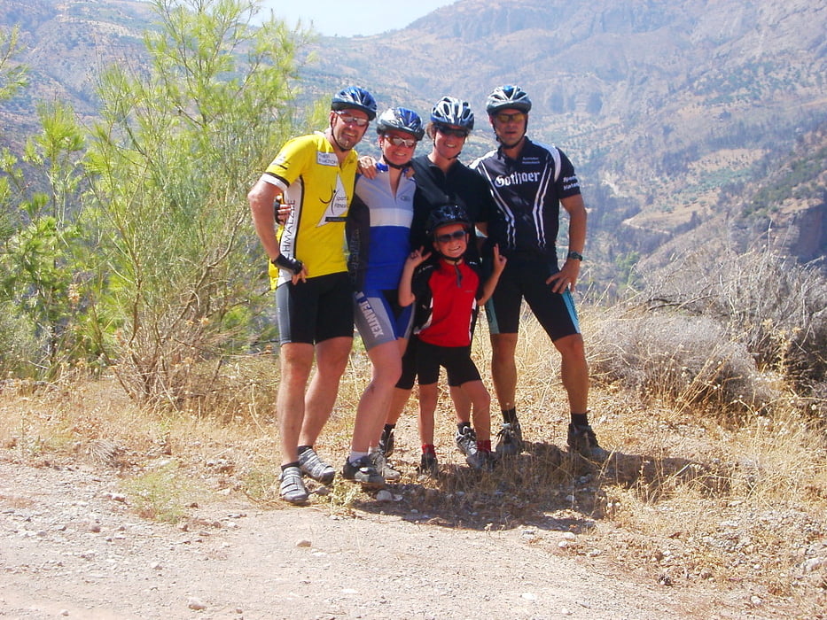
Kurze Urlaubsrunde in das Hinterland von Dhiakopto. Die Tour führt ein Stück entlang der Eisenbahn die in die Berge führt. Es geht in eine wunderschöne Schlucht mit einem Bergbach an dem man auch mal rast machen kann und sich abkühlen kann. Leider war es uns angesichts der Temperaturen ( 45 Grad)  nicht möglich noch weiter zu fahren, was sich aber auf alle fälle lohnen würde.

Leider ist die Eisenbahn von Dhiakopto-Kalavrita momentan nicht für Touristen in betrieb wegen Brückenbauarbeiten, aber wenn, dann ist dies bestimmt auch ein Highlight das man sich nicht entgehen lassen sollte.

Further information at

http://de.wikipedia.org/wiki/Bahnstrecke_Diakopto%E2%80%93Kalavryta

Galeria trasy

Mapa trasy i profil wysokości

  • Open Street Map
  • Google
Minimum height -204 m Maximum height 202 m Widok szczegółowy

More about the tour author

minispeedy
Member since 2007

Send private message

Komentarze

Wir sind mit dem Wohnmobil mit der Fähre von Ancona nach Patra gereist und von da aus dann nach dem Schulzreiseführer für Griechenland Peloponnes zum Stellplatz Nr. 6 Dhiakopto gefahren. Von dort starteten wir am nächsten Tag auch unsere kleine Tour.

GPS tracks

Trackpoints
  • GPX / Garmin Map Source (gpx) download
  • TCX / Garmin Training Center® (tcx) download
  • CRS / Garmin Training Center® (crs) download
  • Google Earth (kml) download
  • G7ToWin (g7t) download
  • TTQV (trk) download
  • Overlay (ovl) download
  • Fugawi (txt) download
  • Kompass (DAV) Track (tk) download
  • Karta trasy (pdf) download
  • Original file of the author (gpx) download

More about the tour author

minispeedy
Member since 2007

Send private message
Share track
Add to my favorites
Remove from my favorites
Edit tags
My score
Rate
Trasa: Dhiakopto entlang der Eisenbahn in die Berge
Rodzaj: Rower górski (MTB)
Długość: 19,2 km
Evaluated on:
Czas trwania:
Day(s)
Hour(s)
Minute(s)
Ocena: Krajobraz Czynnik zadowolenia Kondycja Technika