Login

Zapomniałeś swój login?

Cookies have to be accepted!
Your browser's cookie functionality is disabled. Please enable this functionality.

Not a member yet?

Register now
Login

Available for registred users only

Log in to use this feature.

Zapomniałeś swój login?

Cookies have to be accepted!
Your browser's cookie functionality is disabled. Please enable this functionality.

Not a member yet?

Register now
Filter
Kategorie
Advanced filters
  • Długość (km)
  • Wysokość
Zapisz filtr Reset filter

TrackRank

QRCode

Technical data

Długość72,2 km Wysokość1635 m Way down1639 m Czas trwania00:00 h:m Data09.05.2006
Oceny Author User Krajobraz Czynnik zadowolenia Kondycja Technika

Statystyka

3103 Widoki 2 Oceny 1079 Downloads / Pliki do pobrania 3.50 Przeciętnie
Rate
  • Karta trasy
  • Dojazd
  • Downloads / Pliki do pobrania
Santa Lucia XL
Samstag, 8:00 - 16:00 Uhr, reine Fahrzeit ca. 6h
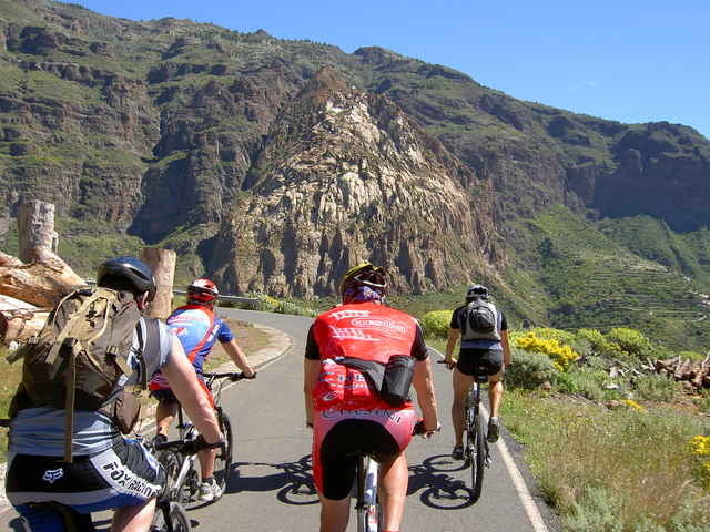
Level 3, 80 km, 1800 hm auf, 1800 hmAnspruchsvolle Auffahrt - 1300 Höhenmeter im Tal der „Tausend Palmen“ - sagenhafte Grand Canyon Blicke - ab Risco Blanco weiter mit St. Lucia Level 2 - nur für konditionsstarke Biker!

Further information at

http://www.free-motion.net/fm/de/tours.php

Galeria trasy

Mapa trasy i profil wysokości

  • Open Street Map
  • Google
Minimum height 8 m Maximum height 1142 m Widok szczegółowy

More about the tour author

winklem
Member since 2005

Send private message

Komentarze

ralf-vollmer on 22.10.2012

So lala

Die ersten 10km über eine stark befahrene Bundesstraße (zumindest im Januar), fand ich ganz schön ätzend. Der Rest entschädigt einen dafür etwas. Ich habe allerdings in Fatga über den Pass abgekürzt (ca. 1km Tragepassage), vielleicht hab ich das beste verpasst!?
erwin58 on 17.12.2013

Feedback

Hallo Michael,
vielen Dank für die prima Tour, habe diese am 10.12.2013 genossen. Klar der "off road- Anteil" hält sich etwas in Grenzen. Aber wie Du schreibst, die Aussichten bei Risco Blanko sind gigantisch und entschädigen. Ralf, Deine u.a. Vermutung ist richtig. Die Landschaft und die Aussichten in der Region beim weißen Fels sind die High Lights der Tour.
Besten Dank nochmals, schöne Grüße, Erwin
Start am Free Motion Center in der Avda. de Alfereces Provisionales

GPS tracks

Trackpoints
  • GPX / Garmin Map Source (gpx) download
  • TCX / Garmin Training Center® (tcx) download
  • CRS / Garmin Training Center® (crs) download
  • Google Earth (kml) download
  • G7ToWin (g7t) download
  • TTQV (trk) download
  • Overlay (ovl) download
  • Fugawi (txt) download
  • Kompass (DAV) Track (tk) download
  • Karta trasy (pdf) download
  • Original file of the author (g7t) download

More about the tour author

winklem
Member since 2005

Send private message
Share track
Add to my favorites
Remove from my favorites
Edit tags
My score
Rate
Trasa: Gran Canaria Santa Lucia XL mit FreeMotion
Rodzaj: Rower górski (MTB)
Długość: 72,2 km
Evaluated on:
Czas trwania:
Day(s)
Hour(s)
Minute(s)
Ocena: Krajobraz Czynnik zadowolenia Kondycja Technika