Login

Zapomniałeś swój login?

Cookies have to be accepted!
Your browser's cookie functionality is disabled. Please enable this functionality.

Not a member yet?

Register now
Login

Available for registred users only

Log in to use this feature.

Zapomniałeś swój login?

Cookies have to be accepted!
Your browser's cookie functionality is disabled. Please enable this functionality.

Not a member yet?

Register now
Filter
Kategorie
Advanced filters
  • Długość (km)
  • Wysokość
Zapisz filtr Reset filter

TrackRank

QRCode

Technical data

Długość2,4 km Wysokość0 m Way down367 m Czas trwania03:00 h:m Data12.07.2009
Oceny Author Krajobraz Czynnik zadowolenia Kondycja Technika

Statystyka

442 Widoki Oceny 122 Downloads / Pliki do pobrania Przeciętnie
Rate
  • Karta trasy
  • Dojazd
  • Downloads / Pliki do pobrania

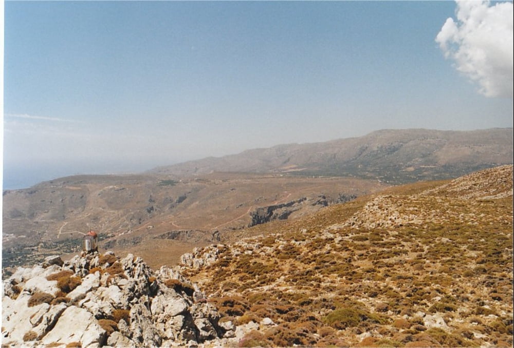
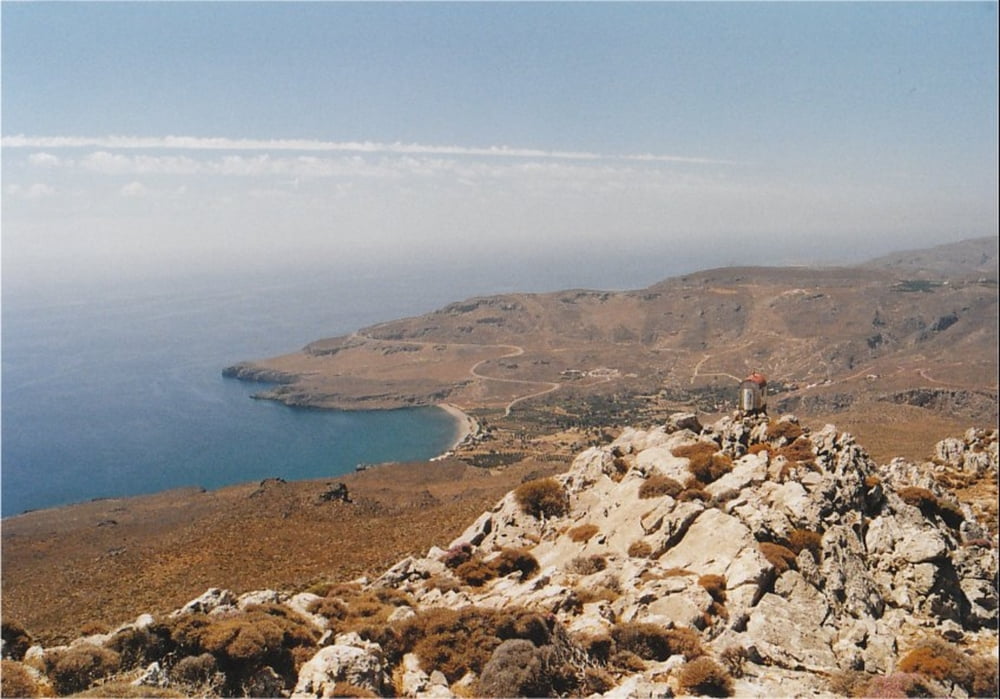
This is a hiking-track in the area of Kato Zakros (Eastern End of Crete).

It is a very nice trip offering great panoramic views over the bay of Kato Zakros. It goes up onto the summit of Mt. Skopeli which dominates the cliffs north of Kato Zakros. From the summit, you have a wonderful view over the sea and the surrounding mountain area.

The walk is very well waymarked with signs and red dots (special thanks to Stella's Traditional in Kato Zakros!), and it is not too difficult to walk. You can take the same track for going up and down (the provided GPX-file only covers one way). From Skopeli you have the option to go on to the summit of Mt. Traostalos or follow a steep climb towards Pelekita Cave. Boths ways are also waymarked with red dots.

Take a good amount of water with you, because there is virtually no shadow on the way.

Further information at

http://www.stelapts.com/

Galeria trasy

Mapa trasy i profil wysokości

  • Open Street Map
  • Google
Minimum height 8 m Maximum height 388 m Widok szczegółowy

More about the tour author

Kretakulk
Member since 2009

Send private message

Komentarze

Drive down to Kato Zakros and continue past the Taverns at the beach and follow the sign towards the archeological site of Kato Zakros. Drive past the Minoan palace to the mouth of the Gorge of Dead (at the right side). Some meters before the entrance to the Gorge is a wooden signpost pointing towards Azokeramos and Mt. Traostalos. This is the beginning of the track.

GPS tracks

Trackpoints
  • GPX / Garmin Map Source (gpx) download
  • TCX / Garmin Training Center® (tcx) download
  • CRS / Garmin Training Center® (crs) download
  • Google Earth (kml) download
  • G7ToWin (g7t) download
  • TTQV (trk) download
  • Overlay (ovl) download
  • Fugawi (txt) download
  • Kompass (DAV) Track (tk) download
  • Karta trasy (pdf) download
  • Original file of the author (gpx) download

More about the tour author

Kretakulk
Member since 2009

Send private message
Share track
Add to my favorites
Remove from my favorites
Edit tags
My score
Rate
Trasa: Kato Zakros to Skopeli Summit
Rodzaj: Wędrówki
Długość: 2,4 km
Evaluated on:
Czas trwania:
Day(s)
Hour(s)
Minute(s)
Ocena: Krajobraz Czynnik zadowolenia Kondycja Technika