Login

Zapomniałeś swój login?

Cookies have to be accepted!
Your browser's cookie functionality is disabled. Please enable this functionality.

Not a member yet?

Register now
Login

Available for registred users only

Log in to use this feature.

Zapomniałeś swój login?

Cookies have to be accepted!
Your browser's cookie functionality is disabled. Please enable this functionality.

Not a member yet?

Register now
Filter
Kategorie
Advanced filters
  • Długość (km)
  • Wysokość
Zapisz filtr Reset filter

TrackRank

QRCode

Technical data

Długość10,1 km Wysokość597 m Way down580 m Czas trwania04:30 h:m Data12.07.2009
Oceny Author Krajobraz Czynnik zadowolenia Kondycja Technika

Statystyka

3376 Widoki Oceny 340 Downloads / Pliki do pobrania Przeciętnie
Rate
  • Karta trasy
  • Dojazd
  • Downloads / Pliki do pobrania

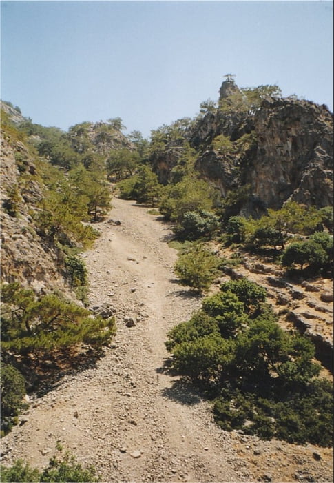
This is a hiking-track in the area of Sougia, a small town at the southern coast of Crete, a bit West of the Samaria Gorge.

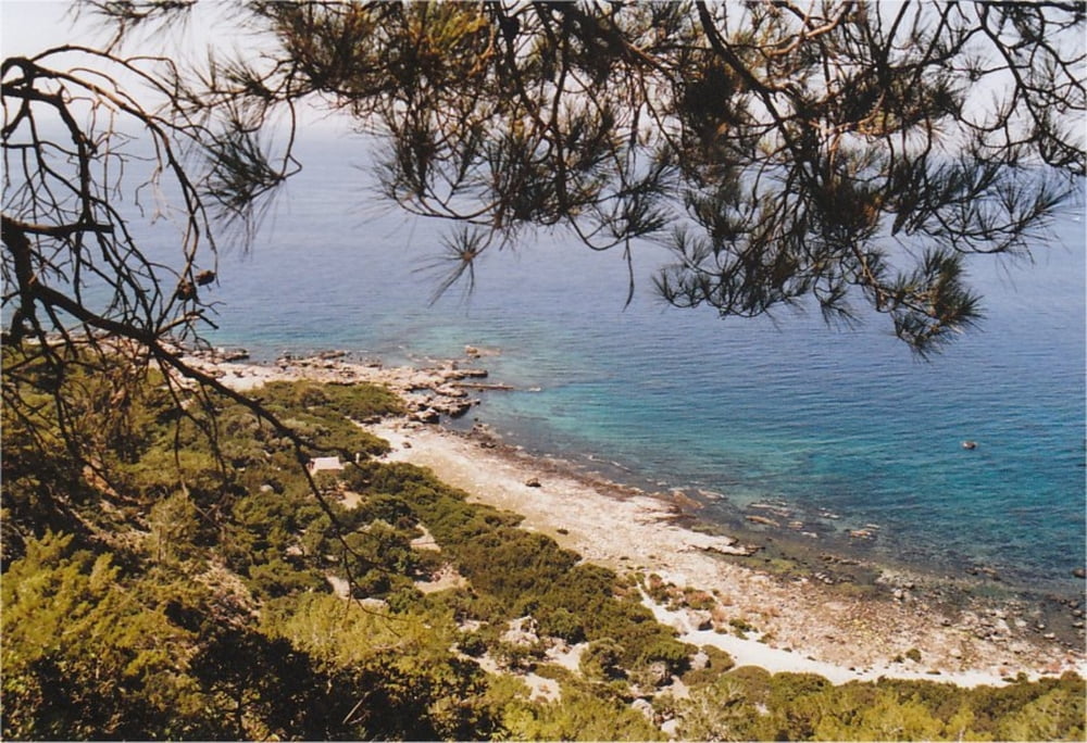
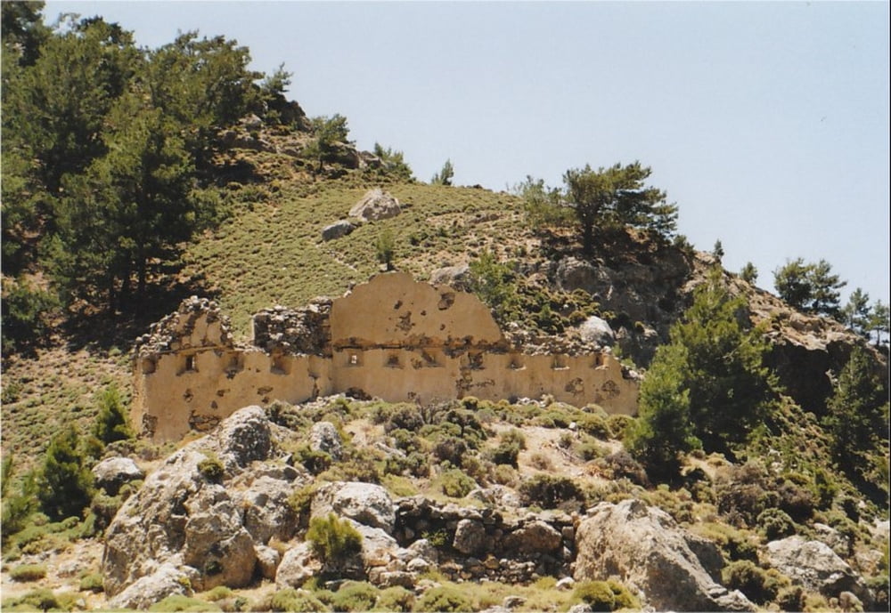
It is a nice trip alonh the European Hiking Route E4, going up onto a high summit with the remains of a Turkish Fort and a small chapel spectacularly overlooking a large part of the southern coast.

You can take the same track for both ways, adding up to about 7 hours of walking time if you turn back at Tripiti summit. The provided GPX-file only covers one way, leading down to Tripiti beach. From there it is possible to use a mobile phone to call Captain George's Taxi Boat from Sougia (60 Euro for the trip), but you should check with him at Sougia to see whether he is available before you do the trip.

If you go down from Tripiti summit to Tripiti beach, please be extremely careful because there is a lot of rubble which is rather dangerous to walk. This part is absolutely unsuitable for children. There may be better alternatives to go down than the route indicated by this last part of the track. So be careful: the descent is DIFFICULT !!!

Apart from this, the way is fairly easy to walk and partly waymarked with E4-signs.

Take a good amount of water with you, because there is virtually no shadow on the way.

Further information at

http://www.sougia.info/

Galeria trasy

Mapa trasy i profil wysokości

  • Open Street Map
  • Google
Minimum height -8 m Maximum height 382 m Widok szczegółowy

More about the tour author

Kretakulk
Member since 2009

Send private message

Komentarze

From the main part of Sougia, go East to the dry riverbed and follow the dry bed for about 100 meters upwards. Then turn right and look out for black-yellow E4 signs close to a small farm.

GPS tracks

Trackpoints
  • GPX / Garmin Map Source (gpx) download
  • TCX / Garmin Training Center® (tcx) download
  • CRS / Garmin Training Center® (crs) download
  • Google Earth (kml) download
  • G7ToWin (g7t) download
  • TTQV (trk) download
  • Overlay (ovl) download
  • Fugawi (txt) download
  • Kompass (DAV) Track (tk) download
  • Karta trasy (pdf) download
  • Original file of the author (gpx) download

More about the tour author

Kretakulk
Member since 2009

Send private message
Share track
Add to my favorites
Remove from my favorites
Edit tags
My score
Rate
Trasa: Sougia to Tripiti Beach (E4)
Rodzaj: Wędrówki
Długość: 10,1 km
Evaluated on:
Czas trwania:
Day(s)
Hour(s)
Minute(s)
Ocena: Krajobraz Czynnik zadowolenia Kondycja Technika