Login

Zapomniałeś swój login?

Cookies have to be accepted!
Your browser's cookie functionality is disabled. Please enable this functionality.

Not a member yet?

Register now
Login

Available for registred users only

Log in to use this feature.

Zapomniałeś swój login?

Cookies have to be accepted!
Your browser's cookie functionality is disabled. Please enable this functionality.

Not a member yet?

Register now
Filter
Kategorie
Advanced filters
  • Długość (km)
  • Wysokość
Zapisz filtr Reset filter

TrackRank

QRCode

Technical data

Długość15,9 km Wysokość1410 m Way down1409 m Czas trwania04:30 h:m Data06.02.2010
Oceny Author User Krajobraz Czynnik zadowolenia Kondycja Technika

Statystyka

1954 Widoki 1 Ocena 221 Downloads / Pliki do pobrania 5.00 Przeciętnie
Rate
  • Karta trasy
  • Dojazd
  • Downloads / Pliki do pobrania

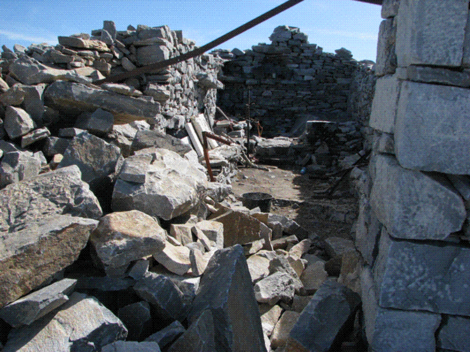
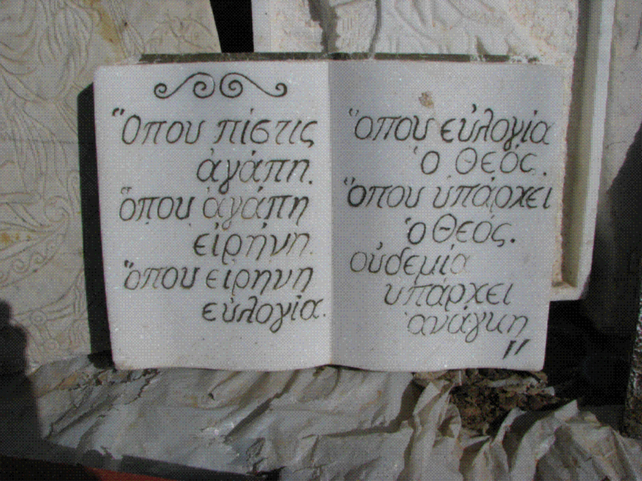
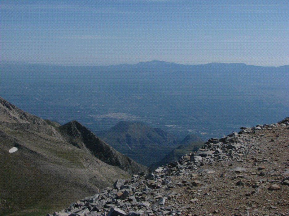
Vom Parkplatz an der Maganiari-Quelle geht es durch den Wald auf markiertem Weg an Tripoda-Quelle vorbei zur Schutzhütte des Griechischen Alpenvereins (EOS) . Hier wird der Gipfel erstmals sichtbar. Auf gutem Pfad über die baumlosen Hänge zum Gipfel mit der eingestürzten Kapelle des Propheten Elias, Schutzpatron der Hirten. Die Ruine ist aber mit ganz neuen (2008) Votivtafeln ausgestattet. Grandioser Blick auf die wilde Halbinsel Mani zwischem Lakonischen und Messinischem Golf.

Galeria trasy

Mapa trasy i profil wysokości

  • Open Street Map
  • Google
Minimum height 960 m Maximum height 2405 m Widok szczegółowy

More about the tour author

Rhadamanthys
Member since 2010

Send private message

Komentarze

Von Sparta auf der E961 Richtung Githio, nach ca. 6 km rechtsab nach Anogia und weiter nach Palaiopanagia. Im Ort rechts dem Wegweiser "Shelter of Taygetos" folgen, schmale Bergstraße, so gut wie geteert, bis zum schattigen Parkplatz an der Maganiari-Quelle mit Pavillion. Am Wochenende beliebter Ausflugsort der Autochtonen (Einheimischen).

GPS tracks

Trackpoints
  • GPX / Garmin Map Source (gpx) download
  • TCX / Garmin Training Center® (tcx) download
  • CRS / Garmin Training Center® (crs) download
  • Google Earth (kml) download
  • G7ToWin (g7t) download
  • TTQV (trk) download
  • Overlay (ovl) download
  • Fugawi (txt) download
  • Kompass (DAV) Track (tk) download
  • Karta trasy (pdf) download
  • Original file of the author (gpx) download

More about the tour author

Rhadamanthys
Member since 2010

Send private message
Share track
Add to my favorites
Remove from my favorites
Edit tags
My score
Rate
Trasa: Prophitis Elias (Taygetos)
Rodzaj: Trasy górskie
Długość: 15,9 km
Evaluated on:
Czas trwania:
Day(s)
Hour(s)
Minute(s)
Ocena: Krajobraz Czynnik zadowolenia Kondycja Technika