Login

Zapomniałeś swój login?

Cookies have to be accepted!
Your browser's cookie functionality is disabled. Please enable this functionality.

Not a member yet?

Register now
Login

Available for registred users only

Log in to use this feature.

Zapomniałeś swój login?

Cookies have to be accepted!
Your browser's cookie functionality is disabled. Please enable this functionality.

Not a member yet?

Register now
Filter
Kategorie
Advanced filters
  • Długość (km)
  • Wysokość
Zapisz filtr Reset filter

TrackRank

QRCode

Technical data

Długość44,0 km Wysokość70 m Way down139 m Czas trwania03:00 h:m Data04.03.2010
Oceny Author Krajobraz Czynnik zadowolenia Kondycja Technika

Statystyka

612 Widoki Oceny 54 Downloads / Pliki do pobrania Przeciętnie
Rate
  • Karta trasy
  • Dojazd
  • Downloads / Pliki do pobrania


Dieser Rundkurs führt ab Wiener Neudorf durch die Felder zwischen Himberg und Ebergassing. In diesem Bereich sind die Feldwege naturbelassen.

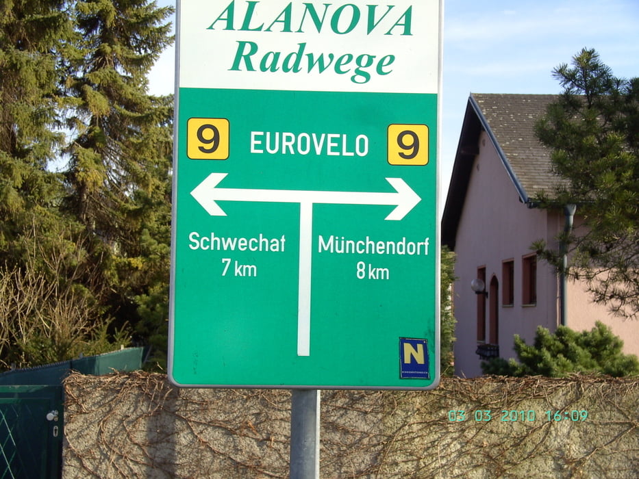
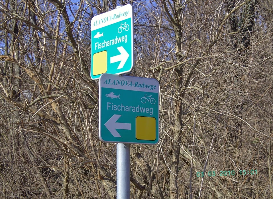
Routenbezeichnunge gibt es in diesem Bereich nur wenige, siehe dazu die entsprechenden Bilder.

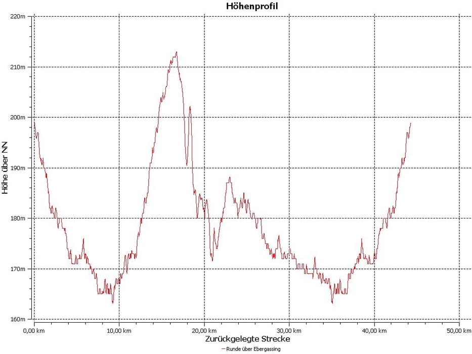
Da die Höhenangaben meines Garmingeätes EDGE 705 leider falsche Werte geliefert hat, hab ich das tatsächliche Streckenprofil als Bild dargestellt.

Further information at

http://de.wikipedia.org/wiki/Bezirk_Wien-Umgebung

Galeria trasy

Mapa trasy i profil wysokości

  • Open Street Map
  • Google
Minimum height 101 m Maximum height 157 m Widok szczegółowy

More about the tour author

efelber
Member since 2008

Send private message

Komentarze

Die Tour startet und endet beim alten Feuerwehrhaus in Wiener Neudorf.

In Himberg quert die Route den Eurovelo 9, aus Wien kommend kann hier in die Tour eingestiegen werden.
Der Rundkurs verkürzt sich dadurch um ca 20 km.

GPS tracks

Trackpoints
  • GPX / Garmin Map Source (gpx) download
  • TCX / Garmin Training Center® (tcx) download
  • CRS / Garmin Training Center® (crs) download
  • Google Earth (kml) download
  • G7ToWin (g7t) download
  • TTQV (trk) download
  • Overlay (ovl) download
  • Fugawi (txt) download
  • Kompass (DAV) Track (tk) download
  • Karta trasy (pdf) download
  • Original file of the author (gpx) download

More about the tour author

efelber
Member since 2008

Send private message
Share track
Add to my favorites
Remove from my favorites
Edit tags
My score
Rate
Trasa: Radtour südöstlich von Wien
Rodzaj: Trasy rowerowe
Długość: 44,0 km
Evaluated on:
Czas trwania:
Day(s)
Hour(s)
Minute(s)
Ocena: Krajobraz Czynnik zadowolenia Kondycja Technika