


Meakan-dake ist ein moutain im östlichen Hokkaido. Wir gingen durch Snowshoe vom Parkplatz am heißen Frühling und gehen gerade zur Oberseite voran. Jedoch ist das letzte Teil nahe der Oberseite auf der Nordseite für Snowshoes zu steil, also gingen wir zum Süden umher und kletterten dann von dort. Es gibt ein fabulou 360 Grad Panorama von der Oberseite. Auf der Weise unten, nahmen wir zu langes im tiefen Schnee, also war er dunkel, als wir zum See kamen. Bleiben Sie auf dem Weg auf der Nordseite von diesem See.
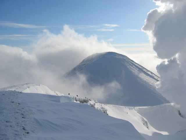
Meakan-dake is a mountain in Eastern Hokkaido. We went by snowshoe from the car park at the hot spring and headed straight to the top. However, the last part near the top on the northern side is too steep for snowshoes, so we went around to the south, and then climbed from there. There is a fabulou 360 degrees panorama from the top.
On the way down, we took too long in the deep snow, so it was dark when we got to the lake. Stay on the path on the northern side of this lake.
Further information at
http://www.malcomson.com/gallery/hokkaido2004Galeria trasy
Mapa trasy i profil wysokości
Minimum height 127 m
Maximum height 1498 m
More about the tour author

|
zangezur |
Komentarze

More about the tour author
|
|
zangezur |
Add to my favorites
Remove from my favorites
Edit tags
Open track
My score
Rate