Login

Zabudli ste prihlasovacia meno

Cookies have to be accepted!
Your browser's cookie functionality is disabled. Please enable this functionality.

Not a member yet?

Register now
Login

Available for registred users only

Log in to use this feature.

Zabudli ste prihlasovacia meno

Cookies have to be accepted!
Your browser's cookie functionality is disabled. Please enable this functionality.

Not a member yet?

Register now
Filter
Kategórie
Advanced filters
  • Dĺžka (km)
  • výškomer
Uložiť filter Reset filter

TrackRank

QRCode

Technical data

Dĺžka26,4 km výškomer1037 m Way down999 m Doba03:00 h:m dátum09.07.2012
ohodnotenia Author Kraj pôžitok z túry kondícia technika

štatistika

127 náhľady ohodnotenia 10 Stiahnutia priemer
Rate
  • list trasy
  • príjazd
  • Stiahnutia

 NIce tour on the ridge between Tri Krize and Skalka.


galéria trás

Mapa trasy a výškový profil

  • Open Street Map
  • Google
Minimum height 529 m Maximum height 1258 m Detailný pohľad

More about the tour author

joe007
Member since 2009

Send private message

komentáre

From Malachov we took the Blue trail to Tri Krize

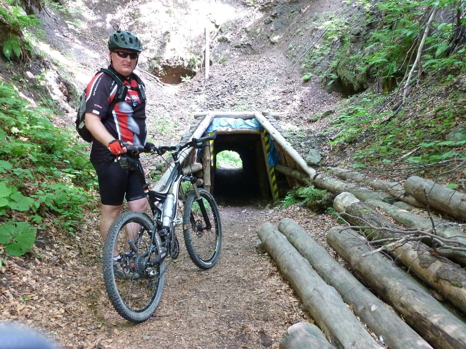
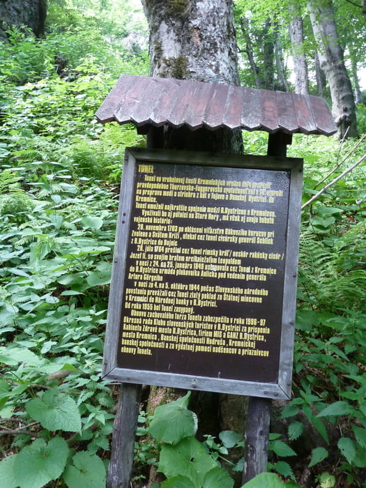
Follow the Red marks to Skalka tower and then to the tunnel

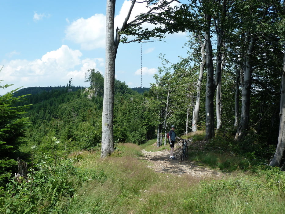
Yellow trail takes you down to Ticha - then turn right on green trail unil the ski-slopes of Kralky.

Follow the Blue signs to the meadows of Pol'noh. Turn right onto the unmaked trail, until you reach the  Blue sign leading back to Malachov


GPS trasy

Trackpoints
  • GPX / Garmin Map Source (gpx) download
  • TCX / Garmin Training Center® (tcx) download
  • CRS / Garmin Training Center® (crs) download
  • Google Earth (kml) download
  • G7ToWin (g7t) download
  • TTQV (trk) download
  • Overlay (ovl) download
  • Fugawi (txt) download
  • Kompass (DAV) Track (tk) download
  • list trasy (pdf) download
  • Original file of the author (gpx) download

More about the tour author

joe007
Member since 2009

Send private message
Share track
Add to my favorites
Remove from my favorites
Edit tags
My score
Rate
trasa: Skalka ridge tour
Druh: horský bicykel
Dĺžka: 26,4 km
Evaluated on:
Doba:
Day(s)
Hour(s)
Minute(s)
ohodnotenie: Kraj pôžitok z túry kondícia technika