Login

Zabudli ste prihlasovacia meno

Cookies have to be accepted!
Your browser's cookie functionality is disabled. Please enable this functionality.

Not a member yet?

Register now
Login

Available for registred users only

Log in to use this feature.

Zabudli ste prihlasovacia meno

Cookies have to be accepted!
Your browser's cookie functionality is disabled. Please enable this functionality.

Not a member yet?

Register now
Filter
Kategórie
Advanced filters
  • Dĺžka (km)
  • výškomer
Uložiť filter Reset filter

TrackRank

QRCode

Technical data

Dĺžka9,0 km výškomer601 m Way down628 m Doba04:30 h:m dátum10.08.2012
ohodnotenia Author Kraj pôžitok z túry kondícia technika

štatistika

219 náhľady 1 ohodnotenie 40 Stiahnutia 5.00 priemer
Rate
  • list trasy
  • príjazd
  • Stiahnutia

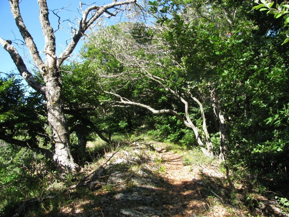
Nette kleine und einsame Wanderung auf der man kaum jemandem begegnet. Der Weg ist teilweise sogar einem Wildwechsel gleich zugewachsen.

Auf und Abstieg fast ohne Schatten, aber auf der Krete bewaldet.

Unterwegs kommt man an einer Turmruine vorbei, weiter eine Passage die jemanden mit Höhenangst beeindrucken könnte, denn es geht mal rechts mal links oder sogar beidseitig steil runter.

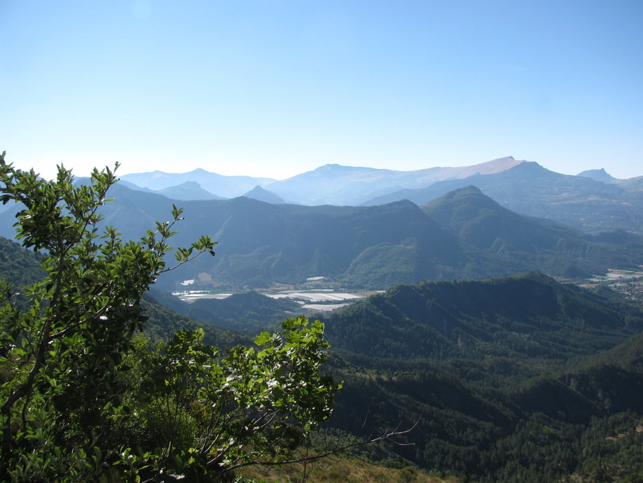
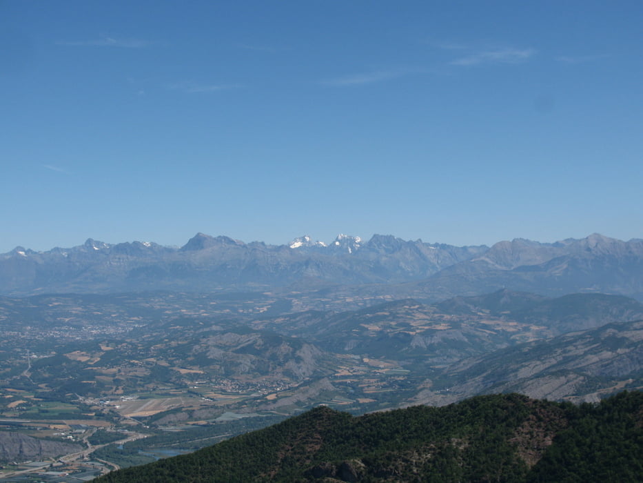
Auf der Krete angekommen, gehts im Schatten von Buchen richtung Gipfel, von wo man eine tolle Aussicht auf das Durançe-Tal, die Alpen der Provençe mit der Montagne de Lure, der Drôme Provençal und bis zum Mont Ventoux hat. Weiter auf der schattigen Krete öffnet sich schon bald der Blick auch nach Norden mit dem Pic de Bure und dem Massif des Escrins mit seinen Gletschern.

Vom Segelflugplatz in Tallard gestartet, nuzen nachmittags viele Segelflieger den Aufwind und tun es den Greifvögeln gleich, die man am Vormittag beobachten kann.

Further information at

http://www.hautesterresprovence.com/

galéria trás

Mapa trasy a výškový profil

  • Open Street Map
  • Google
Minimum height 869 m Maximum height 1483 m Detailný pohľad

More about the tour author

Iris04
Member since 2012

Send private message

komentáre

Entweder vom Durançe-Tal zwischen Sisteron und Tallard in Monetier-Allemond nach E auf die D104 bis Melve, oder von la Motte Du Caire auf de 104 nach W.

Parkiern auf dem Dorfplatz in Melve.

GPS trasy

Trackpoints
  • GPX / Garmin Map Source (gpx) download
  • TCX / Garmin Training Center® (tcx) download
  • CRS / Garmin Training Center® (crs) download
  • Google Earth (kml) download
  • G7ToWin (g7t) download
  • TTQV (trk) download
  • Overlay (ovl) download
  • Fugawi (txt) download
  • Kompass (DAV) Track (tk) download
  • list trasy (pdf) download
  • Original file of the author (gpx) download

More about the tour author

Iris04
Member since 2012

Send private message
Share track
Add to my favorites
Remove from my favorites
Edit tags
My score
Rate
trasa: Melve - Les Croix
Druh: trasa
Dĺžka: 9,0 km
Evaluated on:
Doba:
Day(s)
Hour(s)
Minute(s)
ohodnotenie: Kraj pôžitok z túry kondícia technika