


Hier wollte ich schon seit über 20 Jahren her.
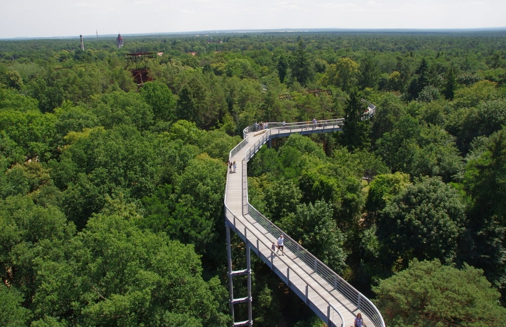
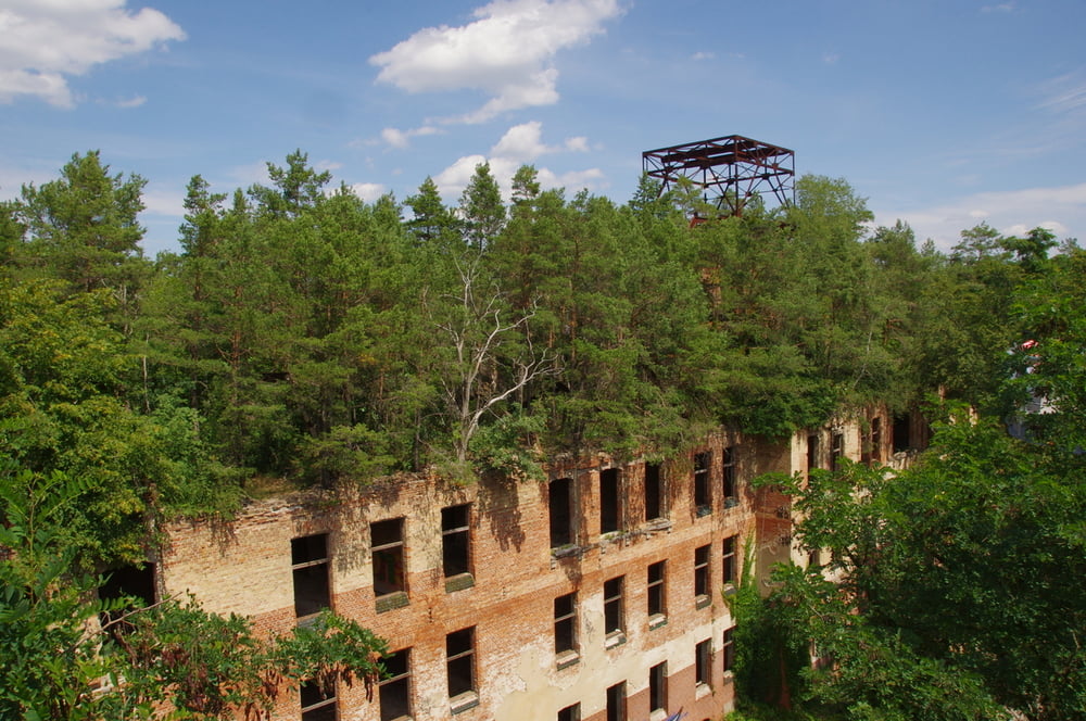
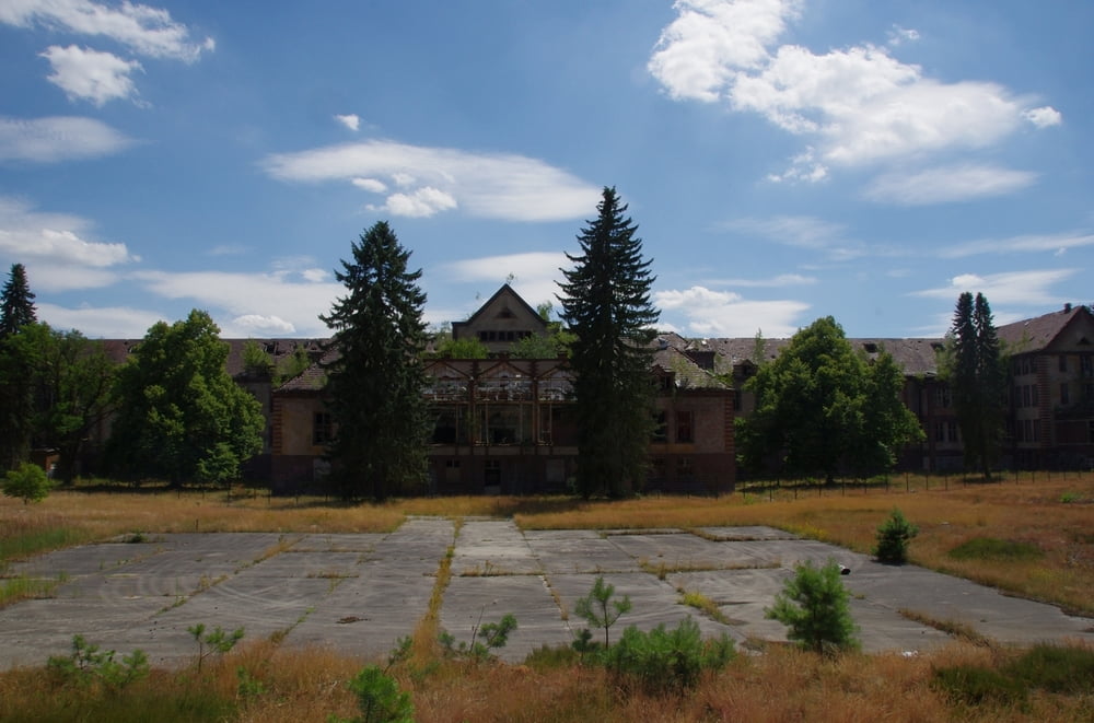
Im nordwestlichen Quadrant der Beelitzer Heilstätten schaut es wild aus. Der Brandenburger Wald hatte lange Jahre Zeit an den beschädigten Gebäuden zu arbeiten. Was sich daraus entwickelt hat kann mit einem sehr beeindruckenden Baumwipfelpfad absolut gefahrlos besichtigt werden.
Unglaubliche Ausblicke ergeben sich vom Turm und dem Pfad auf bewaldete Gebäude und auf die schöne Brandenburger Landschaft.
Nebenbei kann, wer will, noch Wissen anlesen oder zusätzliche Besichtigungstouren buchen.
Das Projekt ist nicht gefördert und kostet deswegen etwas Geld das aber noch akzeptabel ist.
Ein lohnendes Ausflugsziel.
Further information at
http://www.berlin.de/special/reise/brandenburg/3954404-1098592-baumkronenpfad-beelitzheilstaetten.htmlgaléria trás

Mapa trasy a výškový profil
Minimum height 62 m
Maximum height 98 m
More about the tour author
|
|
Pheinz |
komentáre

Los geht es auf dem Parkplatz für den Baumwipfelpfad.
Am Wochenende knöpfen die einem hier noch zwei €euro extra ab!
GPS trasy
Trackpoints-
GPX / Garmin Map Source (gpx) download
-
TCX / Garmin Training Center® (tcx) download
-
CRS / Garmin Training Center® (crs) download
-
Google Earth (kml) download
-
G7ToWin (g7t) download
-
TTQV (trk) download
-
Overlay (ovl) download
-
Fugawi (txt) download
-
Kompass (DAV) Track (tk) download
-
list trasy (pdf) download
-
Original file of the author (gpx) download
More about the tour author
|
|
Pheinz |
Add to my favorites
Remove from my favorites
Edit tags
Open track
My score
Rate