Login

Si pozabil/a podatke za prijavo?

Cookies have to be accepted!
Your browser's cookie functionality is disabled. Please enable this functionality.

Not a member yet?

Register now
Login

Available for registred users only

Log in to use this feature.

Si pozabil/a podatke za prijavo?

Cookies have to be accepted!
Your browser's cookie functionality is disabled. Please enable this functionality.

Not a member yet?

Register now
Filter
Kategorije
Advanced filters
  • Dolžina (km)
  • Metri nadmorske višine
Shrani filter Reset filter

TrackRank

QRCode

Technical data

Dolžina325,9 km Metri nadmorske višine628 m Way down761 m Trajanje3 days 0 h Datum19.08.2012
Ocene Author Pokrajina Dejavnik zabave Kondicija Tehnika

Statistika

1304 Pogledi Ocene 22 Prenosi Povprečje
Rate
  • List z izleti
  • Prihod
  • Prenosi

Die erste Etappe Passau-Linz, 97 km ist reiner Genuss.

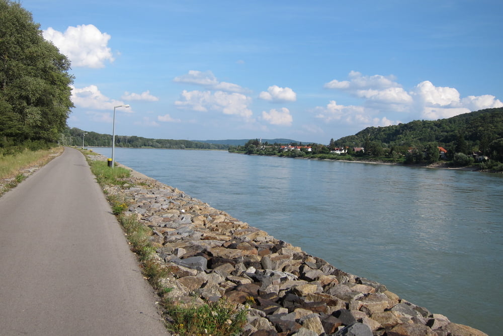
Die zweite Etappe Linz-Melk, 113 km, ist sehr schön und ruhig. Es gibt kaum Steigungen, der Asphalt ist fast überall sauber und glatt. Eine kleine Ausnahme ist in der Nähe von Mitterkirchen-Pitzing. Dort wegen Hochwasseranlagen wurden einpaar Straßenabschnitte geändert und noch nicht asphaltiert. Die Verpflegung ist lückenlos, Geschäfte oder Raststationen gibt es jede 5-10 km.

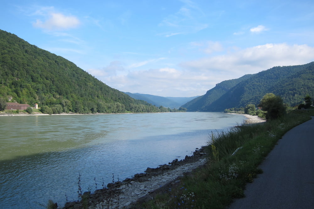
Die dritte Etappe Melk-Wien, 116 km, war am schwierigsten und hat am längsten gedauert. Die Müdigkeit macht sich schon bemerkbar, der Rucksack drückt an die Schultern und der Straßenbelag wird schlechter. Allerschlimmste Abschnitt fängt kurz vor Tulln an und dauert fast bis zu Ende. Erst einige Kilometer vor Wien wird der Asphalt wieder besser. Die Highlights der Strecke sind die wunderschöne Natur in Wachau und ein Paar Downhills zwischen Pischelsdorf und Kronau.
 

Galerija izletov

Zemljevid in višinski profil izleta

  • Open Street Map
  • Google
Minimum height 159 m Maximum height 306 m Prikaz podrobnosti

More about the tour author

maklaj
Member since 2009

Send private message

Komentarji

Poti GPS

Trackpoints
  • GPX / Garmin Map Source (gpx) download
  • TCX / Garmin Training Center® (tcx) download
  • CRS / Garmin Training Center® (crs) download
  • Google Earth (kml) download
  • G7ToWin (g7t) download
  • TTQV (trk) download
  • Overlay (ovl) download
  • Fugawi (txt) download
  • Kompass (DAV) Track (tk) download
  • List z izleti (pdf) download
  • Original file of the author (gpx) download

More about the tour author

maklaj
Member since 2009

Send private message
Share track
Add to my favorites
Remove from my favorites
Edit tags
My score
Rate
Izlet: 2012 Passau-Wien auf Skates
Vrsta: Rolerji
Dolžina: 325,9 km
Evaluated on:
Trajanje:
Day(s)
Hour(s)
Minute(s)
Ocena: Pokrajina Dejavnik zabave Kondicija Tehnika